File:Kackar Mountains Summit Trek.jpg
![File:Kackar Mountains Summit Trek.jpg](https://upload.wikimedia.org/wikipedia/commons/thumb/8/8d/Kackar_Mountains_Summit_Trek.jpg/450px-Kackar_Mountains_Summit_Trek.jpg?20200630140759)
Original file (3,024 × 4,032 pixels, file size: 2.32 MB, MIME type: image/jpeg)
Captions
Captions
Summary
[edit]DescriptionKackar Mountains Summit Trek.jpg |
English: 
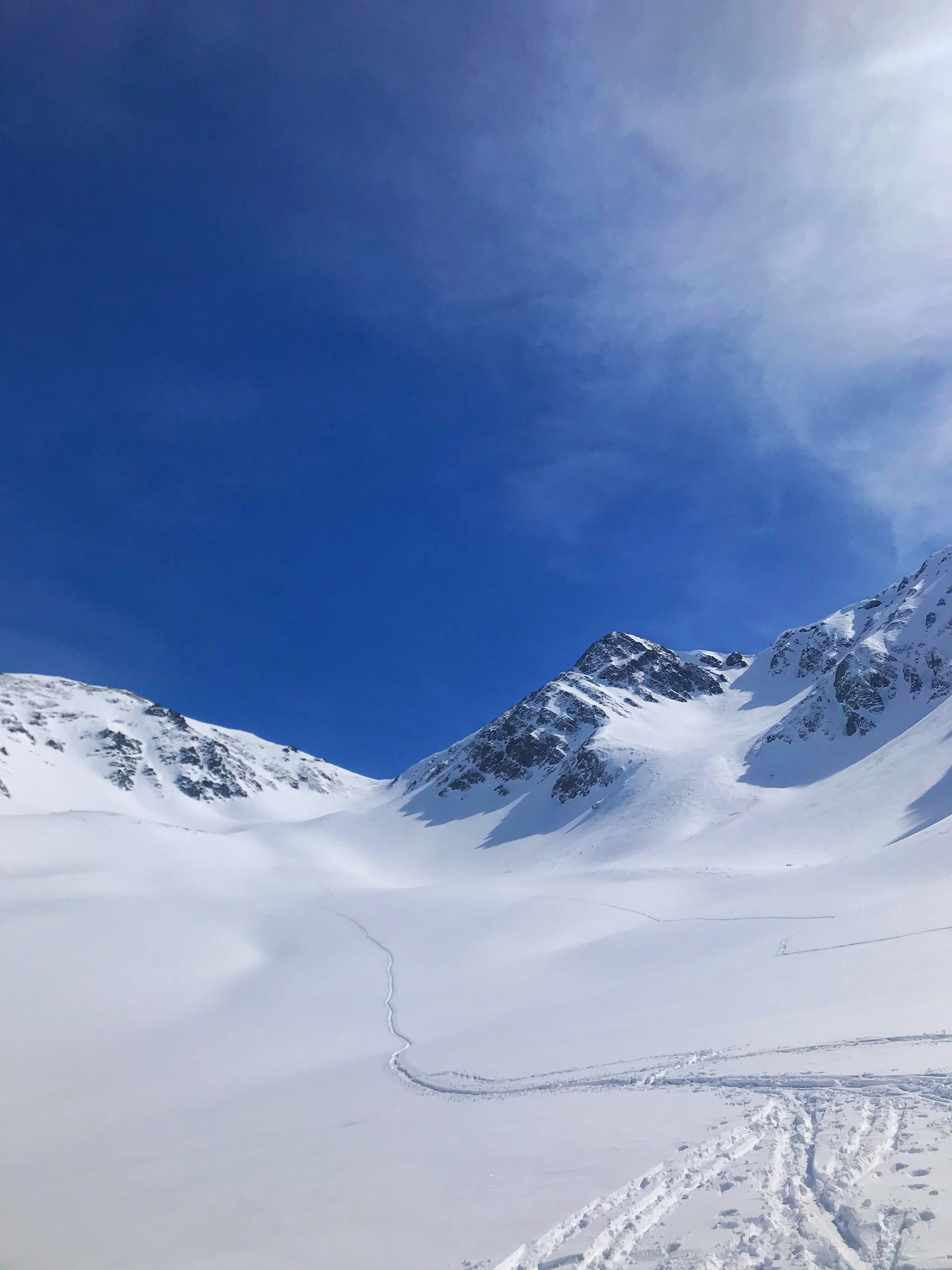
Ski touring for one of the summits at Kackar Mountain Range, we were trying to keep up with the main group as they were quicker to the summit. Being alone ona plateau was an amazing feeling. |
Date | |
Source | Own work |
Author | Kaankosemen |
Camera location | 40° 50′ 26.17″ N, 41° 14′ 48.23″ E ![]() ![]() | View this and other nearby images on: OpenStreetMap | ![]() |
---|
Licensing
[edit]![w:en:Creative Commons](https://upload.wikimedia.org/wikipedia/commons/thumb/7/79/CC_some_rights_reserved.svg/90px-CC_some_rights_reserved.svg.png)
![attribution](https://upload.wikimedia.org/wikipedia/commons/thumb/1/11/Cc-by_new_white.svg/24px-Cc-by_new_white.svg.png)
![share alike](https://upload.wikimedia.org/wikipedia/commons/thumb/d/df/Cc-sa_white.svg/24px-Cc-sa_white.svg.png)
- You are free:
- to share – to copy, distribute and transmit the work
- to remix – to adapt the work
- Under the following conditions:
- attribution – You must give appropriate credit, provide a link to the license, and indicate if changes were made. You may do so in any reasonable manner, but not in any way that suggests the licensor endorses you or your use.
- share alike – If you remix, transform, or build upon the material, you must distribute your contributions under the same or compatible license as the original.
![]() |
This image was uploaded as part of Wiki Loves Earth 2020.
aragonés ∙ العربية ∙ asturianu ∙ azərbaycanca ∙ беларуская (тарашкевіца) ∙ български ∙ বাংলা ∙ brezhoneg ∙ català ∙ čeština ∙ Cymraeg ∙ Deutsch ∙ Ελληνικά ∙ English ∙ español ∙ eesti ∙ euskara ∙ فارسی ∙ français ∙ galego ∙ עברית ∙ hrvatski ∙ հայերեն ∙ Bahasa Indonesia ∙ italiano ∙ 日本語 ∙ ქართული ∙ 한국어 ∙ latviešu ∙ македонски ∙ മലയാളം ∙ मराठी ∙ Bahasa Melayu ∙ norsk bokmål ∙ नेपाली ∙ Nederlands ∙ norsk ∙ polski ∙ português ∙ português do Brasil ∙ română ∙ русский ∙ sicilianu ∙ shqip ∙ slovenščina ∙ српски / srpski ∙ svenska ∙ ไทย ∙ Türkçe ∙ українська ∙ اردو ∙ 简体中文 ∙ 繁體中文 ∙ +/− |
![]() |
File history
Click on a date/time to view the file as it appeared at that time.
Date/Time | Thumbnail | Dimensions | User | Comment | |
---|---|---|---|---|---|
current | 14:07, 30 June 2020 | ![]() | 3,024 × 4,032 (2.32 MB) | Kaankosemen (talk | contribs) | Uploaded own work with UploadWizard |
You cannot overwrite this file.
File usage on Commons
There are no pages that use this file.
File usage on other wikis
The following other wikis use this file:
- Usage on en.wikipedia.org
- Usage on tr.wikipedia.org
Metadata
This file contains additional information such as Exif metadata which may have been added by the digital camera, scanner, or software program used to create or digitize it. If the file has been modified from its original state, some details such as the timestamp may not fully reflect those of the original file. The timestamp is only as accurate as the clock in the camera, and it may be completely wrong.
Camera manufacturer | Apple |
---|---|
Camera model | iPhone 7 |
Exposure time | 1/13,699 sec (0) |
F-number | f/1.8 |
ISO speed rating | 20 |
Date and time of data generation | 13:46, 9 March 2019 |
Lens focal length | 3.99 mm |
Latitude | 40° 50′ 26.17″ N |
Longitude | 41° 14′ 48.23″ E |
Altitude | 2,771.654 meters above sea level |
Orientation | Normal |
Horizontal resolution | 72 dpi |
Vertical resolution | 72 dpi |
Software used | Snapseed 2.19.280302127 |
File change date and time | 13:46, 9 March 2019 |
Y and C positioning | Centered |
Exposure Program | Normal program |
Exif version | 2.21 |
Date and time of digitizing | 13:46, 9 March 2019 |
Meaning of each component |
|
APEX shutter speed | 13.74174401036 |
APEX aperture | 1.6959938128384 |
APEX brightness | 13.446317136914 |
APEX exposure bias | 0 |
Metering mode | Spot |
Flash | Flash did not fire, compulsory flash suppression |
DateTimeOriginal subseconds | 972 |
DateTimeDigitized subseconds | 972 |
Supported Flashpix version | 1 |
Color space | sRGB |
Sensing method | One-chip color area sensor |
Scene type | A directly photographed image |
Exposure mode | Auto exposure |
White balance | Auto white balance |
Focal length in 35 mm film | 28 mm |
Scene capture type | Standard |
Speed unit | Kilometers per hour |
Speed of GPS receiver | 0 |
Reference for direction of image | True direction |
Direction of image | 144.24848942598 |
Reference for bearing of destination | True direction |
Bearing of destination | 144.24848942598 |
GPS date | 9 March 2019 |
Structured data
Items portrayed in this file
depicts
9 March 2019
40°50'26.171"N, 41°14'48.232"E
0.00007299802905321556 second
1.8
3.99 millimetre
image/jpeg
- Files with coordinates missing SDC location of creation
- CC-BY-SA-4.0
- Self-published work
- Images from Wiki Loves Earth 2020
- Images from Wiki Loves Earth 2020 in Turkey
- Images from Wiki Loves Earth missing SDC depicts
- Images from Wiki Loves Earth missing SDC location of creation
- Uploaded via Campaign:wle-tr
- Turkey photographs taken on 2019-03-09
- Pages with maps