File:KarboleSkans2.jpg
Jump to navigation
Jump to search

Size of this preview: 800 × 516 pixels. Other resolutions: 320 × 206 pixels | 640 × 413 pixels | 1,024 × 661 pixels | 1,280 × 826 pixels | 2,407 × 1,553 pixels.
Original file (2,407 × 1,553 pixels, file size: 634 KB, MIME type: image/jpeg)
Captions
Captions
Add a one-line explanation of what this file represents
Summary
[edit]
| Description |
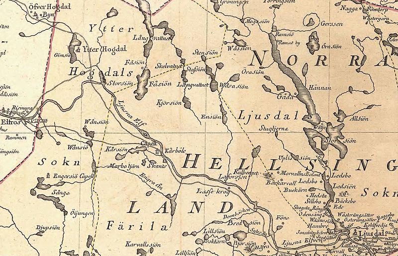
English: Map over area in northwest Hälsingland, Sweden, year 1796
Svenska: Detalj av landskapskarta visande nordvästra Hälsingland år 1976. |
| Date | |
| Source | Krigsarkivet: - Sverige Topografiska kartor, Gästrikland och Hälsingland, generalkartor, 0400:09A:006 b |
| Author | Olof Insulander, - S.G Hermelin |
Licensing
[edit]
|
This work is in the public domain in its country of origin and other countries and areas where the copyright term is the author's life plus 100 years or fewer. | |
| This file has been identified as being free of known restrictions under copyright law, including all related and neighboring rights. | |
File history
Click on a date/time to view the file as it appeared at that time.
| Date/Time | Thumbnail | Dimensions | User | Comment | |
|---|---|---|---|---|---|
| current | 20:03, 6 January 2014 | | 2,407 × 1,553 (634 KB) | Dagjoh (talk | contribs) | {{Information |Description ={{en|1=Map over area in northwest Hälsingland, Sweden, year 1796}} {{sv|1=Detalj av landskapskarta visande nordvästra Hälsingland år 1976.}} |Source =Krigsarkivet: - Sverige Topografiska kartor, Gästrikland... |
You cannot overwrite this file.
File usage on Commons
The following page uses this file:
File usage on other wikis
The following other wikis use this file:
- Usage on sv.wikipedia.org
- Kårböle skans
- Wikipedia:Wikimedia X-län
- Wikipedia:Wikimedia X-län/Dashboard
- Wikipedia:Wikimedia X-län/Önskelistor
- Wikipedia:Wikimedia X-län/Fotografering
- Mall:Wikimedia X Header
- Wikipedia:Wikimedia X-län/Träffar 2020
- Wikipedia:Wikimedia X-län/Träffar 2019
- Wikipedia:Wikimedia X-län/Träffar
- Wikipedia:Wikimedia X-län/Träffar 2021
- Wikipedia:Wikimedia X-län/Studiebesök Länsmuseet Gävleborg
- Wikipedia:Wikimedia X-län/Träffar 2022
- Wikipedia:Wikimedia X-län/Arkiv
- Wikipedia:Wikimedia X-län/Utflykt i Bollnäs 2023
- Wikipedia:Wikimedia X-län/Önskelistor/Bollnäs bokmässa 2023
- Wikipedia:Wikimedia X-län/Träffar 2023
- Wikipedia:Wikimedia X-län/Utflykt i Alfta 2024