File:Karte Bahnstrecke Wismar-Rostock.png
Jump to navigation
Jump to search
Size of this preview: 800 × 585 pixels. Other resolutions: 320 × 234 pixels | 640 × 468 pixels | 1,024 × 749 pixels | 1,280 × 936 pixels | 1,542 × 1,128 pixels.
Original file (1,542 × 1,128 pixels, file size: 785 KB, MIME type: image/png)
Captions
Captions
Add a one-line explanation of what this file represents
| Description |
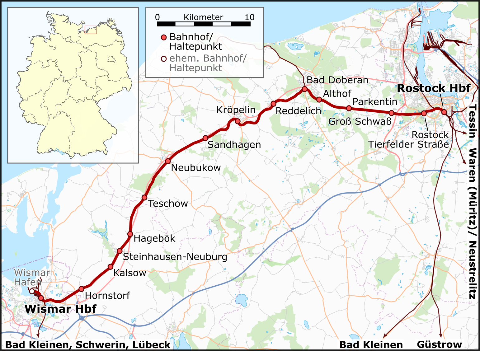
English: Railway Map Germany: Wismar - Rostock
Deutsch: Eisenbahnstrecke Wismar - Rostock |
| Date | vgl. Versionsgeschicht/ see history |
| Source |
Deutsch: Eigene Arbeit, nutzt
English: Own work, uses
|
| Author | Muns |
| Description |
This map was created from OpenStreetMap project data, collected by the community. This map may be incomplete, and may contain errors. Don't rely solely on it for navigation. |
| Date | (see file history) |
| Source | openstreetmap.org |
| Creator |
OpenStreetMap contributors |
| Permission (Reusing this file) |
OpenStreetMap data and maps are licensed under the Creative Commons Attribution-ShareAlike 2.0 license (CC-BY-SA 2.0). This file is licensed under the Creative Commons Attribution-Share Alike 2.0 Generic license.
|
| Georeferencing | If inappropriate please set warp_status = skip to hide. |

|
This map has been made or improved in the German Kartenwerkstatt (Map Lab). You can propose maps to improve as well.
|
File history
Click on a date/time to view the file as it appeared at that time.
| Date/Time | Thumbnail | Dimensions | User | Comment | |
|---|---|---|---|---|---|
| current | 19:14, 1 June 2015 | | 1,542 × 1,128 (785 KB) | Cmdrjameson (talk | contribs) | Compressed with pngout. Reduced by 323kB (29% decrease). |
| 22:59, 30 August 2010 |  | 1,542 × 1,128 (1.08 MB) | Muns (talk | contribs) | {{Information |Description={{en|1=Railway Map Germany: Wismar - Rostock}} {{de|1=Eisenbahnstrecke Wismar - Rostock}} |Source={{de|Eigene Arbeit, nutzt}} {{en|Own work, uses}} *File:Germany location map.svg, by NordNordWest |Date |
You cannot overwrite this file.
File usage on Commons
The following 5 pages use this file:
File usage on other wikis
The following other wikis use this file:
- Usage on de.wikipedia.org
- Usage on it.wikipedia.org
- Usage on pl.wikipedia.org
- Usage on www.wikidata.org