File:Karte Kanton Appenzell Innerrhoden.png
Jump to navigation
Jump to search
Size of this preview: 626 × 600 pixels. Other resolutions: 251 × 240 pixels | 501 × 480 pixels | 1,003 × 961 pixels.
Original file (1,003 × 961 pixels, file size: 156 KB, MIME type: image/png)
Captions
Captions
Add a one-line explanation of what this file represents
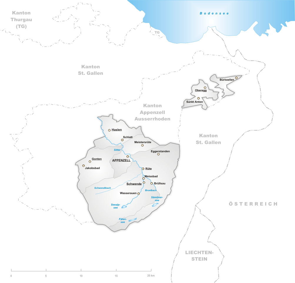
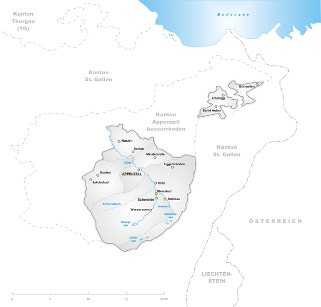
Deutsch: Karte des Kantons Appenzell Innerrhoden.
English: Map of canton Appenzell Innerrhoden.
drawn by/gezeichnet von de:Benutzer:Tschubby 12. Aug 2004

|
Permission is granted to copy, distribute and/or modify this document under the terms of the GNU Free Documentation License, Version 1.2 or any later version published by the Free Software Foundation; with no Invariant Sections, no Front-Cover Texts, and no Back-Cover Texts. A copy of the license is included in the section entitled GNU Free Documentation License. |
| This file is licensed under the Creative Commons Attribution-Share Alike 3.0 Unported license. | ||
| ||
| This licensing tag was added to this file as part of the GFDL licensing update. |
File history
Click on a date/time to view the file as it appeared at that time.
| Date/Time | Thumbnail | Dimensions | User | Comment | |
|---|---|---|---|---|---|
| current | 19:04, 30 August 2005 | | 1,003 × 961 (156 KB) | Tschubby (talk | contribs) | |
| 18:54, 30 August 2005 |  | 1,003 × 961 (156 KB) | Tschubby (talk | contribs) | ||
| 16:48, 30 August 2005 |  | 1,003 × 961 (134 KB) | Tschubby (talk | contribs) | ||
| 20:45, 15 April 2005 |  | 826 × 785 (124 KB) | Wikibob~commonswiki (talk | contribs) | *'''de'': Karte Kanton Appenzell Innerrhoden. *'''en'': Map of Appenzell Innerrhoden. *Artist: drawn by/selbstgezeichnet von de:Benutzer:Tschubby 12. Aug 2004 *Licence/Lizenz: GNU-FDL *Source/Quelle: http://upload.wikimedia.org/wikipedia/de/5/54/Kar |
You cannot overwrite this file.
File usage
The following page uses this file:
Global file usage
The following other wikis use this file:
- Usage on de.wikipedia.org
- Usage on hr.wikipedia.org
- Usage on id.wikipedia.org
- Usage on ja.wikipedia.org
- Usage on jv.wikipedia.org
- Usage on la.wikipedia.org
- Usage on li.wikipedia.org
- Usage on nl.wikipedia.org
- Usage on pl.wikipedia.org
- Usage on pms.wikipedia.org
- Usage on pnb.wikipedia.org
- Usage on pt.wikipedia.org
- Usage on rm.wikipedia.org