File:Karte Verwaltungsgliederung Äthiopien 1987-1991.png
跳转到导航
跳转到搜索
本预览的尺寸:570 × 600像素。 其他分辨率:228 × 240像素 | 456 × 480像素 | 730 × 768像素 | 1,266 × 1,332像素。
原始文件 (1,266 × 1,332像素,文件大小:203 KB,MIME类型:image/png)
说明
说明
添加一行文字以描述该文件所表现的内容
摘要
[编辑]
| 描述 |
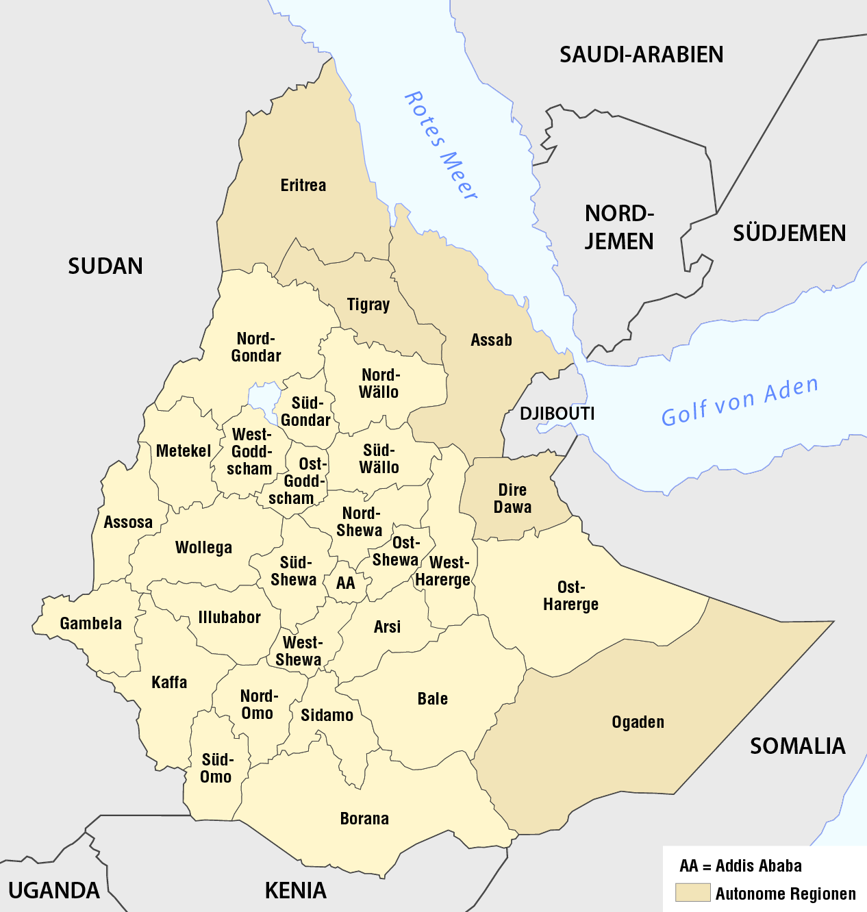
Deutsch: Karte der Verwaltungsgliederung Äthiopiens 1987-1991
English: Map of the 30 regions of Ethiopia, 1987-1991 |
| 日期 | see file history |
| 来源 |
自己的作品, using the information from |
| 作者 | Maximilian Dörrbecker (Chumwa) |
| 授权 (二次使用本文件) |
我,本作品著作权人,特此采用以下许可协议发表本作品: 本文件采用知识共享署名-相同方式共享 2.5 通用许可协议授权。
Sie dürfen das Bild zu den folgenden Bedingungen nutzen:
|
文件历史
点击某个日期/时间查看对应时刻的文件。
| 日期/时间 | 缩略图 | 大小 | 用户 | 备注 | |
|---|---|---|---|---|---|
| 当前 | 2016年10月23日 (日) 06:53 | | 1,266 × 1,332(203 KB) | Chumwa(留言 | 贡献) | corr |
| 2013年11月17日 (日) 11:37 |  | 1,266 × 1,332(203 KB) | Chumwa(留言 | 贡献) | == {{int:filedesc}} == {{Information |Description = {{de|1=Karte der Verwaltungsgliederung Äthiopiens 1987-1991}} |Source = {{own}}, using the information from Negussay Ayele: [ http://www.ethiopians.com/Negussay_NaturalSeaShores.htm On Ethi... |
您不可以覆盖此文件。
文件用途
全域文件用途
以下其他wiki使用此文件:
- de.wikipedia.org上的用途
- fr.wikipedia.org上的用途
- sv.wikipedia.org上的用途
- uk.wikipedia.org上的用途
- zh.wikipedia.org上的用途