File:Karte der Verkehrsverbünde und Tarifverbünde in Deutschland.png
Aller à la navigation
Aller à la recherche

Taille de cet aperçu : 382 × 600 pixels. Autres résolutions : 153 × 240 pixels | 306 × 480 pixels | 489 × 768 pixels | 652 × 1 024 pixels | 1 432 × 2 248 pixels.
Fichier d’origine (1 432 × 2 248 pixels, taille du fichier : 1,2 Mio, type MIME : image/png)
Légendes
Légendes
Ajoutez en une ligne la description de ce que représente ce fichier

|
Une version vectorielle de cette image existe, dans le format « SVG ». Si elle n’est pas inférieure, elle devrait être utilisée à la place de la présente version pour des affichages en plus grandes dimensions ou nécessitant une meilleure résolution. (motif: Please use the svg only for updating and don't include it in articles. It seems that the renderer does not support all graphical functions used in the image.)
File:Karte der Verkehrsverbünde und Tarifverbünde in Deutschland.png → File:Karte der Verkehrsverbünde und Tarifverbünde in Deutschland.svg
Pour plus d’informations sur les images vectorielles, consultez la page de transition de Commons vers le format SVG. Voir aussi les informations à propos de la manière dont le logiciel MediaWiki gère les images au format SVG. |
 |
| Description |
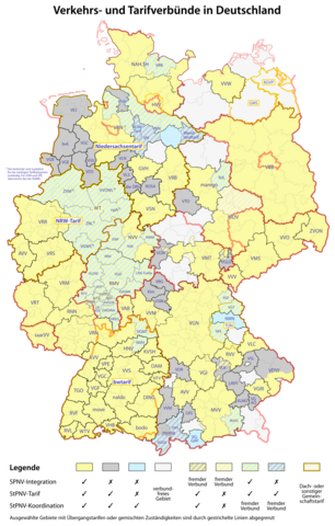
Deutsch: Karte der Verkehrsverbünde und Tarifverbünde in Deutschland
Die Bedeutung der Abkürzungen kann der Liste deutscher Tarif- und Verkehrsverbünde entnommen werden. English: Map of German transport associations Abbreviations are explained in this list of German transport associations. |
| Date | see file history |
| Source | Travail personnel |
| Auteur |
Karte der Landkreise: TUBS, CC BY-SA 3.0 Verkehrsverbünde: Maximilian Dörrbecker (Chumwa), NJ Giggie, CC BY-SA 4.0 |
| Autorisation (Réutilisation de ce fichier) |
Moi, en tant que détenteur des droits d’auteur sur cette œuvre, je la publie sous la licence suivante : Ce fichier est disponible selon les termes de la licence Creative Commons Attribution – Partage dans les Mêmes Conditions 2.5 Générique
Sie dürfen das Bild zu den folgenden Bedingungen nutzen:
|
| Autres versions |
|

.png)
.svg)


_in_Deutschland.png)

_location_map.svg)
Historique du fichier
Cliquer sur une date et heure pour voir le fichier tel qu'il était à ce moment-là.
| Date et heure | Vignette | Dimensions | Utilisateur | Commentaire | |
|---|---|---|---|---|---|
| actuel | 6 janvier 2024 à 22:14 | | 1 432 × 2 248 (1,2 Mio) | NJ Giggie (d | contributions) | Erweiterungen MVV und VGN |
| 4 janvier 2023 à 12:19 |  | 1 432 × 2 248 (1,35 Mio) | NJ Giggie (d | contributions) | new "move" network | |
| 31 octobre 2022 à 09:46 |  | 1 432 × 2 248 (1,35 Mio) | NJ Giggie (d | contributions) | added VRK, changed key, removed yellow outline of Westfalentarif, removed licence stamp | |
| 17 octobre 2022 à 18:03 |  | 1 432 × 2 248 (1,37 Mio) | NJ Giggie (d | contributions) | removed outline | |
| 17 octobre 2022 à 18:01 |  | 1 432 × 2 248 (1,37 Mio) | NJ Giggie (d | contributions) | fixes | |
| 14 octobre 2022 à 16:36 |  | 1 432 × 2 250 (1,23 Mio) | NJ Giggie (d | contributions) | Thicker lines, fixes | |
| 14 octobre 2022 à 16:07 |  | 1 432 × 2 250 (1,2 Mio) | NJ Giggie (d | contributions) | added white background | |
| 14 octobre 2022 à 16:04 |  | 1 432 × 2 250 (1,19 Mio) | NJ Giggie (d | contributions) | recreated and updated | |
| 3 janvier 2021 à 08:10 |  | 1 432 × 2 246 (1 008 kio) | Chumwa (d | contributions) | KomBus ist Teil des VMT geworden / Filsland Mobilitätsverbund wurde in den VVS integriert | |
| 14 juin 2020 à 15:32 |  | 1 432 × 2 246 (1 008 kio) | Chumwa (d | contributions) | nicht mehr existierende Verbünde in Schleswig-Holstein entfernt |
Vous ne pouvez pas remplacer ce fichier.
Utilisations locales du fichier
Les 71 pages suivantes utilisent ce fichier :
- Atlas of Germany
- User:Chumwa/Gallery
- User:Chumwa/OgreBot/Potential transport maps/2016 September 1-10
- User:Chumwa/OgreBot/Potential transport maps/2017 August 21-31
- User:Chumwa/OgreBot/Potential transport maps/2017 February 10-18
- User:Chumwa/OgreBot/Potential transport maps/2017 January 11-20
- User:Chumwa/OgreBot/Potential transport maps/2017 September 11-20
- User:Chumwa/OgreBot/Potential transport maps/2018 January 11-20
- User:Chumwa/OgreBot/Potential transport maps/2018 May 11-20
- User:Chumwa/OgreBot/Potential transport maps/2019 December 1-10
- User:Chumwa/OgreBot/Potential transport maps/2019 February 1-9
- User:Chumwa/OgreBot/Potential transport maps/2019 January 11-20
- User:Chumwa/OgreBot/Public transport information/2015 November 11-20
- User:Chumwa/OgreBot/Public transport information/2016 September 1-10
- User:Chumwa/OgreBot/Public transport information/2017 August 21-31
- User:Chumwa/OgreBot/Public transport information/2017 February 10-18
- User:Chumwa/OgreBot/Public transport information/2017 January 11-20
- User:Chumwa/OgreBot/Public transport information/2017 September 11-20
- User:Chumwa/OgreBot/Public transport information/2018 January 11-20
- User:Chumwa/OgreBot/Public transport information/2018 May 11-20
- User:Chumwa/OgreBot/Public transport information/2019 December 1-10
- User:Chumwa/OgreBot/Public transport information/2019 February 1-9
- User:Chumwa/OgreBot/Public transport information/2019 January 11-20
- User:Chumwa/OgreBot/Public transport information/2020 June 11-20
- User:Chumwa/OgreBot/Public transport information/2021 January 1-10
- User:Chumwa/OgreBot/Public transport information/2022 October 11-20
- User:Chumwa/OgreBot/Public transport information/2022 October 21-31
- User:Chumwa/OgreBot/Public transport information/2023 January 1-10
- User:Chumwa/OgreBot/Public transport information/2024 January 1-10
- User:Chumwa/OgreBot/Transport Maps/2015 November 11-20
- User:Chumwa/OgreBot/Transport Maps/2016 September 1-10
- User:Chumwa/OgreBot/Transport Maps/2017 August 21-31
- User:Chumwa/OgreBot/Transport Maps/2017 February 10-18
- User:Chumwa/OgreBot/Transport Maps/2017 January 11-20
- User:Chumwa/OgreBot/Transport Maps/2017 September 11-20
- User:Chumwa/OgreBot/Transport Maps/2018 January 11-20
- User:Chumwa/OgreBot/Transport Maps/2018 May 11-20
- User:Chumwa/OgreBot/Transport Maps/2019 December 1-10
- User:Chumwa/OgreBot/Transport Maps/2019 February 1-9
- User:Chumwa/OgreBot/Transport Maps/2019 January 11-20
- User:Chumwa/OgreBot/Transport Maps/2020 June 11-20
- User:Chumwa/OgreBot/Transport Maps/2021 January 1-10
- User:Chumwa/OgreBot/Transport Maps/2022 October 11-20
- User:Chumwa/OgreBot/Transport Maps/2022 October 21-31
- User:Chumwa/OgreBot/Transport Maps/2023 January 1-10
- User:Chumwa/OgreBot/Transport Maps/2024 January 1-10
- User:Chumwa/OgreBot/Travel and communication maps/2016 September 1-10
- User:Chumwa/OgreBot/Travel and communication maps/2017 August 21-31
- User:Chumwa/OgreBot/Travel and communication maps/2017 February 10-18
- User:Chumwa/OgreBot/Travel and communication maps/2017 January 11-20
- User:Chumwa/OgreBot/Travel and communication maps/2017 September 11-20
- User:Chumwa/OgreBot/Travel and communication maps/2018 January 11-20
- User:Chumwa/OgreBot/Travel and communication maps/2018 May 11-20
- User:Chumwa/OgreBot/Travel and communication maps/2019 February 1-9
- User:Chumwa/OgreBot/Travel and communication maps/2019 January 11-20
- User:Daniel Mietchen/Category:Images used by media organizations but violating license terms
- User:Minorax/SVG available/2022 October 13-18
- User:Minorax/SVG available/2022 October 25-31
- User:Minorax/SVG available/2023 January 1-6
- User:Minorax/SVG available/2024 January 1-6
- Commons:Files used on the OpenStreetMap Wiki/14
- File:2015-07-18 FahrradmitnahmeDeutschland.jpg
- File:Karte der Aufgabenträger des Schienenpersonennahverkehrs (SPNV) in Deutschland.png
- File:Karte der Verkehrsverbünde und Tarifverbünde in Deutschland, Österreich und der Schweiz.png
- File:Karte der Verkehrsverbünde und Tarifverbünde in Deutschland.png
- File:Karte der Verkehrsverbünde und Tarifverbünde in Deutschland.svg
- File:Karte der Verkehrsverbünde und Tarifverbünde in Deutschland (inkl. Legende).png
- File:Karte der Verkehrsverbünde und Tarifverbünde in Deutschland (inkl. Legende).svg
- File:Karte der Verkehrsverbünde und Tarifverbünde in der Schweiz.png
- File:Karte der Verkehrsverbünde und Tarifverbünde in Österreich.png
- File:ÖPNV-Tarifsysteme in Deutschland.png
Utilisations du fichier sur d’autres wikis
Les autres wikis suivants utilisent ce fichier :
- Utilisation sur de.wikipedia.org
- Utilisation sur de.wikivoyage.org
- Utilisation sur en.wikipedia.org
- Utilisation sur en.wikivoyage.org
- Utilisation sur fr.wikipedia.org
- Utilisation sur ja.wikipedia.org
- Utilisation sur pl.wikivoyage.org
- Utilisation sur tr.wikipedia.org