File:Kent's Ait.xcf
Jump to navigation
Jump to search

Size of this PNG preview of this XCF file: 800 × 228 pixels. Other resolutions: 320 × 91 pixels | 640 × 182 pixels | 2,038 × 581 pixels.
Original file (2,038 × 581 pixels, file size: 2.91 MB, MIME type: image/x-xcf)
Captions
Captions
Add a one-line explanation of what this file represents
Summary
[edit]| Description |
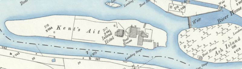
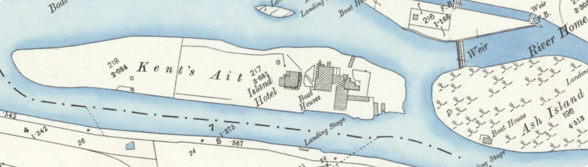
English: Map showing Kent's Ait (now Tagg's Island) and the Island Hotel |
| Date | |
| Source |
Ordnance Survey, London (Edition of 1894–96) CXXXIX Revised: 1894, Published: 1897, Reproduced with the permission of the National Library of Scotland. View map: Ordnance Survey, London (Edition of 1894–96) CXXXIX (East Molesey; Twickenham St Mary The Virgin;... - Ordnance Survey 25 inch England and Wales, 1841–1952. maps.nls.uk. Retrieved on 2023-09-01. |
| Author | Unknown author |
Licensing
[edit]This file is licensed under the Creative Commons Attribution 4.0 International license.
Attribution: National Library of Scotland
- You are free:
- to share – to copy, distribute and transmit the work
- to remix – to adapt the work
- Under the following conditions:
- attribution – You must give appropriate credit, provide a link to the license, and indicate if changes were made. You may do so in any reasonable manner, but not in any way that suggests the licensor endorses you or your use.
File history
Click on a date/time to view the file as it appeared at that time.
| Date/Time | Thumbnail | Dimensions | User | Comment | |
|---|---|---|---|---|---|
| current | 09:19, 1 September 2023 | 2,038 × 581 (2.91 MB) | Orwell'sElephant (talk | contribs) | Map showing Kent's Ait (now Tagg's Island) and the Island Hotel Ordnance Survey, London (Edition of 1894-96) CXXXIX Revised: 1894, Published: 1897, Reproduced with the permission of the National Library of Scotland. |
You cannot overwrite this file.
File usage on Commons
There are no pages that use this file.
File usage on other wikis
The following other wikis use this file:
- Usage on en.wikipedia.org