File:Kingdom of Mann and the Isles-en.svg
跳至導覽
跳至搜尋

此 SVG 檔案的 PNG 預覽的大小:571 × 600 像素。 其他解析度:229 × 240 像素 | 457 × 480 像素 | 731 × 768 像素 | 975 × 1,024 像素 | 1,950 × 2,048 像素 | 1,297 × 1,362 像素。
原始檔案 (SVG 檔案,表面大小:1,297 × 1,362 像素,檔案大小:209 KB)
說明
說明
添加單行說明來描述出檔案所代表的內容
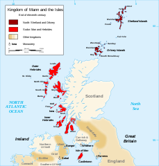
Map of the kingdom of Mann and the Isles, near the end of eleventh century
摘要[編輯]
| 描述 |
English: Map of the kingdom of Mann and the Isles, nearly the end of eleventh century.
Norðr: Shetland and Orkney
Sodor: Man and Hebrides Français : Carte du royaume de Man et des Îles, vers la fin du onzième siècle.
Norðr : Shetland et Orcades
Sodor : Man et Hebrides |
||
| 日期 | |||
| 來源 |
我個人以下列物件為基礎來創作: British Isles.svg, Mormaerdoms.png和Www.wesleyjohnston.com-users-ireland-maps-historical-map1014.gif |
||
| 作者 | Sémhur | ||
| 其他版本 |
Derivative works of this file: Kingdom of Mann and the Isles-es.svg
|
||
| 姓名標示 (由许可协议要求) | © Sémhur / Wikimedia Commons / | ||
| SVG | W3C-validity not checked.
|
||
| Atelier graphique |

| 拍攝地點 | | 位於此地的本圖片與其他圖片: OpenStreetMap |
|---|
授權條款[編輯]
我,本作品的著作權持有者,決定用以下授權條款發佈本作品:
| 公共版權:本藝術作品是自由的,您可以依據自由藝術作品許可協議的條款傳播和/或修改本藝術作品。您可以在Copyleft Attitude網站或其他網站找到該許可協議的樣本。 |
您可以選擇您需要的授權條款。
檔案歷史
點選日期/時間以檢視該時間的檔案版本。
| 日期/時間 | 縮圖 | 尺寸 | 用戶 | 備註 | |
|---|---|---|---|---|---|
| 目前 | 2015年12月26日 (六) 20:06 | | 1,297 × 1,362(209 KB) | Alphathon(對話 | 貢獻) | Various minor corrections/tweaks |
| 2007年10月15日 (一) 10:06 |  | 1,297 × 1,362(208 KB) | Sémhur(對話 | 貢獻) | {{Information |Description=Map of the kingdom of Mann and the Isles, nearly the end of eleventh century |Source=Own work, from : * Map of British Isles * [[:Image:Mormaerdoms.png|Map of kingdoms of Scotland in the Middle Ages] |
無法覆蓋此檔案。
檔案用途
下列4個頁面有用到此檔案:
全域檔案使用狀況
以下其他 wiki 使用了這個檔案:
- af.wikipedia.org 的使用狀況
- be.wikipedia.org 的使用狀況
- bn.wikipedia.org 的使用狀況
- br.wikipedia.org 的使用狀況
- ca.wikipedia.org 的使用狀況
- cs.wikipedia.org 的使用狀況
- cy.wikipedia.org 的使用狀況
- da.wikipedia.org 的使用狀況
- de.wikipedia.org 的使用狀況
- el.wikipedia.org 的使用狀況
- en.wikipedia.org 的使用狀況
- Hebrides
- Isle of Man
- History of the Isle of Man
- Norn language
- Scotland
- Outer Hebrides
- Kingdom of the Isles
- Slate Islands
- Diocese of Sodor and Man
- User:Jnestorius/Regions with significant island landmass
- Earldom of Orkney
- Thorfinn the Mighty
- List of early Germanic peoples
- Norse–Gaels
- Scotland in the High Middle Ages
- Portal:Middle Ages/Selected article
- Portal:Middle Ages/Selected article/10
- Manx runestones
- Viking expansion
- Kewish
- King of Mann
- List of active separatist movements in Europe
- Scottish island names
- Portal:Scotland/Selected article/2012
- Scandinavian Scotland
- Portal:Scotland/Selected article/Week 2, 2012
- Portal:Scotland/Selected article/2016
- Portal:Scotland/Selected article/Week 2, 2016
- es.wikipedia.org 的使用狀況
- eu.wikipedia.org 的使用狀況
檢視此檔案的更多全域使用狀況。