File:Klausenpass-passhöhe05.jpg
Jump to navigation
Jump to search
Size of this preview: 800 × 533 pixels. Other resolutions: 320 × 213 pixels | 640 × 427 pixels | 1,024 × 682 pixels | 1,280 × 853 pixels | 1,937 × 1,291 pixels.
Original file (1,937 × 1,291 pixels, file size: 1.82 MB, MIME type: image/jpeg)
Captions
Captions
Add a one-line explanation of what this file represents
Summary[edit]
| Description |
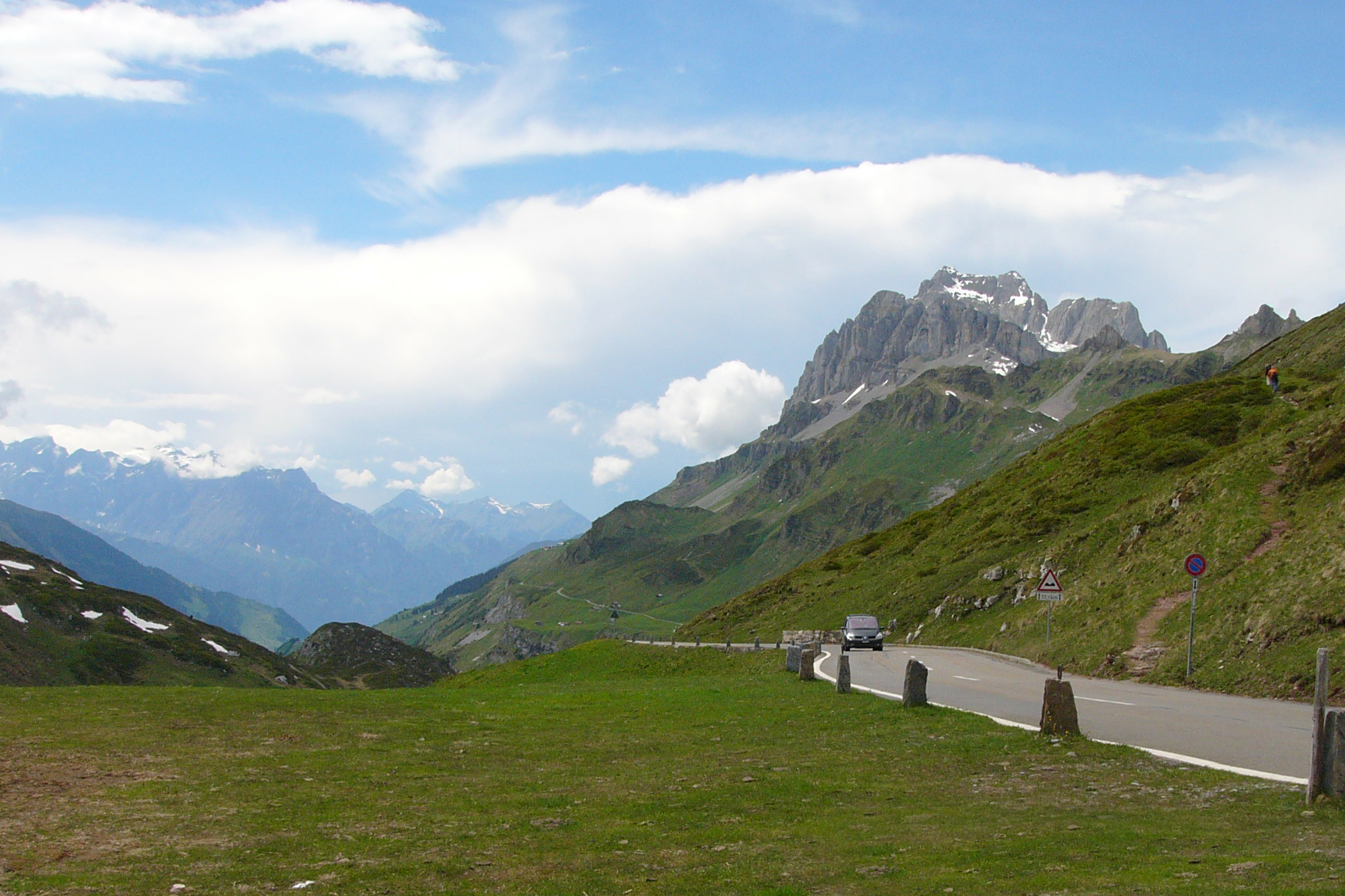
Deutsch: Der Klausenpass (Passhöhe auf 1948 m) ist ein Pass in der Schweiz, der die Kantone Uri und Glarus verbindet. Im Bild: Blick aus der Kapelle auf der Passhöhe zum Glatten (2505 m) English: Klausen Pass (el. 1948 m.) is a high mountain pass in the Swiss Alps connecting the cantons of Uri and Glarus. |
| Date | |
| Source | Own work |
| Author | Nikater |
| Permission (Reusing this file) |
Own work, all rights released (Public domain) |
| Camera location | | View this and other nearby images on: OpenStreetMap |
|---|
Licensing[edit]
| I, the copyright holder of this work, release this work into the public domain. This applies worldwide. In some countries this may not be legally possible; if so: I grant anyone the right to use this work for any purpose, without any conditions, unless such conditions are required by law. |
| Annotations | This image is annotated: View the annotations at Commons |
File history
Click on a date/time to view the file as it appeared at that time.
| Date/Time | Thumbnail | Dimensions | User | Comment | |
|---|---|---|---|---|---|
| current | 08:33, 6 July 2011 | | 1,937 × 1,291 (1.82 MB) | Nikater (talk | contribs) | {{Information |Description= {{de| Der Klausenpass (Passhöhe auf 1948 m) ist ein Pass in der Schweiz, der die Kantone Uri und Glarus verbindet. '''Im Bild''': Blick aus der Kapelle auf der Passhöhe zum Glatten (2505 m)}} {{en|Klausen |
You cannot overwrite this file.
File usage on Commons
There are no pages that use this file.