File:Kosovo regioni sr.png
Jump to navigation
Jump to search
Size of this preview: 531 × 599 pixels. Other resolutions: 213 × 240 pixels | 425 × 480 pixels | 838 × 946 pixels.
Original file (838 × 946 pixels, file size: 41 KB, MIME type: image/png)
Captions
Captions
Add a one-line explanation of what this file represents
Summary
[edit]
| Description |
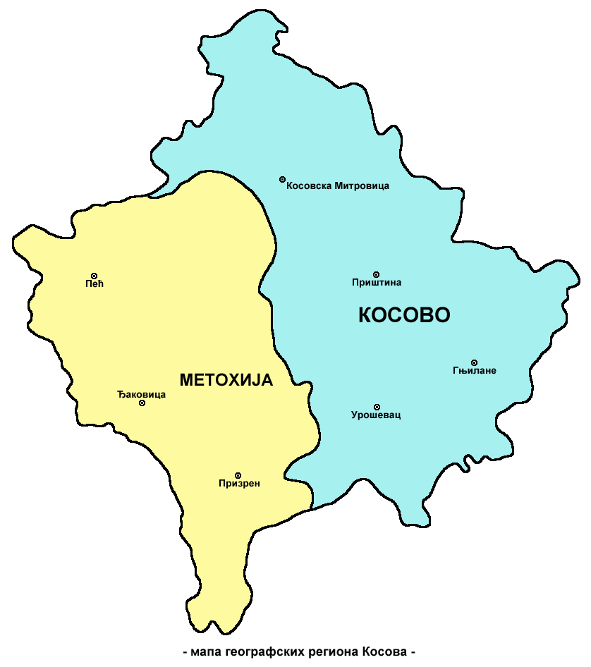
English: Map of geographical regions of Kosovo - Kosovo (proper) and Metohija - Serbian language Cyrillic script version. Serbian: Мапа географских региона Косова - (ужег) Косова и Метохије - ћирилична верзија на српском језику. |
| Date | |
| Source | Own work |
| Author | PANONIAN |
References
[edit]
- http://www.rastko.rs/kosovo/crucified/img/metoh.jpg
- Milovan Radovanović, Kosovo i Metohija - antropogeografske, istorijskogeografske, demografske i geopolitičke osnove, Beograd, 2008.
- Miodrag Milošević, Geografija za 8. razred osnovne škole, Beograd, 1994.
- Dragan Rodić, Geografija za I ili III razred srednje škole, Beograd, 1995.
- Slobodan Radovanović, Geografski atlas, Magic Map, Smederevska Palanka, 2001.
Licensing
[edit]
| I, the copyright holder of this work, release this work into the public domain. This applies worldwide. In some countries this may not be legally possible; if so: I grant anyone the right to use this work for any purpose, without any conditions, unless such conditions are required by law. |
File history
Click on a date/time to view the file as it appeared at that time.
| Date/Time | Thumbnail | Dimensions | User | Comment | |
|---|---|---|---|---|---|
| current | 09:56, 11 October 2009 | | 838 × 946 (41 KB) | PANONIAN (talk | contribs) | {{Information |Description={{en|1='''English:''' Map of geographical regions of Kosovo - Kosovo (proper) and Metohija - Serbian language Cyrillic script version.<br>'''Serbian:''' Мапа географских региона Косова - (ужег) К |
You cannot overwrite this file.
File usage
There are no pages that use this file.
Global file usage
The following other wikis use this file:
- Usage on sh.wikipedia.org
- Usage on sq.wikipedia.org
- Usage on sr.wikipedia.org