File:Kreisreform Mecklenburg-Vorpommern 2011 (Karte).png
Jump to navigation
Jump to search

Size of this preview: 800 × 553 pixels. Other resolutions: 320 × 221 pixels | 640 × 442 pixels | 1,024 × 708 pixels | 1,453 × 1,004 pixels.
Original file (1,453 × 1,004 pixels, file size: 278 KB, MIME type: image/png)
Captions
Captions
Add a one-line explanation of what this file represents
| Description |
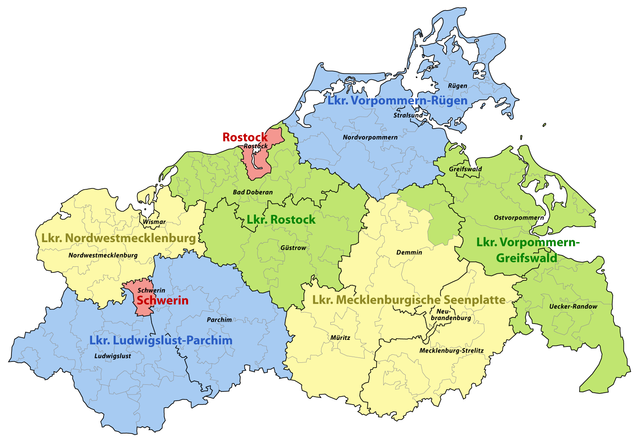
Deutsch: Karte der Änderungen für die Kreisreform in Mecklenburg-Vorpommern 2011
English: Changes in the counties of Mecklenburg-Western Pomerania in 2011 |
||
| Date | |||
| Source | Own work | ||
| Author | Maximilian Dörrbecker (Chumwa) | ||
| Permission (Reusing this file) |
I, the copyright holder of this work, hereby publish it under the following license: This file is licensed under the Creative Commons Attribution-Share Alike 3.0 Unported license.
Sie dürfen das Bild zu den folgenden Bedingungen nutzen:
|
||
| Other versions |
|


.png)


File history
Click on a date/time to view the file as it appeared at that time.
| Date/Time | Thumbnail | Dimensions | User | Comment | |
|---|---|---|---|---|---|
| current | 04:54, 16 September 2011 | | 1,453 × 1,004 (278 KB) | Chumwa (talk | contribs) | Gemeinde Boltenhagen ist im Amt Klützer Winkel aufgegangen |
| 16:28, 15 September 2011 |  | 1,453 × 1,004 (279 KB) | Chumwa (talk | contribs) | {{Information |Description= {{ de }} Karte der Änderungen für die Kreisreform in Mecklenburg-Vorpommern 2011 {{ en }} Changes in the counties of Mecklenburg-Western Pomerania in 2011 |Source={{Own}} |Date=2011-09 |A |
You cannot overwrite this file.
File usage on Commons
The following 8 pages use this file:
- Mecklenburg-Vorpommern
- User:Chumwa/Gallery
- File:Karte der Änderungen infolge der Kreisreform in Mecklenburg-Vorpommern 2011.png
- File:Karte der Änderungen infolge der Kreisreform in Mecklenburg-Vorpommern 2011 mit alter Grenze.png
- File:Kreisreform Mecklenburg-Vorpommern 2011 (Karte).png
- File:Mecklenburg-Vorpommern - Karte der Ämter und der amtsfreien Gemeinden.png
- File:Mecklenburg-Vorpommern - Karte der Ämter und der amtsfreien Gemeinden.svg
- File:Mecklenburg-Vorpommern - Karte der Ämter und der amtsfreien Gemeinden 2011.png
File usage on other wikis
The following other wikis use this file:
- Usage on de.wikipedia.org
- Usage on www.wikidata.org
.png&oldid=619540312)