File:Krt 1510 full.jpg

Original file (4,000 × 3,000 pixels, file size: 14.13 MB, MIME type: image/jpeg)
Captions
Captions
Summary[edit]
| Description |
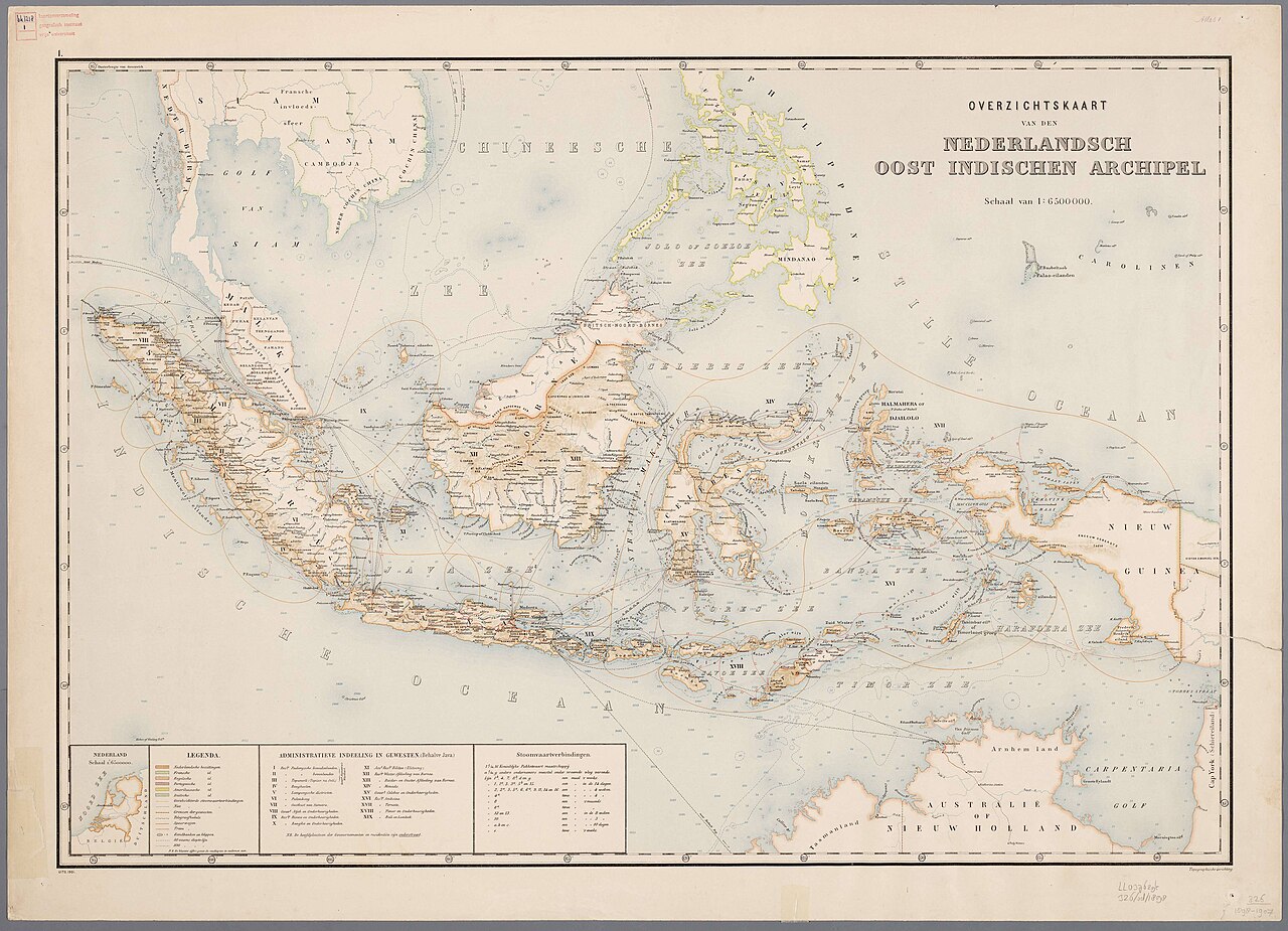
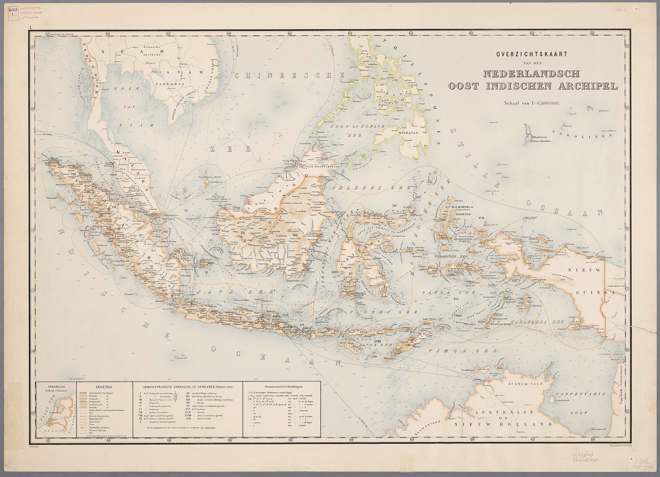
Nederlands: Atlas van Nederlandsch Oost-Indië / samengest. door Topographisch Bureau te Batavia van 1897-1904 |
| Date | 1897-1904 |
| Source |
https://vu.contentdm.oclc.org/digital/collection/krt/id/1510 or https://digitalcollections.universiteitleiden.nl/view/item/2014658 restored and enchanced by u/helloVizart |
| Author | Topographisch Bureau, Batavia |
| Other versions |
.jpg)
.jpg)


|
This work is in the public domain in its country of origin and other countries and areas where the copyright term is the author's life plus 70 years or fewer.
| |
| This file has been identified as being free of known restrictions under copyright law, including all related and neighboring rights. | |
File history
Click on a date/time to view the file as it appeared at that time.
| Date/Time | Thumbnail | Dimensions | User | Comment | |
|---|---|---|---|---|---|
| current | 06:44, 8 August 2023 | | 4,000 × 3,000 (14.13 MB) | Bennylin (talk | contribs) | restored and enchanced by u/helloVizart |
| 06:41, 8 August 2023 |  | 4,555 × 3,292 (1.81 MB) | Bennylin (talk | contribs) | {{Information |Description={{nl|Atlas van Nederlandsch Oost-Indië / samengest. door Topographisch Bureau te Batavia van 1897-1904<br /> 1. Overzichtskaart van den Nederlandsch Oost Indischen Archipel}} |Source=https://vu.contentdm.oclc.org/digital/collection/krt/id/1510 |Date=1897-1904 |Author=Topographisch Bureau, Batavia |Permission= |other_versions= }} {{PD-old}} Category:Old maps of Indonesia |
You cannot overwrite this file.
File usage on Commons
The following 4 pages use this file:
File usage on other wikis
The following other wikis use this file: