File:La Corbière Lighthouse from the water (18706058294).jpg
Jump to navigation
Jump to search

Size of this preview: 800 × 600 pixels. Other resolutions: 320 × 240 pixels | 640 × 480 pixels | 1,024 × 768 pixels | 1,280 × 960 pixels | 2,048 × 1,536 pixels.
Original file (2,048 × 1,536 pixels, file size: 840 KB, MIME type: image/jpeg)
Captions
Captions
Add a one-line explanation of what this file represents
Summary
[edit].jpg&action=edit§ion=1)
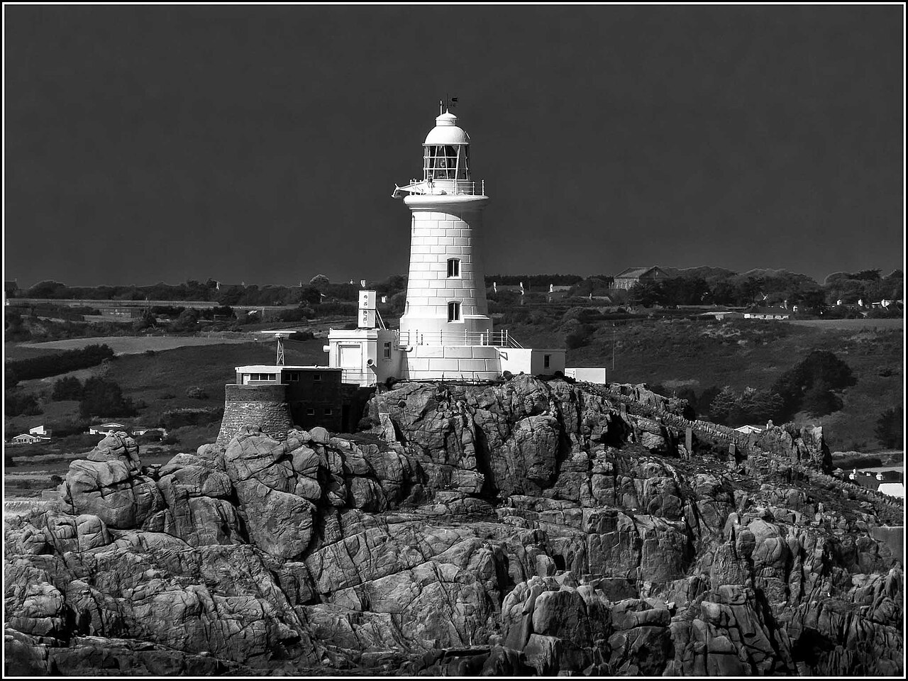
| Description | The lighthouse was the first in the British Isles to be built of reinforced conrete and its light is visible for 18 miles (29 kms) in clear weather. The lighthouse is connected to the shore by a causeway that is covered at high tide. The rush of the tide around this part of the coast can be very dangerous but it is a beautiful place, whether in broad daylight or at sunset. |
| Date | |
| Source | La Corbière Lighthouse from the water |
| Author | Smudge 9000 from North Kent Coast, England |
| Camera location | | View this and other nearby images on: OpenStreetMap |
|---|
.jpg¶ms=049.179977_N_-002.250170_E_globe:Earth_type:camera_source:Flickr_&language=en)
Licensing
[edit].jpg&action=edit§ion=2)
This file is licensed under the Creative Commons Attribution-Share Alike 2.0 Generic license.
- You are free:
- to share – to copy, distribute and transmit the work
- to remix – to adapt the work
- Under the following conditions:
- attribution – You must give appropriate credit, provide a link to the license, and indicate if changes were made. You may do so in any reasonable manner, but not in any way that suggests the licensor endorses you or your use.
- share alike – If you remix, transform, or build upon the material, you must distribute your contributions under the same or compatible license as the original.
| This image was originally posted to Flickr by Smudge 9000 at https://flickr.com/photos/7599112@N08/18706058294. It was reviewed on 4 November 2020 by FlickreviewR 2 and was confirmed to be licensed under the terms of the cc-by-sa-2.0. |
File history
Click on a date/time to view the file as it appeared at that time.
| Date/Time | Thumbnail | Dimensions | User | Comment | |
|---|---|---|---|---|---|
| current | 04:12, 4 November 2020 | | 2,048 × 1,536 (840 KB) | JotaCartas (talk | contribs) | Transferred from Flickr via #flickr2commons |
You cannot overwrite this file.
File usage on Commons
There are no pages that use this file.
.jpg&oldid=885928711)