File:Lage Naturschutzgebiet Kaltenberg.png
Jump to navigation
Jump to search

Size of this preview: 800 × 341 pixels. Other resolutions: 320 × 137 pixels | 640 × 273 pixels | 1,024 × 437 pixels | 1,852 × 790 pixels.
Original file (1,852 × 790 pixels, file size: 1.13 MB, MIME type: image/png)
Captions
Captions
Add a one-line explanation of what this file represents
Summary
[edit]
| Description |
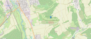
Deutsch: Lagekarte |
|||
| Date | ||||
| Source |
Own work
|
|||
| Author | Triplec85 |
Licensing
[edit]
This file is licensed under the Creative Commons Attribution-Share Alike 4.0 International license.
- You are free:
- to share – to copy, distribute and transmit the work
- to remix – to adapt the work
- Under the following conditions:
- attribution – You must give appropriate credit, provide a link to the license, and indicate if changes were made. You may do so in any reasonable manner, but not in any way that suggests the licensor endorses you or your use.
- share alike – If you remix, transform, or build upon the material, you must distribute your contributions under the same or compatible license as the original.
File history
Click on a date/time to view the file as it appeared at that time.
| Date/Time | Thumbnail | Dimensions | User | Comment | |
|---|---|---|---|---|---|
| current | 21:58, 26 June 2020 | | 1,852 × 790 (1.13 MB) | Triplec85 (talk | contribs) | Uploaded a work by Triplec85 from {{own}} {{ODbL OpenStreetMap}} with UploadWizard |
You cannot overwrite this file.
File usage on Commons
The following page uses this file:
Metadata
Categories:
- Naturschutzgebiet Kaltenberg
- OpenStreetMap maps of Lauda-Königshofen
- Kreisstraße 2800 (Main-Tauber-Kreis) in Lauda-Königshofen
- Kreisstraße 2847 (Main-Tauber-Kreis) in Lauda-Königshofen
- Bundesstraße 292 in Lauda-Königshofen
- Bundesstraße 290 in Königshofen (Lauda-Königshofen)
- 2020 maps of Lauda-Königshofen
- OpenStreetMap maps of nature reserves in Main-Tauber-Kreis
- Bundesstraße 290 in Unterbalbach