File:Lage altmyhl.png
Jump to navigation
Jump to search
Size of this preview: 800 × 591 pixels. Other resolutions: 320 × 237 pixels | 640 × 473 pixels | 1,024 × 757 pixels | 1,066 × 788 pixels.
Original file (1,066 × 788 pixels, file size: 169 KB, MIME type: image/png)
Captions
Captions
Add a one-line explanation of what this file represents
Summary
[edit]
| Description |
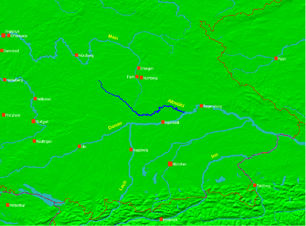
Preparation by User:Ulamm of Image:Lage_fluss_altmühl.PNG,
which has been uploaded to Wikimedia commons by User:Omnidom 999 on 18.01.2006 |
| Date | 3 April 2007 (original upload date) |
| Source | Own work |
| Author | Ulamm |
Licensing
[edit]
| I, the copyright holder of this work, release this work into the public domain. This applies worldwide. In some countries this may not be legally possible; if so: I grant anyone the right to use this work for any purpose, without any conditions, unless such conditions are required by law. |
File history
Click on a date/time to view the file as it appeared at that time.
| Date/Time | Thumbnail | Dimensions | User | Comment | |
|---|---|---|---|---|---|
| current | 19:59, 3 April 2007 | | 1,066 × 788 (169 KB) | Ulamm (talk | contribs) | Preparation of Picture:Lage_fluss_altmühl.PNG, which has been uploaded to Wikimedia commons by Niklas Dehne on 18.01.2006 Survey of the Bavarian territory (only international borders ar emarked) with positiion and course of Altmühl River |
You cannot overwrite this file.
File usage on Commons
There are no pages that use this file.
File usage on other wikis
The following other wikis use this file:
- Usage on de.wikipedia.org