File:Lage des Landkreises Eichsfeld in Deutschland.png
Jump to navigation
Jump to search
No higher resolution available.
Lage_des_Landkreises_Eichsfeld_in_Deutschland.png (197 × 235 pixels, file size: 2 KB, MIME type: image/png)
Captions
Captions
Add a one-line explanation of what this file represents
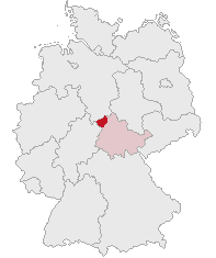
| Description | Landkreis Eichsfeld, Thuringia, Germany | ||||||||
| Date | |||||||||
| Source | Own work | ||||||||
| Author | own work by Geograv | ||||||||
| Permission (Reusing this file) |
|

File history
Click on a date/time to view the file as it appeared at that time.
| Date/Time | Thumbnail | Dimensions | User | Comment | |
|---|---|---|---|---|---|
| current | 16:37, 11 October 2007 | | 197 × 235 (2 KB) | Rauenstein (talk | contribs) | |
| 23:41, 31 May 2006 |  | 176 × 234 (4 KB) | Rauenstein (talk | contribs) | == Summary == Karte erstellt auf der Grundlage der opengeodb.de-Umrisse. Moved from de.wikipedia.org, first uploaded by de:Benutzer:Geograv. == License == {{GFDL-OpenGeoDB}} Category:Maps of Thuringia |
You cannot overwrite this file.
File usage
There are no pages that use this file.
Global file usage
The following other wikis use this file:
- Usage on bg.wikipedia.org
- Usage on eo.wikipedia.org
- Usage on es.wikipedia.org
- Usage on fr.wikipedia.org
- Usage on ka.wikipedia.org
- Usage on kk.wikipedia.org
- Usage on pl.wikipedia.org
- Usage on pt.wikipedia.org
- Usage on sv.wikipedia.org