File:Lago Ranco-en.svg
Jump to navigation
Jump to search

Size of this PNG preview of this SVG file: 800 × 585 pixels. Other resolutions: 320 × 234 pixels | 640 × 468 pixels | 1,024 × 749 pixels | 1,280 × 936 pixels | 2,560 × 1,872 pixels | 1,400 × 1,024 pixels.
Original file (SVG file, nominally 1,400 × 1,024 pixels, file size: 7.38 MB)
Captions
Captions
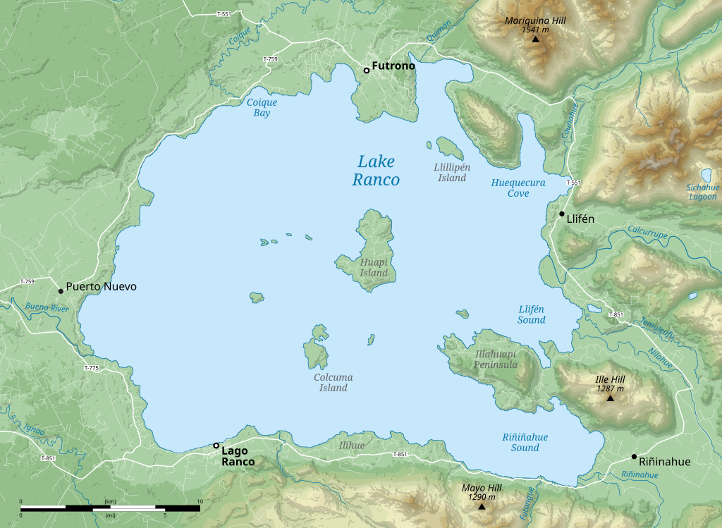
Lake Ranco topographic map
Summary[edit]
| Title |
English: Lake Ranco topographic map |
| Description |
|
| Date | |
| Source |
Own work.
|
| Creator | |
| Geotemporal data | |
| Map location | Lake Ranco |
| Map type | Topographic map |
| Heading |
 |
| Georeferencing | If inappropriate please set warp_status = skip to hide. |
| Bibliographic data | |
| Language | English |
| Other versions |
|

Licensing[edit]
I, the copyright holder of this work, hereby publish it under the following license:
This file is licensed under the Creative Commons Attribution-Share Alike 4.0 International license.
- You are free:
- to share – to copy, distribute and transmit the work
- to remix – to adapt the work
- Under the following conditions:
- attribution – You must give appropriate credit, provide a link to the license, and indicate if changes were made. You may do so in any reasonable manner, but not in any way that suggests the licensor endorses you or your use.
- share alike – If you remix, transform, or build upon the material, you must distribute your contributions under the same or compatible license as the original.
File history
Click on a date/time to view the file as it appeared at that time.
| Date/Time | Thumbnail | Dimensions | User | Comment | |
|---|---|---|---|---|---|
| current | 07:14, 9 February 2024 | | 1,400 × 1,024 (7.38 MB) | DEGA MD (talk | contribs) | Uploaded own work with UploadWizard |
You cannot overwrite this file.
File usage on Commons
The following page uses this file:
File usage on other wikis
The following other wikis use this file:
- Usage on en.wikipedia.org
- Usage on id.wikipedia.org
- Usage on ru.wikipedia.org