File:Lake Balkhash (MODIS 2022-06-13).jpg

Original file (3,083 × 2,436 pixels, file size: 3.2 MB, MIME type: image/jpeg)
Captions
Captions
Summary
[edit].jpg&action=edit§ion=1)
| Description |
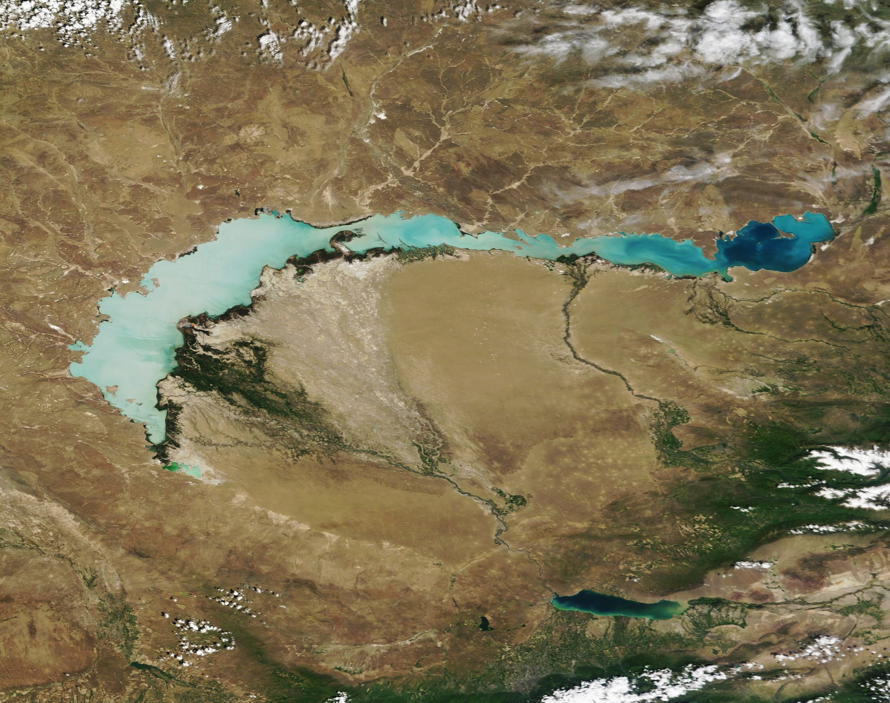
English: The milky-blue waters of Lake Balkhash stand in stark contrast to the tans and browns of the arid land surrounding the massive lake. Sitting in southeastern Kazakhstan, the crescent-shaped Lake Balkhash spans about 400 miles (644 km) from east to west, and covers an area of roughly 6,600 square miles (17,000 square km), making it the fifteenth-largest lake on Earth, by surface area. More than 35,000 years old, Lake Balkhash receives water from seven rivers, but has no outflow. The largest river is the Ili River, which rises in the snow-covered Tian-Shan mountains, cuts across northwestern China to form a massive delta on the southeastern shore of the western section of Lake Balkhash.
Water in the western part of the lake is almost fresh—suitable for drinking and industrial uses—whereas the eastern side of the basin is brackish to salty. The western side is also murkier; visibility/light penetrates to about 1 meter, compared to more than 5 meters on the eastern side. This murkiness, and the water’s milky blue color, is primarily due to sediments suspended in the water. The sediment is both carried it from the Ili and other rivers and stirred up from the bottom by action of winds on the surface of the shallow lake. On June 12, 2022, the Moderate Resolution Imaging Spectroradiometer (MODIS) on board NASA’s Terra satellite acquired a true-color image of Lake Balkhash. The immense Ili River Delta appears as an expanse of dark water and braided channels in the west, while the Karatal River forms a smaller delta in the eastern section of Lake Balkhash. |
||
| Date | Taken on 7 June 2022 | ||
| Source |
|
||
| Author | MODIS Land Rapid Response Team, NASA GSFC |
| This media is a product of the Terra mission Credit and attribution belongs to the mission team, if not already specified in the "author" row |
Licensing
[edit].jpg&action=edit§ion=2)
| This file is in the public domain in the United States because it was solely created by NASA. NASA copyright policy states that "NASA material is not protected by copyright unless noted". (See Template:PD-USGov, NASA copyright policy page or JPL Image Use Policy.) | ||
 |
Warnings:
|
File history
Click on a date/time to view the file as it appeared at that time.
| Date/Time | Thumbnail | Dimensions | User | Comment | |
|---|---|---|---|---|---|
| current | 22:01, 9 January 2024 | | 3,083 × 2,436 (3.2 MB) | OptimusPrimeBot (talk | contribs) | #Spacemedia - Upload of http://modis.gsfc.nasa.gov/gallery/images/image06132022_250m.jpg via Commons:Spacemedia |
You cannot overwrite this file.
File usage on Commons
There are no pages that use this file.
.jpg&oldid=840072162)