File:Lake Chad (MODIS 2018-06-07).jpg

Original file (2,223 × 1,723 pixels, file size: 401 KB, MIME type: image/jpeg)
Captions
Captions
Summary
[edit].jpg&action=edit§ion=1)
| Description |
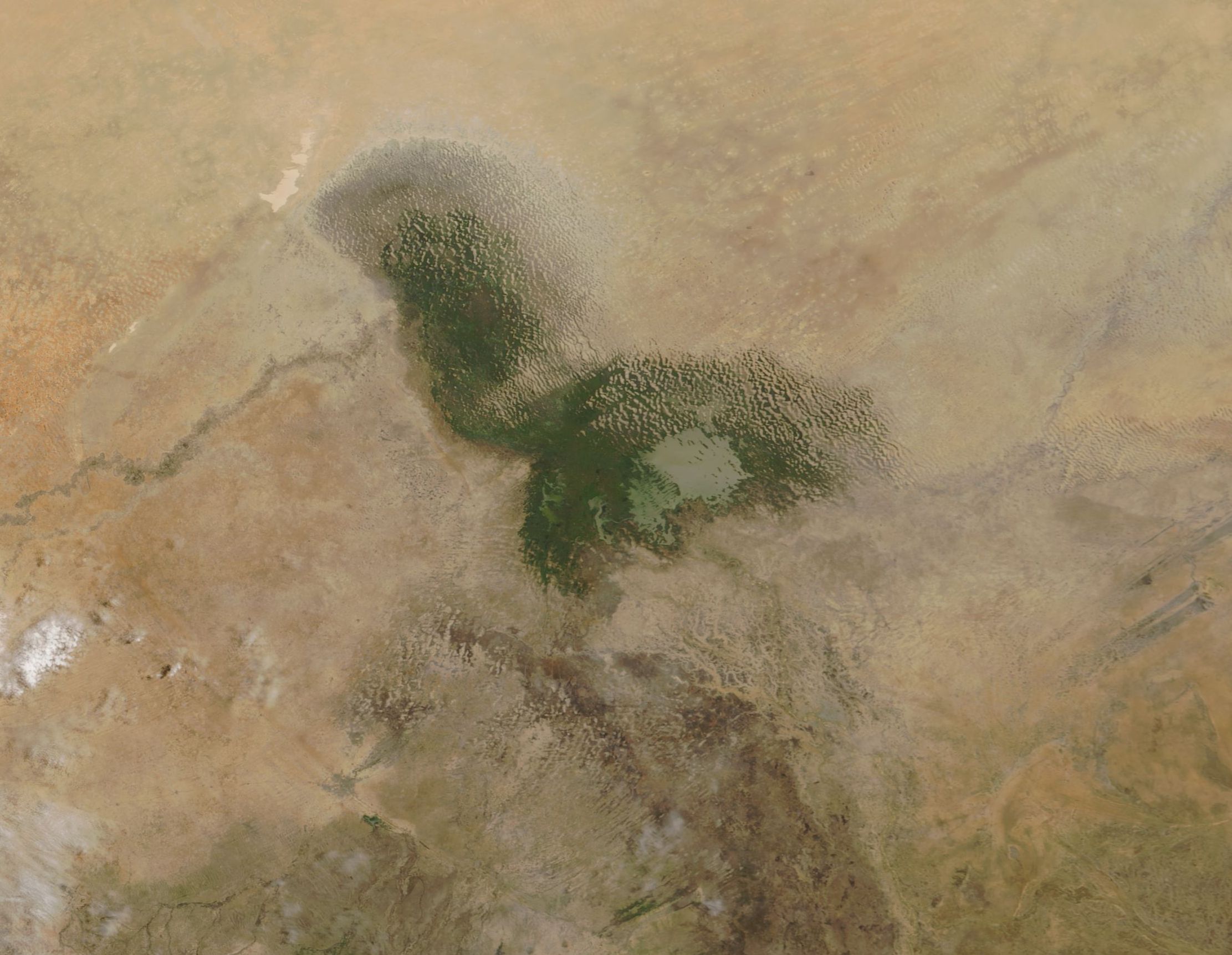
English: Lake Chad, located in west-central Africa, was once one of the largest bodies of fresh water on the continent. The waters supported a thriving community through fishing, agriculture, irrigation and economic activities.
Today Lake Chad spans less than a tenth of the area it covered in the 1960s while supporting more than 30 million people in Chad, Niger, Nigeria, and Cameroon. The Chad Basin sits within the Sahel, a semiarid strip of land dividing the Sahara Desert from the humid savannas of equatorial Africa. The basin is bordered by mountain ranges and spans more than 2.4 million square kilometers of Cameroon, Nigeria, Chad, and Niger. The water level in the lake is largely controlled by the inflow from rivers, notably the Chari from the south and, seasonally, the Komodugu-Yobe from the northwest. Rainfall can also reach the lake by way of smaller tributaries and groundwater discharge. An increasingly dry climate along with the use of the lake for massive irrigation projects are cited as primary reasons for the decline of the lake. The decline in the lake has caused economic shrinkage, particularly a shortage of jobs as fishing and agriculture sectors contract. At the same time, conflict between non-state armed groups has ravaged the region, triggering displacement of a large number of people in an area suffering significant food insecurity. According to the United Nations Office for Coordination of Human Affairs (UN OCHA): “the Lake Chad Basin humanitarian emergency is among the most severe in the world. The protracted conflict has uprooted around 2.4 million people, stoked high levels of hunger and malnutrition, and subjected millions of civilians to extreme hardship. Insecurity is hampering the resumption of normal life, leaving conflict-affected families dependent on humanitarian assistance for survival.” Food insecurity is expected to increase in the coming months, with more individuals reliant on aide for survival. The Moderate Resolution Imaging Spectroradiometer (MODIS) aboard NASA’s Terra satellite acquired a true-color image of Lake Chad on June 3, 2018. |
||
| Date | Taken on 3 June 2018 | ||
| Source |
|
||
| Author | Jeff Schmaltz, MODIS Land Rapid Response Team, NASA GSFC |
| This media is a product of the Terra mission Credit and attribution belongs to the mission team, if not already specified in the "author" row |
Licensing
[edit].jpg&action=edit§ion=2)
| This file is in the public domain in the United States because it was solely created by NASA. NASA copyright policy states that "NASA material is not protected by copyright unless noted". (See Template:PD-USGov, NASA copyright policy page or JPL Image Use Policy.) | ||
 |
Warnings:
|
File history
Click on a date/time to view the file as it appeared at that time.
| Date/Time | Thumbnail | Dimensions | User | Comment | |
|---|---|---|---|---|---|
| current | 01:42, 17 February 2024 | | 2,223 × 1,723 (401 KB) | OptimusPrimeBot (talk | contribs) | #Spacemedia - Upload of http://modis.gsfc.nasa.gov/gallery/images/image06072018_250m.jpg via Commons:Spacemedia |
You cannot overwrite this file.
File usage on Commons
There are no pages that use this file.
File usage on other wikis
The following other wikis use this file:
- Usage on en.wikipedia.org
.jpg&oldid=852765142)