File:Lake Washington Ship Canal Fish Ladder pamphlet 03.jpg
Jump to navigation
Jump to search
Size of this preview: 800 × 501 pixels. Other resolutions: 320 × 200 pixels | 640 × 401 pixels | 1,024 × 641 pixels | 1,280 × 801 pixels | 2,169 × 1,358 pixels.
Original file (2,169 × 1,358 pixels, file size: 1.11 MB, MIME type: image/jpeg)
Captions
Captions
Add a one-line explanation of what this file represents
Summary[edit]
| Description |
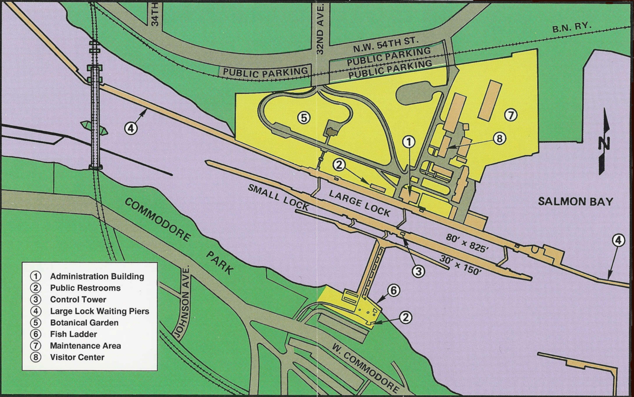
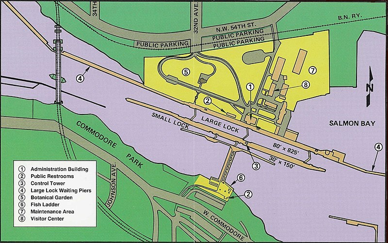
English: Map of the Hiram M. Chittenden Locks, Seattle, Washington, scanned at 600 dpi and cleaned up. Major features are labeled on the map; buildings in the locks complex are numbered, and a legend indicates what they are.
|
||
| Date | Presumably 1996, based on pamphlet number | ||
| Source |
Back cover of U.S. Government Printing Office Pamphlet 1996-792-501: Lake Washington Ship Canal Fish Ladder. The same map can also be found on the back cover of U.S. Government Printing Office Pamphlet 1999-791-887: Lake Washington Ship Canal and Hiram M. Chittenden Locks. |
||
| Author | US government | ||
| Permission (Reusing this file) |
Original work of the US Federal Government is public domain |
| Object location | | View this and other nearby images on: OpenStreetMap |
|---|
Licensing[edit]
This work is in the public domain in the United States because it is a work prepared by an officer or employee of the United States Government as part of that person’s official duties under the terms of Title 17, Chapter 1, Section 105 of the US Code.
Note: This only applies to original works of the Federal Government and not to the work of any individual U.S. state, territory, commonwealth, county, municipality, or any other subdivision. This template also does not apply to postage stamp designs published by the United States Postal Service since 1978. (See § 313.6(C)(1) of Compendium of U.S. Copyright Office Practices). It also does not apply to certain US coins; see The US Mint Terms of Use.
|
 | |
| This file has been identified as being free of known restrictions under copyright law, including all related and neighboring rights. | ||
File history
Click on a date/time to view the file as it appeared at that time.
| Date/Time | Thumbnail | Dimensions | User | Comment | |
|---|---|---|---|---|---|
| current | 18:29, 20 September 2007 | | 2,169 × 1,358 (1.11 MB) | Jmabel (talk | contribs) | == Summary == {{Information |Description=Map of the Hiram M. Chittenden Locks, Seattle, Washington, scanned at 600 dpi and cleaned up. Major features are labeled on the map; buildings in the locks complex are numbered, and a legend indicates what they are |
You cannot overwrite this file.
File usage on Commons
The following page uses this file:
File usage on other wikis
The following other wikis use this file:
- Usage on en.wikipedia.org
- Usage on fr.wikipedia.org
- Usage on nl.wikipedia.org
- Usage on ru.wikipedia.org