File:Lascar The Meridian Gate (4473846693).jpg
Jump to navigation
Jump to search
Size of this preview: 800 × 531 pixels. Other resolutions: 320 × 213 pixels | 640 × 425 pixels | 1,024 × 680 pixels | 1,280 × 850 pixels | 2,560 × 1,700 pixels | 3,216 × 2,136 pixels.
Original file (3,216 × 2,136 pixels, file size: 2.76 MB, MIME type: image/jpeg)
Captions
Captions
Add a one-line explanation of what this file represents
Summary
[edit].jpg&action=edit§ion=1)
| Description |
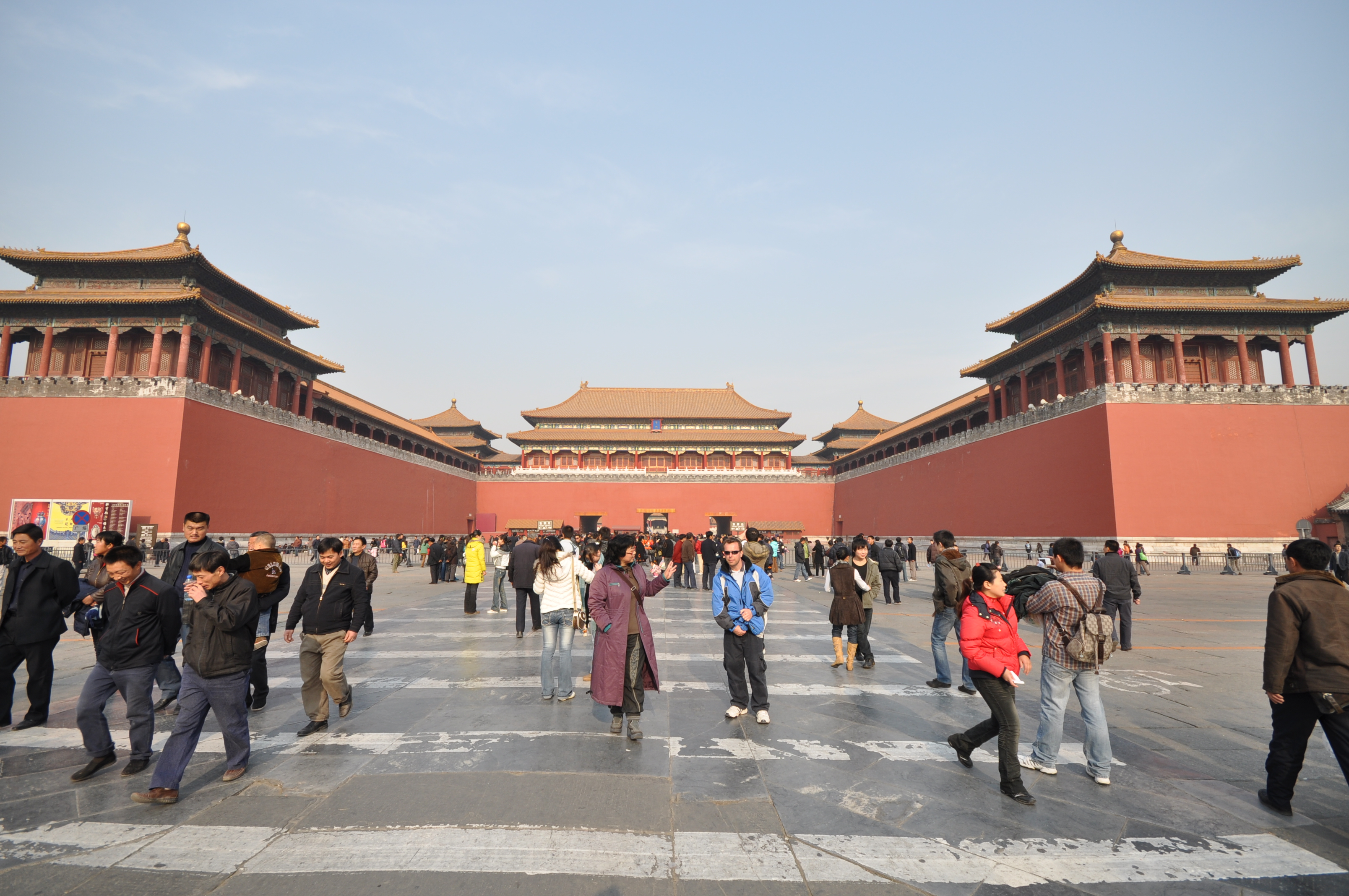
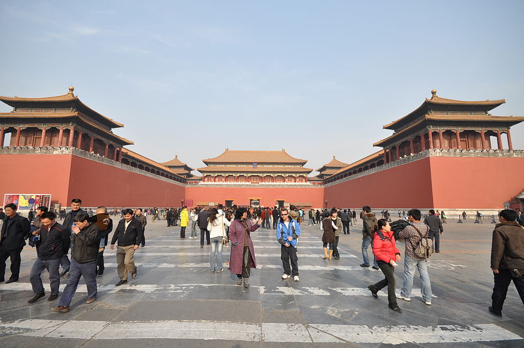
"Wu men" English: Beijing - Forbidden City(view N) - Meridian Gate -
The Meridian Gate is the southern (and largest) gate of the Forbidden City. It has five arches. The three central arches are close together; the two flanking arches are farther apart from the three central arches. The center arch was formerly reserved for the Emperor alone; the exceptions were the Empress, who could enter it once on the day of her wedding, and the top three scholars of the triennial civil service examinations, who left the exams through the central arch. All other officials and servants had to use the four side arches. Above the arches are a series of buildings. The central one is the palace of nine bays wide, with double roofs. In each side, the 13 bays-wide building, single roof, connects the two pavilions on the top. The Emperor of China reviewed his troops from this location during the Ming and Qing dynasties. Its superstructure is also called the "Five Phoenix Turrets" because it is composed of five buildings.[1] Imperial proclamations and almanacs were issued from the gate house. After successful campaigns, the Emperor received prisoners of war here, sometimes followed by mass decapitations.[2] The gate has five gateways. Although urban myth has it that senior officers were executed here in Imperial China; in reality only corporal punishment was actually carried out. Behind the viewer is Tiananmen Gate, the principal entrance to the imperial palace grounds. When proceeding northward through the palace grounds, the next major gate encountered is the Gate of Supreme Harmony. [Wikipedia.org]
Deutsch: Beijing - Verbotene Stadt(Blick N) - Mittagstor |
| Date | |
| Source | The Meridian Gate |
| Author | Jorge Láscar from Australia |
| Camera location | | View this and other nearby images on: OpenStreetMap |
|---|
.jpg¶ms=039.907925_N_0116.390919_E_globe:Earth_type:camera_source:Flickr_&language=en)
Licensing
[edit].jpg&action=edit§ion=2)
This file is licensed under the Creative Commons Attribution 2.0 Generic license.
- You are free:
- to share – to copy, distribute and transmit the work
- to remix – to adapt the work
- Under the following conditions:
- attribution – You must give appropriate credit, provide a link to the license, and indicate if changes were made. You may do so in any reasonable manner, but not in any way that suggests the licensor endorses you or your use.
| This image was originally posted to Flickr by Jorge Lascar at https://www.flickr.com/photos/8721758@N06/4473846693. It was reviewed on 2 April 2014 by FlickreviewR and was confirmed to be licensed under the terms of the cc-by-2.0. |
File history
Click on a date/time to view the file as it appeared at that time.
| Date/Time | Thumbnail | Dimensions | User | Comment | |
|---|---|---|---|---|---|
| current | 09:25, 2 April 2014 | | 3,216 × 2,136 (2.76 MB) | Russavia (talk | contribs) | Transferred from Flickr |
You cannot overwrite this file.
File usage on Commons
There are no pages that use this file.
File usage on other wikis
The following other wikis use this file:
- Usage on ja.wikipedia.org
.jpg&oldid=895262833)