File:Launch Row - GPN-2000-001323.jpg
Jump to navigation
Jump to search

Size of this preview: 792 × 600 pixels. Other resolutions: 317 × 240 pixels | 634 × 480 pixels | 1,014 × 768 pixels | 1,280 × 970 pixels | 2,560 × 1,939 pixels | 2,970 × 2,250 pixels.
Original file (2,970 × 2,250 pixels, file size: 5.56 MB, MIME type: image/jpeg)
Captions
Captions
Add a one-line explanation of what this file represents
| Description |
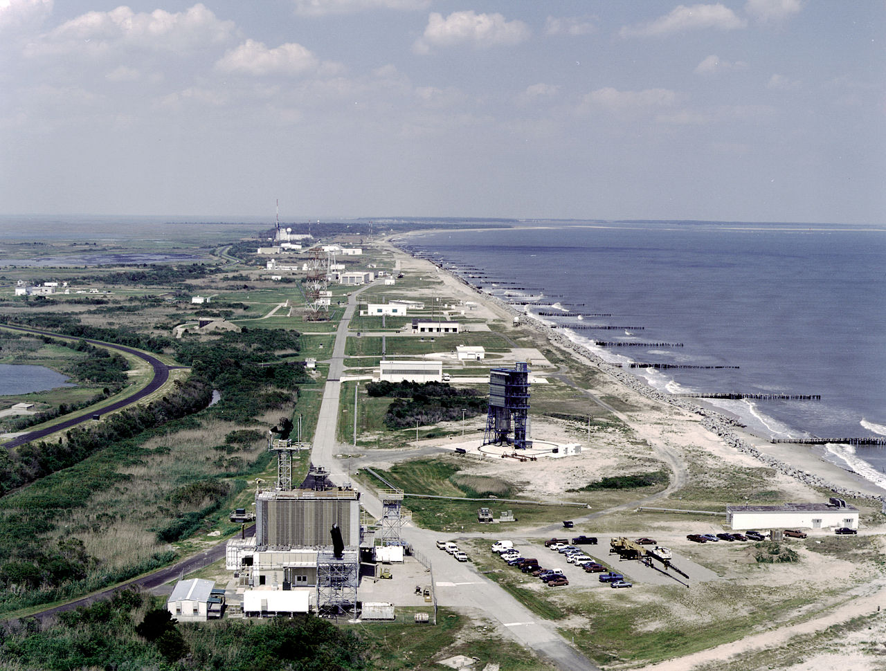
English: Located on Virginia's Eastern Shore, the Wallops Island Flight Facility shown in this aerial view began as an auxiliary flight research station associated with the Langley Aeronautical Laboratory in 1945. Its remote barrier-island location on the Atlantic coast made it ideal for testing aircraft models and launching small rockets. As the space program evolved, it became one of the agency's mainstays for launching sounding rockets carrying scientific experiments. In the 1980s, however, a proposal emerged to close Wallops as a way of reducing NASA's operating costs. Instead, NASA managers decided to incorporate the facility into the Goddard Space Flight Center because the latter already was closely linked with the facility because Goddard had a sounding rocket division that relied on Wallops for launch, range, tracking and data support. In 1982, Wallops Island Station became the Wallops Island Flight Facility managed under the "Suborbital Projects and Operations" directorate at Goddard. |
|||||
| Date | ||||||
| Source | Great Images in NASA Description | |||||
| Author | NASA | |||||
| Permission (Reusing this file) |
|

This image or video was catalogued by Goddard Space Flight Center of the United States National Aeronautics and Space Administration (NASA) under Photo ID: GPN-2000-001323 and Alternate ID: WALLOPS7. This tag does not indicate the copyright status of the attached work. A normal copyright tag is still required. See Commons:Licensing. Other languages:
|
File history
Click on a date/time to view the file as it appeared at that time.
| Date/Time | Thumbnail | Dimensions | User | Comment | |
|---|---|---|---|---|---|
| current | 04:28, 9 April 2009 | | 2,970 × 2,250 (5.56 MB) | BotMultichillT (talk | contribs) | {{Information |Description={{en|1=Located on Virginia's Eastern Shore, the Wallops Island Flight Facility shown in this aerial view began as an auxiliary flight research station associated with the Langley Aeronautical Laboratory in 1945. Its remote barri |
You cannot overwrite this file.
File usage on Commons
The following page uses this file:
File usage on other wikis
The following other wikis use this file:
- Usage on pt.wikipedia.org