File:Lee and Maria 2017-09-27 1415Z.jpg
Jump to navigation
Jump to search
Size of this preview: 800 × 563 pixels. Other resolutions: 320 × 225 pixels | 640 × 450 pixels | 1,024 × 720 pixels | 1,450 × 1,020 pixels.
Original file (1,450 × 1,020 pixels, file size: 479 KB, MIME type: image/jpeg)
Captions
Captions
Add a one-line explanation of what this file represents
Summary
[edit]
| Description |
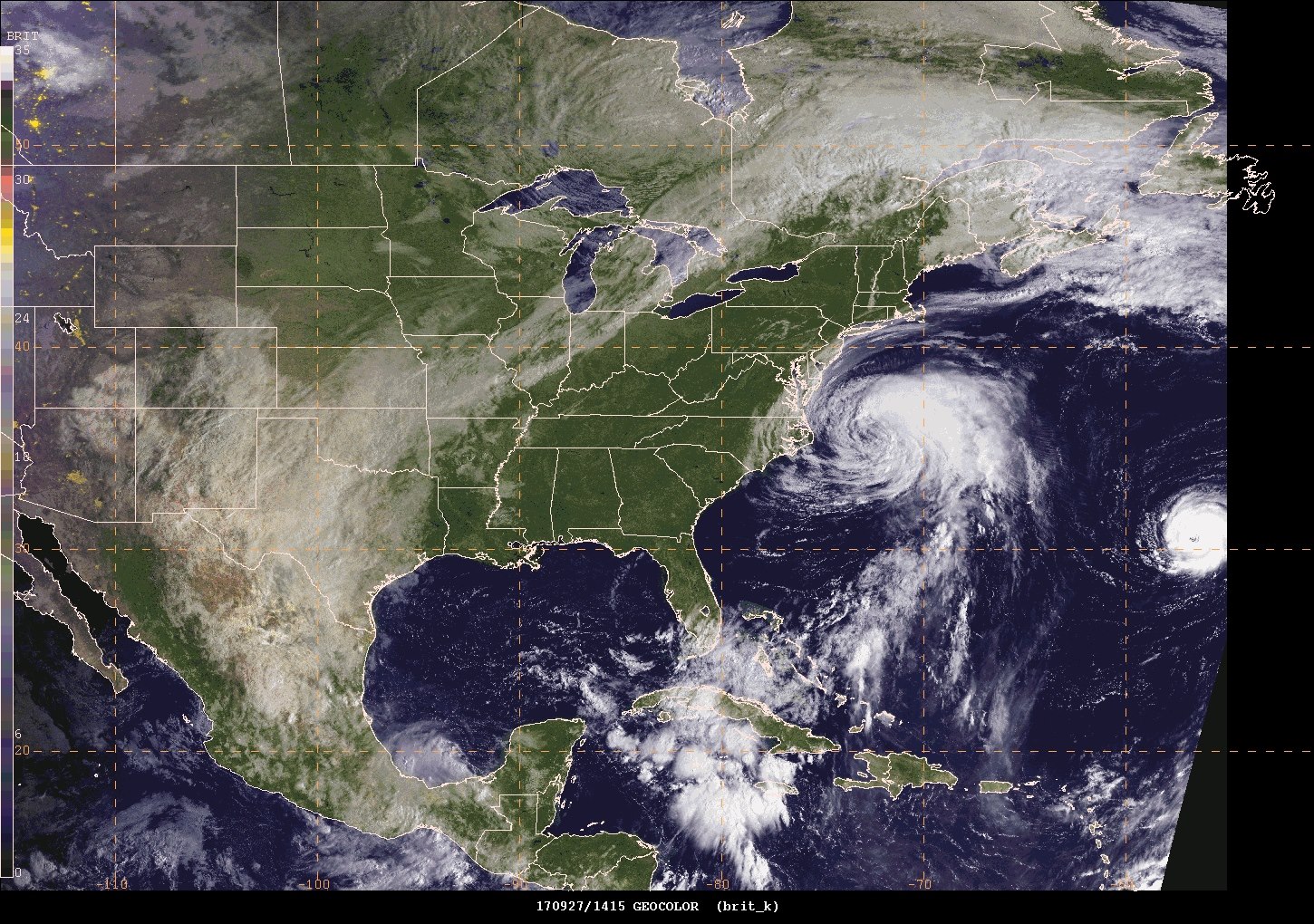
English: Here's a fantastic GOES-16 Geocolor visible satellite image of Hurricane Maria east of the North Carolina beaches, Hurricane Lee to the east of Maria, and a cold front that will continue progressing eastward toward the East Coast. This cold front will actually steer Maria away from the East Coast and take it out to sea. |
| Date | |
| Source | https://www.facebook.com/NWSWPC/photos/a.163357820397809.42984.158734987526759/1552577248142519/?type=3&theater |
| Author | NOAA |
Licensing
[edit]
This image is in the public domain because it contains materials that originally came from the U.S. National Oceanic and Atmospheric Administration, taken or made as part of an employee's official duties.
|
File history
Click on a date/time to view the file as it appeared at that time.
| Date/Time | Thumbnail | Dimensions | User | Comment | |
|---|---|---|---|---|---|
| current | 10:27, 25 March 2018 | | 1,450 × 1,020 (479 KB) | A1Cafel (talk | contribs) | User created page with UploadWizard |
You cannot overwrite this file.
File usage on Commons
The following page uses this file: