File:Leicestershire UK location map.svg
ナビゲーションに移動
検索に移動

この SVG ファイルのこの PNG プレビューのサイズ: 761 × 600 ピクセル. その他の解像度: 305 × 240 ピクセル | 609 × 480 ピクセル | 975 × 768 ピクセル | 1,280 × 1,009 ピクセル | 2,560 × 2,017 ピクセル | 1,425 × 1,123 ピクセル。
元のファイル (SVG ファイル、1,425 × 1,123 ピクセル、ファイルサイズ: 2.23メガバイト)
キャプション
キャプション
このファイルの内容を1行で記述してください
| 解説 |
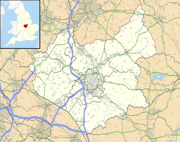
Map of Leicestershire, UK with the following information shown:
Equirectangular map projection on WGS 84 datum, with N/S stretched 160% Geographic limits:
|
| 日付 | |
| 原典 |
|
| 作者 | Nilfanion, created using Ordnance Survey data |
| 許可 (ファイルの再利用) |
このファイルはクリエイティブ・コモンズ 表示-継承 3.0 非移植ライセンスのもとに利用を許諾されています。 帰属: Contains Ordnance Survey data © Crown copyright and database right
|
| その他のバージョン | File:Leicestershire UK district map (blank).svg - Blank map |
.svg)
ファイルの履歴
過去の版のファイルを表示するには、その版の日時をクリックしてください。
| 日付と時刻 | サムネイル | 寸法 | 利用者 | コメント | |
|---|---|---|---|---|---|
| 現在の版 | 2010年9月26日 (日) 19:00 | | 1,425 × 1,123 (2.23メガバイト) | Nilfanion (トーク | 投稿記録) | {{Information |Description=Map of Leicestershire, UK with the following information shown: *Administrative borders *Coastline, lakes and rivers *Roads and railways *Urban areas Equirectangular map projection on WGS 84 datum, with N/S |
このファイルは上書きできません。
ファイルの使用状況
以下のページがこのファイルを使用しています:
グローバルなファイル使用状況
以下に挙げる他のウィキがこの画像を使っています:
- ar.wikipedia.org での使用状況
- bg.wikipedia.org での使用状況
- bn.wikipedia.org での使用状況
- ceb.wikipedia.org での使用状況
- cs.wikipedia.org での使用状況
- en.wikipedia.org での使用状況
- Quorn, Leicestershire
- Walton, Leicestershire
- Belvoir Castle
- Ashby-de-la-Zouch
- Breedon on the Hill
- Kirby Muxloe
- Moira, Leicestershire
- Foxton Locks
- Market Harborough
- Lutterworth
- Ashby de la Zouch Castle
- Donisthorpe
- Loughborough
- Melton Mowbray
- East Midlands Airport
- Wigston
- Hinckley
- Coalville
- Earl Shilton
- Barwell
- Burbage, Leicestershire
- Glenfield, Leicestershire
- Bradgate Park
- Kegworth
- National Space Centre
- Oadby
- Market Bosworth
- Carlton, Leicestershire
- Frisby on the Wreake
- Shepshed
- Blaby
- Cotes, Leicestershire
- Twycross
- Dadlington
- Buckminster
- Sutton Cheney
- Wycomb
- Bruntingthorpe Aerodrome
- Foxton Inclined Plane
このファイルのグローバル使用状況を表示する。