File:Lincolnshire UK locator map 2010.svg
Ir a la navegación
Ir a la búsqueda

Tamaño de esta previsualización PNG del archivo SVG: 494 × 600 píxeles. Otras resoluciones: 198 × 240 píxeles | 395 × 480 píxeles | 633 × 768 píxeles | 843 × 1024 píxeles | 1687 × 2048 píxeles | 1108 × 1345 píxeles.
Archivo original (archivo SVG, nominalmente 1108 × 1345 píxeles, tamaño de archivo: 302 kB)
Leyendas
Leyendas
Añade una explicación corta acerca de lo que representa este archivo
Resumen[editar]
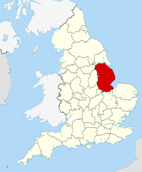
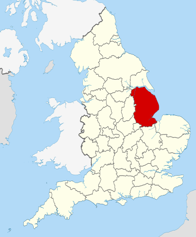
| Descripción | Location of the ceremonial county of Lincolnshire within England. |
| Fecha | |
| Fuente |
National Geospatial-Intelligence Agency
|
| Autor | Nilfanion |
Licencia[editar]
Yo, titular de los derechos de autor de esta obra, la publico en los términos de las siguientes licencias:
Este archivo se encuentra bajo la licencia Creative Commons Genérica de Atribución/Compartir-Igual 3.0.
- Eres libre:
- de compartir – de copiar, distribuir y transmitir el trabajo
- de remezclar – de adaptar el trabajo
- Bajo las siguientes condiciones:
- atribución – Debes otorgar el crédito correspondiente, proporcionar un enlace a la licencia e indicar si realizaste algún cambio. Puedes hacerlo de cualquier manera razonable pero no de manera que sugiera que el licenciante te respalda a ti o al uso que hagas del trabajo.
- compartir igual – En caso de mezclar, transformar o modificar este trabajo, deberás distribuir el trabajo resultante bajo la misma licencia o una compatible como el original.

|
Se autoriza la copia, distribución y modificación de este documento bajo los términos de la licencia de documentación libre GNU, versión 1.2 o cualquier otra que posteriormente publique la Fundación para el Software Libre; sin secciones invariables, textos de portada, ni textos de contraportada. Se incluye una copia de la dicha licencia en la sección titulada Licencia de Documentación Libre GNU. |
Puedes usar la licencia que prefieras.

|
This is one of the images forming part of the Valued image set: Locator maps of the Ceremonial counties of England on Wikimedia Commons. The image set has been assessed under the valued image set criteria and is considered the most valued set on Commons within the scope:
Locator maps of the Ceremonial counties of England
You can see its nomination at Commons:Valued image candidates/Locator maps of English ceremonial counties. |
Historial del archivo
Haz clic sobre una fecha y hora para ver el archivo tal como apareció en ese momento.
| Fecha y hora | Miniatura | Dimensiones | Usuario | Comentario | |
|---|---|---|---|---|---|
| actual | 22:40 23 nov 2010 | | 1108 × 1345 (302 kB) | Nilfanion (discusión | contribs.) | == Summary == {{Information |Description=Location of the ceremonial county of Lincolnshire within England. |Source=Ordnance Survey [https://www.ordnancesurvey.co.uk/opendatadownload/products.html OpenData]: *County |
No puedes sobrescribir este archivo.
Usos del archivo
Las siguientes páginas usan este archivo:
- Valued image set: Locator maps of the Ceremonial counties of England
- Commons:Valued image candidates/Locator maps of English ceremonial counties
- Category:Alumni by school in Lincolnshire
- Category:Archaeological sites in Lincolnshire
- Category:Bridges in Lincolnshire
- Category:Canals in Lincolnshire
- Category:Cemeteries in Lincolnshire
- Category:Hospitals in Lincolnshire
- Category:Lincolnshire
- Category:Lincolnshire in the 17th century
- Category:Lincolnshire in the 1970s
- Category:Lincolnshire in the 1980s
- Category:Lincolnshire in the 1990s
- Category:Lincolnshire in the 19th century
- Category:Lincolnshire in the 2010s
- Category:Lincolnshire in the 20th century
- Category:Lincolnshire in the 21st century
- Category:Maps of Lincolnshire
- Category:People of Lincolnshire
- Category:Populated places in Lincolnshire
- Category:Rail transport in Lincolnshire
- Category:Rivers of Lincolnshire
- Category:Roads in Lincolnshire
- Category:Towers in Lincolnshire
- Category:Tunnels in Lincolnshire
- Category:Views of Lincolnshire
- Category:Villages in Lincolnshire
- Category:Visitor attractions in Lincolnshire
- Category:Windmills in Lincolnshire
Uso global del archivo
Las wikis siguientes utilizan este archivo:
- Uso en af.wikipedia.org
- Uso en ar.wikipedia.org
- Uso en arz.wikipedia.org
- Uso en ast.wikipedia.org
- Uso en be-tarask.wikipedia.org
- Uso en bg.wikipedia.org
- Uso en ca.wikipedia.org
- Uso en ceb.wikipedia.org
- Uso en cs.wikipedia.org
- Uso en en.wikipedia.org
- Lincolnshire
- Scopwick
- Thornton Abbey
- South Ormsby
- Borough of Cleethorpes
- Boothby Graffoe
- Burton, Lincolnshire
- New York, Lincolnshire
- North Ings Farm Museum
- Jurassic Way
- Temple Bruer Preceptory
- Weelsby Woods
- Haverholme Priory
- Appleby, Lincolnshire
- Brampton, Lincolnshire
- Eagle, Lincolnshire
- Linwood, Lincolnshire
- Martin, North Kesteven
- Marton, Lincolnshire
- Upton, Lincolnshire
- Westborough, Lincolnshire
- Westville, Lincolnshire
- Apley
- Asgarby, North Kesteven
- Asgarby, East Lindsey
- Ashby by Partney
- Thompson's Bottom
- Vaudey Abbey
- Aswardby
- Kates Bridge
- Withcall
- Template:Lincolnshire-geo-stub
- Frieston
- Hilldyke, Lincolnshire
- Bourne Abbey
- Skirbeck Wapentake
- Bottesford Preceptory
- Aslackby Preceptory
- Lincolnshire Marsh
- Ailby
Ver más uso global de este archivo.