File:Litomerice District 2008 LT CZ.png
Jump to navigation
Jump to search
Size of this preview: 709 × 599 pixels. Other resolutions: 284 × 240 pixels | 568 × 480 pixels | 854 × 722 pixels.
Original file (854 × 722 pixels, file size: 40 KB, MIME type: image/png)
Captions
Captions
Add a one-line explanation of what this file represents
| Description |
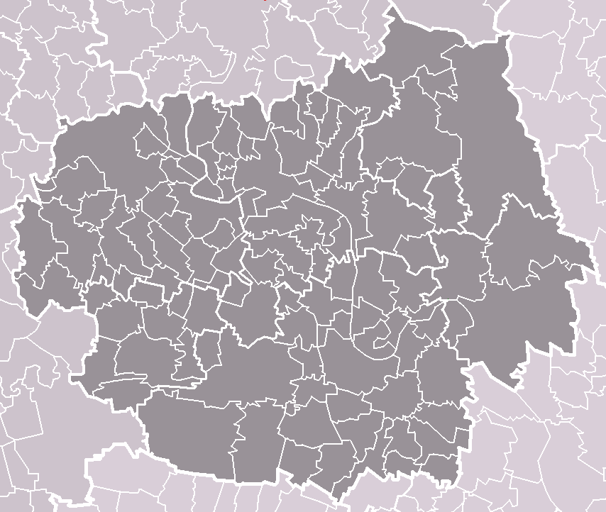
Čeština: Vymezení okresu Litoměřice dle stavu v roce 2008 (105 obcí). Bílé linie o různé tloušťce představují hranice obcí, správních obvodů a okresů.
English: Extent of Litoměřice District as of 2008 (105 municipalities in total). White lines of variable thickness show boundaries of municipalities, administrative areas and districts. |
| Date | |
| Source | Self made, based on Image:ORP_Roudnice_nad_Labem_LT_CZ.png |
| Author | User:Miaow Miaow |
| Permission (Reusing this file) |
PD-self |
| Other versions |
|


Licensing
[edit]
| I, the copyright holder of this work, release this work into the public domain. This applies worldwide. In some countries this may not be legally possible; if so: I grant anyone the right to use this work for any purpose, without any conditions, unless such conditions are required by law. |
File history
Click on a date/time to view the file as it appeared at that time.
| Date/Time | Thumbnail | Dimensions | User | Comment | |
|---|---|---|---|---|---|
| current | 20:49, 22 October 2008 | | 854 × 722 (40 KB) | Miaow Miaow (talk | contribs) | fixed minor inaccuracies in borders of Travčice, Žitenice and Hlinná |
| 11:41, 21 October 2008 |  | 854 × 722 (40 KB) | Miaow Miaow (talk | contribs) | {{Information |Description={{cs|Vymezení '''okresu Litoměřice''' dle stavu v roce 2008 (105 obcí). Bílé linie o různé tloušťce představují hranice obcí, správních obvodů a okresů.}} {{en|Extent of [[:en:Litomě� |
You cannot overwrite this file.
File usage on Commons
The following 4 pages use this file: