File:Localisation EPCI Rahin et Chérimont dans la Haute-Saône, France.svg
Aller à la navigation
Aller à la recherche

Taille de cet aperçu PNG pour ce fichier SVG : 763 × 600 pixels. Autres résolutions : 305 × 240 pixels | 611 × 480 pixels | 977 × 768 pixels | 1 280 × 1 006 pixels | 2 560 × 2 012 pixels | 1 000 × 786 pixels.
Fichier d’origine (Fichier SVG, nominalement de 1 000 × 786 pixels, taille : 172 kio)
Légendes
Légendes
Ajoutez en une ligne la description de ce que représente ce fichier
Description
[modifier]
| Description |
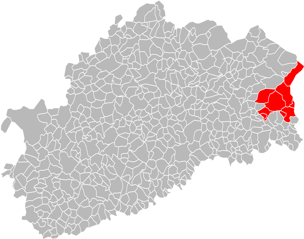
Français : Localisation de la fr:Communauté de communes Rahin et Chérimont dans le département de la Haute-Saône. Composition au 1er janvier 2013. |
| Date | |
| Source | Travail personnel, à partir de File:Blank Map of Haute-Saône Department, France, with Communes.svg. |
| Auteur | Carte d'origine : Poulpy (d · contributions) |
Conditions d’utilisation
[modifier]
Ce fichier est disponible selon les termes de la licence Creative Commons Attribution – Partage dans les Mêmes Conditions 3.0 (non transposée).
- Vous êtes libre :
- de partager – de copier, distribuer et transmettre cette œuvre
- d’adapter – de modifier cette œuvre
- Sous les conditions suivantes :
- paternité – Vous devez donner les informations appropriées concernant l'auteur, fournir un lien vers la licence et indiquer si des modifications ont été faites. Vous pouvez faire cela par tout moyen raisonnable, mais en aucune façon suggérant que l’auteur vous soutient ou approuve l’utilisation que vous en faites.
- partage à l’identique – Si vous modifiez, transformez, ou vous basez sur cette œuvre, vous devez distribuer votre contribution sous la même licence ou une licence compatible avec celle de l’original.
Historique du fichier
Cliquer sur une date et heure pour voir le fichier tel qu'il était à ce moment-là.
| Date et heure | Vignette | Dimensions | Utilisateur | Commentaire | |
|---|---|---|---|---|---|
| actuel | 28 janvier 2017 à 10:52 | | 1 000 × 786 (172 kio) | A.BourgeoisP (d | contributions) | MàJ 2017 |
| 11 août 2016 à 13:11 |  | 1 000 × 786 (199 kio) | A.BourgeoisP (d | contributions) | Errevet (2014) | |
| 4 septembre 2013 à 21:57 |  | 1 000 × 786 (199 kio) | Auxerroisdu68 (d | contributions) | User created page with UploadWizard |
Vous ne pouvez pas remplacer ce fichier.
Utilisations locales du fichier
Aucune page n’utilise ce fichier.
Utilisations du fichier sur d’autres wikis
Les autres wikis suivants utilisent ce fichier :
- Utilisation sur fr.wikipedia.org
Métadonnées
Catégories :
- Maps of groups of communes in Haute-Saône
- Maps of groups of communes in Haute-Saône to 2016
- Maps of Plancher-les-Mines
- Maps of Champagney (Haute-Saône)
- Maps of Clairegoutte
- Maps of Échavanne
- Maps of Frahier-et-Chatebier
- Maps of Frédéric-Fontaine
- Maps of Plancher-Bas
- Maps of Ronchamp
- Maps of Communauté de communes Rahin et Chérimont