File:Lompirt.jpg
Jump to navigation
Jump to search
Size of this preview: 800 × 524 pixels. Other resolutions: 320 × 210 pixels | 640 × 419 pixels | 1,152 × 755 pixels.
Original file (1,152 × 755 pixels, file size: 529 KB, MIME type: image/jpeg)
Captions
Captions
Add a one-line explanation of what this file represents
Summary
[edit]
| Camera location | | View this and other nearby images on: OpenStreetMap |
|---|
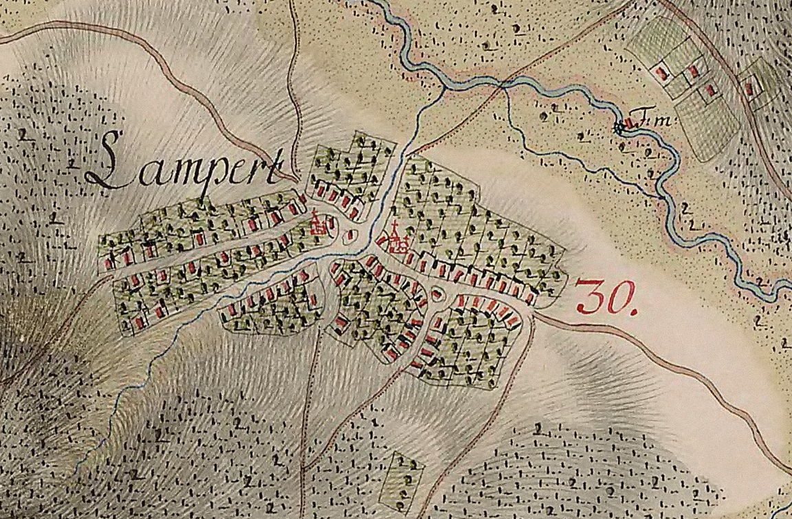
| Description |
English: Lompirt in the 18th century. The calvinist church is in the right and in the left is the Romanian church (it belonged to the Giurtelecu Şimleului parish). Română: Lompirt, Sălaj in secolul 18. Biserica reformată din Lompirt este in dreapta iar in stanga este biserica romaneasca (carea apartinea de parohia Giurtelecu Șimleului) Magyar: Szilágylompért |
||||
| Date | between 1769 and 1773 | ||||
| Source | Josephinische Landesaufnahme | ||||
| Author | Historische Militärkarte der österreichisch-ungarischen Monarchie | ||||
| Permission (Reusing this file) |
|
||||
File history
Click on a date/time to view the file as it appeared at that time.
| Date/Time | Thumbnail | Dimensions | User | Comment | |
|---|---|---|---|---|---|
| current | 21:03, 11 December 2011 | | 1,152 × 755 (529 KB) | Eszak (talk | contribs) |
You cannot overwrite this file.
File usage on Commons
There are no pages that use this file.
File usage on other wikis
The following other wikis use this file:
- Usage on ro.wikipedia.org