File:M23-M25 Intersection - geograph.org.uk - 15455.jpg
跳至導覽
跳至搜尋
無更高解析度可提供。
M23-M25_Intersection_-_geograph.org.uk_-_15455.jpg (640 × 331 像素,檔案大小:118 KB,MIME 類型:image/jpeg)
說明
說明
添加單行說明來描述出檔案所代表的內容
摘要
[編輯]
| 描述 |
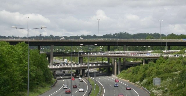
English: The huge multi-level junction of the M23 (top) and M25 (bottom) near Merstham, Surrey |
| 日期 | |
| 來源 | From geograph.org.uk |
| 作者 | Ben Gamble |
| 授權許可 (重用此檔案) |
Creative Commons Attribution Share-alike license 2.0 |
| 拍攝地點 | | 位於此地的本圖片與其他圖片: OpenStreetMap |
|---|
| 目標地點 | | 位於此地的本圖片與其他圖片: OpenStreetMap |
|---|
_region:GB-ENG_heading:292.00&language=zh-tw)
授權條款
[編輯]

|
此檔案採用創用CC 姓名標示-相同方式分享 2.0 通用版授權條款。
姓名標示: Ben Gamble
- 您可以自由:
- 分享 – 複製、發佈和傳播本作品
- 重新修改 – 創作演繹作品
- 惟需遵照下列條件:
- 姓名標示 – 您必須指名出正確的製作者,和提供授權條款的連結,以及表示是否有對內容上做出變更。您可以用任何合理的方式來行動,但不得以任何方式表明授權條款是對您許可或是由您所使用。
- 相同方式分享 – 如果您利用本素材進行再混合、轉換或創作,您必須基於如同原先的相同或兼容的條款,來分布您的貢獻成品。
檔案歷史
點選日期/時間以檢視該時間的檔案版本。
| 日期/時間 | 縮圖 | 尺寸 | 使用者 | 備註 | |
|---|---|---|---|---|---|
| 目前 | 2020年2月7日 (五) 21:54 | | 640 × 331(118 KB) | DavidCane(留言 | 貢獻) | Crop gantry from bottom of image, which, being close to the camera, looks like a bridge and confuses the detracts from the subject. |
| 2006年11月20日 (一) 18:40 |  | 640 × 399(69 KB) | Regan123~commonswiki(留言 | 貢獻) | {{geograph|015455|Ben Gamble}}The huge multi-level junction of the M25 and M23 near Merstham |
無法覆蓋此檔案。
檔案用途
下列3個頁面有用到此檔案:
全域檔案使用狀況
以下其他 wiki 使用了這個檔案:
- el.wikipedia.org 的使用狀況
- en.wikipedia.org 的使用狀況
- fr.wikipedia.org 的使用狀況
- pl.wikipedia.org 的使用狀況
- sh.wikipedia.org 的使用狀況
- uk.wikipedia.org 的使用狀況
- uz.wikipedia.org 的使用狀況
- vi.wikipedia.org 的使用狀況
- www.wikidata.org 的使用狀況
- zh.wikipedia.org 的使用狀況