File:Maestri Bridge - Louisiana (2016).jpg
Jump to navigation
Jump to search
Size of this preview: 799 × 138 pixels. Other resolutions: 320 × 55 pixels | 640 × 111 pixels | 1,024 × 177 pixels | 5,754 × 994 pixels.
Original file (5,754 × 994 pixels, file size: 4.39 MB, MIME type: image/jpeg)
Captions
Captions
Add a one-line explanation of what this file represents
Summary
[edit].jpg&action=edit§ion=1)
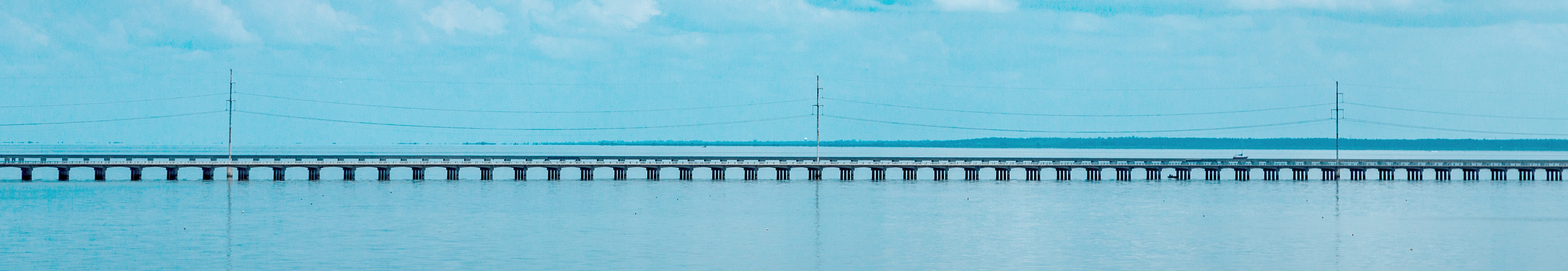
| Description | The Maestri Bridge (formerly Pontchartrain Bridge, Watson-Williams Pontchartrain Bridge, or Five Mile Bridge) carries US Route 11 over Lake Pontchartrain, as seen from the Interstate 10 bridge, near Slidell and New Orleans, Louisiana. |
| Date | |
| Source | Maestri Bridge |
| Author | Tony Webster from Minneapolis, Minnesota |
| Camera location | | View this and other nearby images on: OpenStreetMap |
|---|
.jpg¶ms=030.173661_N_-089.833353_E_globe:Earth_type:camera_source:Flickr_&language=en)
Licensing
[edit].jpg&action=edit§ion=2)
This file is licensed under the Creative Commons Attribution-Share Alike 2.0 Generic license.
- You are free:
- to share – to copy, distribute and transmit the work
- to remix – to adapt the work
- Under the following conditions:
- attribution – You must give appropriate credit, provide a link to the license, and indicate if changes were made. You may do so in any reasonable manner, but not in any way that suggests the licensor endorses you or your use.
- share alike – If you remix, transform, or build upon the material, you must distribute your contributions under the same or compatible license as the original.
| This image was originally posted to Flickr by Tony Webster at https://flickr.com/photos/87296837@N00/27565707430. It was reviewed on 13 July 2016 by FlickreviewR and was confirmed to be licensed under the terms of the cc-by-sa-2.0. |
File history
Click on a date/time to view the file as it appeared at that time.
| Date/Time | Thumbnail | Dimensions | User | Comment | |
|---|---|---|---|---|---|
| current | 12:36, 13 July 2016 | 5,754 × 994 (4.39 MB) | Magnolia677 (talk | contribs) | Cropped; corrected contrast. | |
| 12:29, 13 July 2016 |  | 5,754 × 3,704 (13.84 MB) | Magnolia677 (talk | contribs) | {{Information |Description=The Maestri Bridge (formerly Pontchartrain Bridge, Watson-Williams Pontchartrain Bridge, or Five Mile Bridge) carries US Route 11 over Lake Pontchartrain, as seen from the Interstate 10 bridge, near Slidell and New Orleans, L... |
You cannot overwrite this file.
File usage on Commons
The following page uses this file:
File usage on other wikis
The following other wikis use this file:
- Usage on en.wikipedia.org
- Usage on es.wikipedia.org
- Usage on www.wikidata.org
- Usage on zh.wikipedia.org
.jpg&oldid=928986241)