File:Mamhofen, Flurkarte 1809 ib-2.jpg

Original file (2,362 × 2,377 pixels, file size: 3.3 MB, MIME type: image/jpeg)
Captions
Captions
Summary
[edit]
| Description |
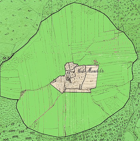
Deutsch: Das Gut Mamhofen inmitten der ab 1905 wiederaufgeforsteten ehemaligen Rodungsinsel. |
| Date | |
| Source | Historische Flurkarten, Staatsarchiv München |
| Author | Topographisches Bureaux München, Bearbeitung I. Berger |
Licensing
[edit]
|
This is a faithful photographic reproduction of a two-dimensional, public domain work of art. The work of art itself is in the public domain for the following reason:
The official position taken by the Wikimedia Foundation is that "faithful reproductions of two-dimensional public domain works of art are public domain".
This photographic reproduction is therefore also considered to be in the public domain in the United States. In other jurisdictions, re-use of this content may be restricted; see Reuse of PD-Art photographs for details. | ||||
File history
Click on a date/time to view the file as it appeared at that time.
| Date/Time | Thumbnail | Dimensions | User | Comment | |
|---|---|---|---|---|---|
| current | 16:54, 30 August 2018 | | 2,362 × 2,377 (3.3 MB) | I. Berger (talk | contribs) | User created page with UploadWizard |
You cannot overwrite this file.
File usage on Commons
There are no pages that use this file.