File:Mamshit. The Palace Courtyard at Mampsis 3 (4099438978).jpg

Original file (4,000 × 3,000 pixels, file size: 5.03 MB, MIME type: image/jpeg)
Captions
Captions
Summary
[edit].jpg&action=edit§ion=1)
| Description |
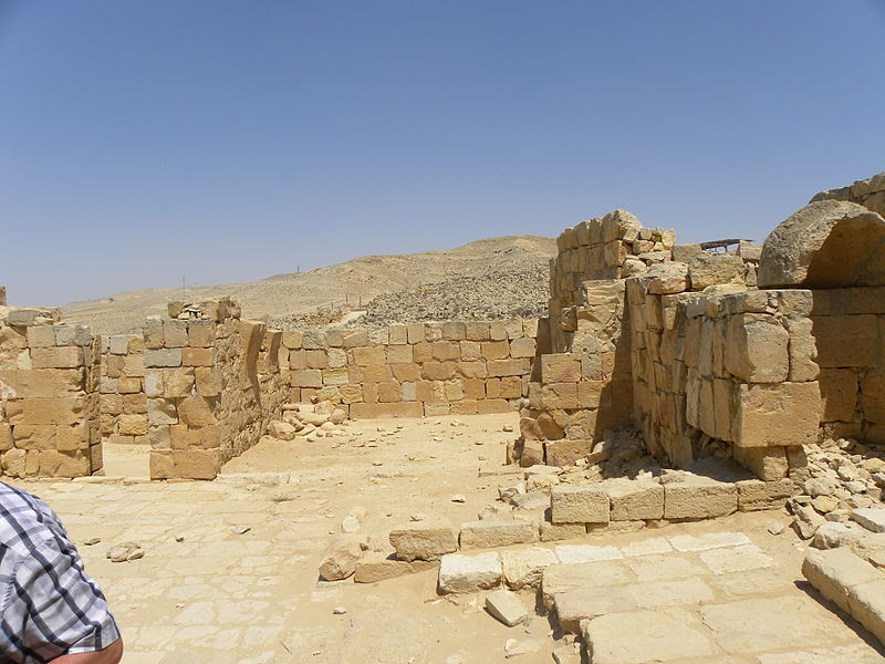
The ground floor of a wealthy private house in ancient Mampsis (Mamshit or Kurnub). Notice the arched vaulting that supported the second-storey. This was a key Nabatean town located on the trade route that ran overland south of the Dead Sea and through the Arabian desert. Mampsis was a key junction point where this caravan route met the north-south routes into Judea and was also a crucial stop-over on the way West toward Egypt. The city survived into the Byzantine period before trade patterns changed and the settlement was abandoned. Since the site was never re-occupied after the Byzantine era, its remains are remarkably well-preserved. |
| Date | |
| Source | The Palace Courtyard at Mampsis 3 |
| Author | Ian Scott |
Licensing
[edit].jpg&action=edit§ion=2)
- You are free:
- to share – to copy, distribute and transmit the work
- to remix – to adapt the work
- Under the following conditions:
- attribution – You must give appropriate credit, provide a link to the license, and indicate if changes were made. You may do so in any reasonable manner, but not in any way that suggests the licensor endorses you or your use.
- share alike – If you remix, transform, or build upon the material, you must distribute your contributions under the same or compatible license as the original.
| This image was originally posted to Flickr by Ian W Scott at https://www.flickr.com/photos/38000818@N06/4099438978. It was reviewed on 15 September 2014 by FlickreviewR and was confirmed to be licensed under the terms of the cc-by-sa-2.0. |
File history
Click on a date/time to view the file as it appeared at that time.
| Date/Time | Thumbnail | Dimensions | User | Comment | |
|---|---|---|---|---|---|
| current | 01:03, 14 September 2014 | | 4,000 × 3,000 (5.03 MB) | Geagea (talk | contribs) | Transferred from Flickr via Flickr2commons |
You cannot overwrite this file.
File usage on Commons
There are no pages that use this file.
File usage on other wikis
The following other wikis use this file:
- Usage on en.wikipedia.org
- Usage on es.wikipedia.org
.jpg&oldid=882918137)