File:Manavgat Şelalesi, Antalya.png
Jump to navigation
Jump to search

Size of this preview: 800 × 564 pixels. Other resolutions: 320 × 226 pixels | 640 × 451 pixels | 882 × 622 pixels.
Original file (882 × 622 pixels, file size: 1.12 MB, MIME type: image/png)
Captions
Captions
Add a one-line explanation of what this file represents
Summary
[edit]
| Description |
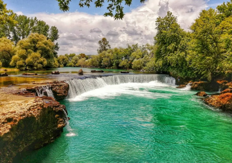
Türkçe: Manavgat Şelalesi, Antalya'nın Manavgat ilçesinde, Manavgat Nehri üzerinde bulunan bir şelaledir.
Antalya'ya 72 km mesafededir. Manavgat ilçesinin 3 km kuzeyinde bulunan ve adını bu ilçeden alan şelale, ırmak sularının 3–4 m'lik bir falezden düşmesiyle meydana gelir. Az bir yükseklikten dökülmesine rağmen geniş bir alan üzerinde yüksek bir debiyle akar. Ayrıca Manavgat Irmağını besleyen kaynaklardan en büyüğü olan karstik Dumanlı kaynağı, Oymapınar barajı yapıldıktan sonra baraj gölü içinde kalmıştır. |
| Date | |
| Source | Own work |
| Author | MESUT YETSEN |
Licensing
[edit]
I, the copyright holder of this work, hereby publish it under the following license:
This file is licensed under the Creative Commons Attribution-Share Alike 4.0 International license.
- You are free:
- to share – to copy, distribute and transmit the work
- to remix – to adapt the work
- Under the following conditions:
- attribution – You must give appropriate credit, provide a link to the license, and indicate if changes were made. You may do so in any reasonable manner, but not in any way that suggests the licensor endorses you or your use.
- share alike – If you remix, transform, or build upon the material, you must distribute your contributions under the same or compatible license as the original.
This image was uploaded as part of Wiki Loves Earth 2022.
|
 |
File history
Click on a date/time to view the file as it appeared at that time.
| Date/Time | Thumbnail | Dimensions | User | Comment | |
|---|---|---|---|---|---|
| current | 11:40, 9 June 2022 | | 882 × 622 (1.12 MB) | Mstyts (talk | contribs) | Uploaded own work with UploadWizard |
You cannot overwrite this file.
File usage on Commons
The following page uses this file:
- File:Ekran görüntüsü 2022-06-09 125223.png (file redirect)