File:Manicouagan Reservoir (MODIS).jpg
Jump to navigation
Jump to search
Size of this preview: 778 × 600 pixels. Other resolutions: 311 × 240 pixels | 623 × 480 pixels | 996 × 768 pixels | 1,280 × 987 pixels | 2,266 × 1,747 pixels.
Original file (2,266 × 1,747 pixels, file size: 739 KB, MIME type: image/jpeg)
Captions
Captions
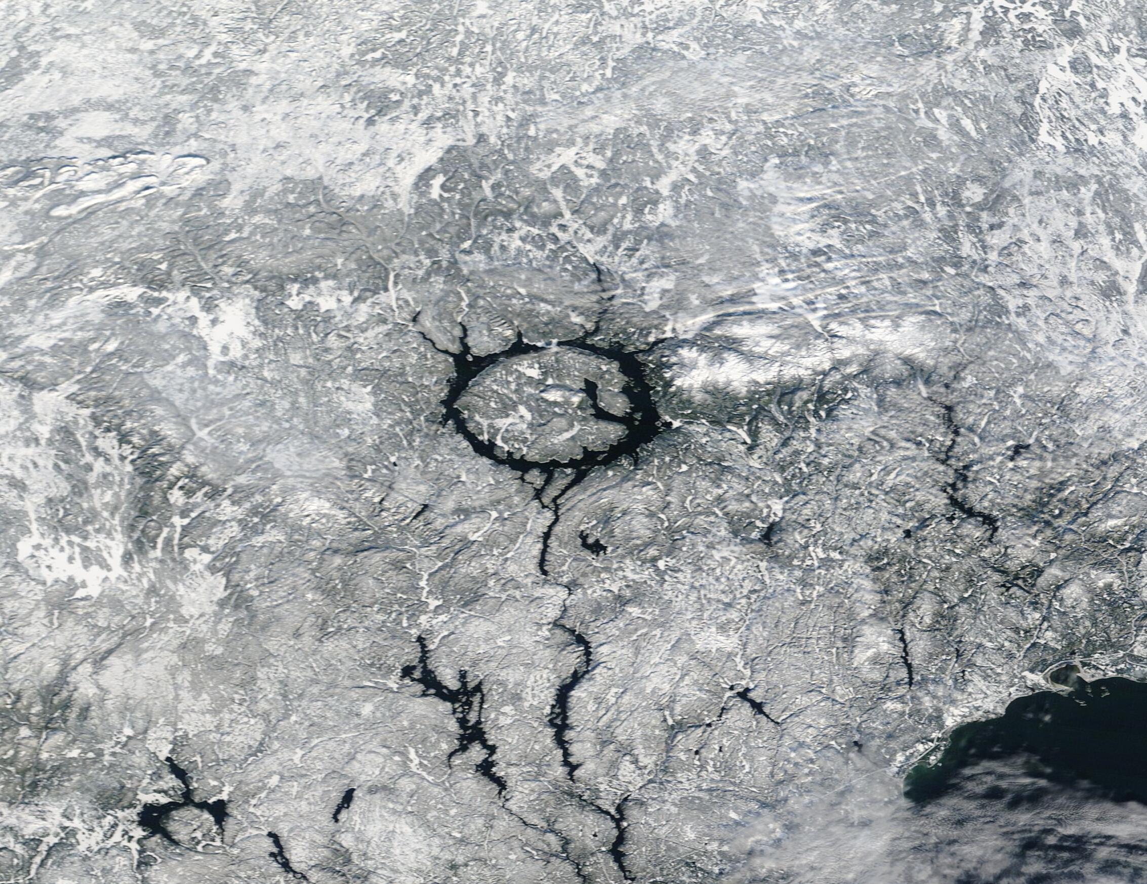
On December 12, 2022, the Moderate Resolution Imaging Spectroradiometer (MODIS) on board NASA’s Terra satellite acquired a true-color image of snow surrounding Manicouagan Reservoir in southeastern Quebec, Canada.
Summary
[edit].jpg&action=edit§ion=1)
| Description |
English: On December 12, 2022, the Moderate Resolution Imaging Spectroradiometer (MODIS) on board NASA’s Terra satellite acquired a true-color image of snow surrounding Manicouagan Reservoir in southeastern Quebec, Canada.
This strikingly circular lake is the most important reservoir of the Manicouagan Hydroelectric Complex. The reservoir itself was created in the 1960s when the Daniel-Johnson dam was completed, flooding two arched lakes that were previously present. The rising floodwaters also created a new island on a high plateau between the lakes. While the reservoir is relatively new, it has been built on a truly ancient foundation—one of the Earth’s largest and oldest impact craters. Manicouagan Crater was formed 214 million years ago, near the end of the Triassic Period, when an asteroid 5 kilometers (3 miles) wide struck what is now Canada. The asteroid's impact not only created a rounded impact crater, but the massive power of the impact shattered rock and debris, causing it to uplift in the center of the crater. This uplifted area is now the Ile Rene-Levasseur. The highest point on the island, Mount Babel, rises about 1,970 feet (600 meters) above the lake level on its northern end. |
||
| Date | Taken on 15 December 2022 | ||
| Source |
Manicouagan Reservoir (direct link)
|
||
| Author | MODIS Land Rapid Response Team, NASA GSFC |
| This media is a product of the Terra mission Credit and attribution belongs to the mission team, if not already specified in the "author" row |
Licensing
[edit].jpg&action=edit§ion=2)
| This file is in the public domain in the United States because it was solely created by NASA. NASA copyright policy states that "NASA material is not protected by copyright unless noted". (See Template:PD-USGov, NASA copyright policy page or JPL Image Use Policy.) | ||
 |
Warnings:
|
File history
Click on a date/time to view the file as it appeared at that time.
| Date/Time | Thumbnail | Dimensions | User | Comment | |
|---|---|---|---|---|---|
| current | 15:07, 9 August 2023 | | 2,266 × 1,747 (739 KB) | OptimusPrimeBot (talk | contribs) | #Spacemedia - Upload of http://modis.gsfc.nasa.gov/gallery/images/image12242022_250m.jpg via Commons:Spacemedia |
You cannot overwrite this file.
File usage on Commons
There are no pages that use this file.
.jpg&oldid=867258571)