File:Manitou Islands Pano (cropped).jpg
Jump to navigation
Jump to search

Size of this preview: 800 × 263 pixels. Other resolutions: 320 × 105 pixels | 640 × 211 pixels | 1,024 × 337 pixels | 1,280 × 421 pixels | 5,513 × 1,814 pixels.
Original file (5,513 × 1,814 pixels, file size: 1.74 MB, MIME type: image/jpeg)
Captions
Captions
Add a one-line explanation of what this file represents
Summary[edit]
.jpg&action=edit§ion=1)
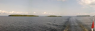
| Description | Manitou Islands Pano |
| Date | Taken on 30 August 2015 |
| Source | https://web.archive.org/web/20161031004321/http://www.panoramio.com/photo/123306656 |
| Author | Paul LaRocque |
| Permission (Reusing this file) |
This file is licensed under the Creative Commons Attribution 3.0 Unported license. Attribution: Paul LaRocque
|
| Other versions | |
| Panoramio Tags | Nipissing, Unorganized, North Part, 2015, Canada, Nipissing, North Bay, Ontario |
| Camera location | | View this and other nearby images on: OpenStreetMap |
|---|
.jpg¶ms=046.238132_N_-079.626549_E_globe:Earth_type:camera_source:Panoramio_&language=en)
File history
Click on a date/time to view the file as it appeared at that time.
| Date/Time | Thumbnail | Dimensions | User | Comment | |
|---|---|---|---|---|---|
| current | 18:57, 1 October 2021 | 5,513 × 1,814 (1.74 MB) | P199 (talk | contribs) | File:Manitou Islands Pano - panoramio.jpg cropped 41 % horizontally, 10 % vertically, rotated 1.79° using CropTool with precise mode. |
You cannot overwrite this file.
File usage on Commons
The following page uses this file:
File usage on other wikis
The following other wikis use this file:
- Usage on ceb.wikipedia.org
- Usage on en.wikipedia.org
- Usage on www.wikidata.org
.jpg&oldid=719132376)