File:Map, New York to New Rochelle, Christopher Colles and Cornelius Tiebout, 1789.jpg
Jump to navigation
Jump to search
Size of this preview: 746 × 600 pixels. Other resolutions: 299 × 240 pixels | 597 × 480 pixels | 955 × 768 pixels | 1,274 × 1,024 pixels | 2,072 × 1,666 pixels.
Original file (2,072 × 1,666 pixels, file size: 1.91 MB, MIME type: image/jpeg)
Captions
Captions
Add a one-line explanation of what this file represents
Summary[edit]
| Description |
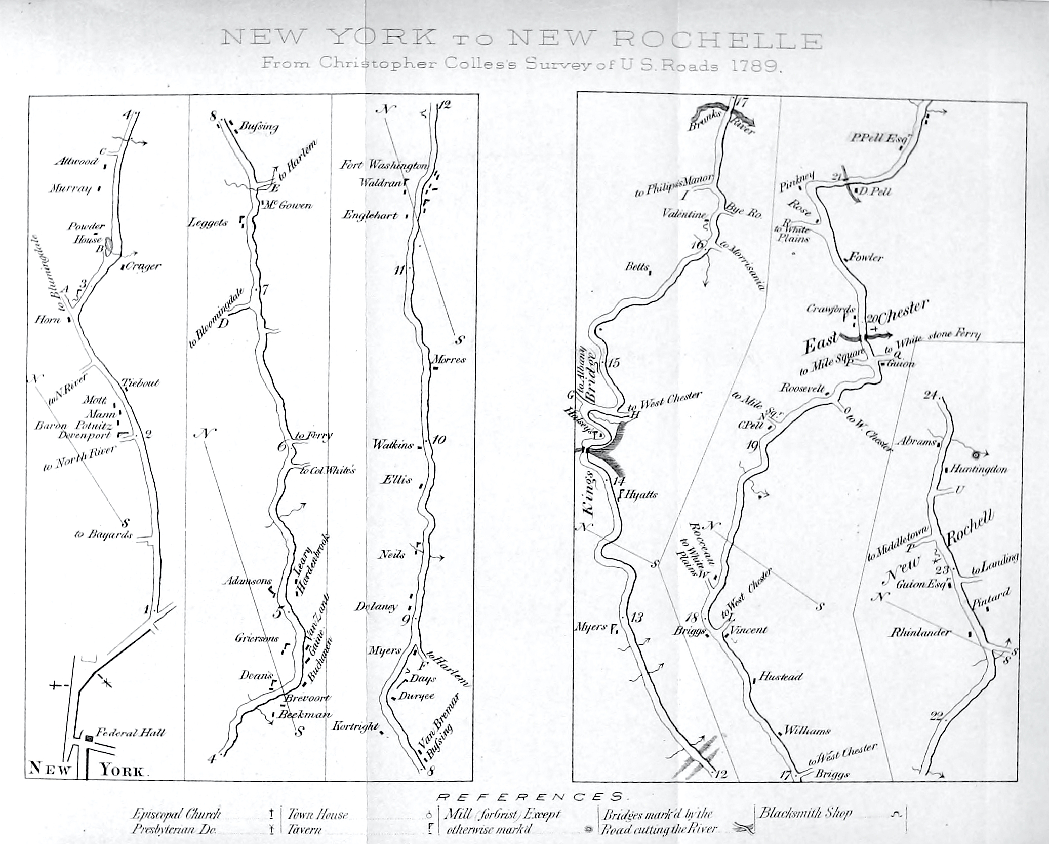
English: Map of road from New York City to New Rochelle, from Christopher Colles's A Survey of the Roads of the United States of America (1789) |
| Date | published 1870 |
| Source | Hardy, John , ed. (1870) Manual of the Corporation of the City of New York, New York City: Common Council, after p. 778 [aka Valentine's Manual (1870)] |
| Author |
Christopher Colles, surveyor Cornelius Tiebout, original engraver |
| Other versions |
|


Licensing[edit]
|
This work is in the public domain in its country of origin and other countries and areas where the copyright term is the author's life plus 70 years or fewer. This work is in the public domain in the United States because it was published (or registered with the U.S. Copyright Office) before January 1, 1929. | |
| This file has been identified as being free of known restrictions under copyright law, including all related and neighboring rights. | |
File history
Click on a date/time to view the file as it appeared at that time.
| Date/Time | Thumbnail | Dimensions | User | Comment | |
|---|---|---|---|---|---|
| current | 14:11, 21 January 2021 | | 2,072 × 1,666 (1.91 MB) | Vzeebjtf (talk | contribs) | Uploaded a work by Christopher Colles, surveyor<br>Cornelius Tiebout, original engraver from {{Cite book|url=https://archive.org/stream/manualofcorporat1870newy#page/n846/mode/2up |title=Manual of the Corporation of the City of New York |editor-first=John |editor-last=Hardy |location=New York City |publisher=Common Council |year=1870 |pages=after p. 778 |nopp=y}} [aka ''Valentine's Manual'' (1870)] with UploadWizard |
You cannot overwrite this file.
File usage on Commons
The following 4 pages use this file:
- File:A survey of the roads of the United States of America LOC 84675230-2.jpg
- File:A survey of the roads of the United States of America LOC 84675230-2.tif
- File:A survey of the roads of the United States of America LOC 84675230-3.jpg
- File:A survey of the roads of the United States of America LOC 84675230-3.tif