File:Map-Latin America2.png
Pāriet uz navigāciju
Pāriet uz meklēšanu
Augstāka izšķirtspēja nav pieejama.
Map-Latin_America2.png (390 × 450 pikseļi, faila izmērs: 22 KB, MIME tips: image/png)
Captions
Captions
Pievieno vienas rindiņas aprakstu, ko šis fails attēlo

|
This linguistic map image could be re-created using vector graphics as an SVG file. This has several advantages; see Commons:Media for cleanup for more information. If an SVG form of this image is available, please upload it and afterwards replace this template with
{{vector version available|new image name}}.
It is recommended to name the SVG file “Map-Latin America2.svg”—then the template Vector version available (or Vva) does not need the new image name parameter. |
Kopsavilkums
[labot šo sadaļu]
Español: Ubicación de América Latina

.
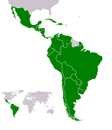
Map of en:Latin america. Thanks to write in the talk page if it's need to improve it. An alternative image is Image:Map-Latin America.png.
Map made from Image:BlankMap-World.png
Licence
[labot šo sadaļu]
Yug, šī darba autortiesību īpašnieks, publicē to saskaņā ar šo licenci:
| I, the copyright holder of this work, release this work into the public domain. This applies worldwide. In some countries this may not be legally possible; if so: I grant anyone the right to use this work for any purpose, without any conditions, unless such conditions are required by law. |
Atlas
[labot šo sadaļu]This map should be added to the Wikimedia Atlas.
derivative works
[labot šo sadaļu]
Derivative works of this file: Map-Latin America2-2.png
Faila hronoloģija
Uzklikšķini uz datums/laiks kolonnā esošās saites, lai apskatītos, kā šis fails izskatījās tad.
| Datums/Laiks | Attēls | Izmēri | Dalībnieks | Komentārs | |
|---|---|---|---|---|---|
| tagadējais | 2018. gada 18. februāris, plkst. 22.23 | | 390 × 450 (22 KB) | Andrew J.Kurbiko (diskusija | devums) | minor fix |
| 2011. gada 20. marts, plkst. 16.14 |  | 390 × 450 (25 KB) | Philip Stevens (diskusija | devums) | The Falkland Islands are not part of Latin America. | |
| 2008. gada 7. decembris, plkst. 11.47 |  | 390 × 450 (23 KB) | Osado (diskusija | devums) | {{Information |Description= |Source= |Date= |Author= |Permission= |other_versions= }} | |
| 2008. gada 20. oktobris, plkst. 07.07 |  | 390 × 450 (21 KB) | Pruxo (diskusija | devums) | malvinas part of latinoamerica | |
| 2008. gada 15. oktobris, plkst. 16.02 |  | 390 × 450 (21 KB) | Pruxo (diskusija | devums) | mejora de "Imagen:Map-Latin America2.png", agregando islas en chile, agregando las Islas malvinas (o falklands) con color neutral, pasando la Guayana francesa junto con las demas guayanas (es territorio de ultramar frances, si fuera latinoamerica, quevec | |
| 2006. gada 25. februāris, plkst. 21.55 |  | 390 × 450 (22 KB) | NoIdeaNick~commonswiki (diskusija | devums) | Changed map to reflect the fact that Jamaica is not part of Latin America. | |
| 2006. gada 19. janvāris, plkst. 14.36 |  | 390 × 450 (23 KB) | NoIdeaNick~commonswiki (diskusija | devums) | Just a little change to the color of Belize. | |
| 2005. gada 21. decembris, plkst. 23.29 |  | 390 × 450 (20 KB) | Yug (diskusija | devums) | Zoom |
Šo failu nevar pārrakstīt.
Faila lietojums
Šo failu izmanto šajās 8 lapās:
- América Latina
- Top 200 map images that should use vector graphics
- User:Chumwa/OgreBot/Travel and communication maps/2018 February 10-18
- File:Dengue epidemic 2019-2020 in the Americas.png
- File:Epidemia de dengue Latinoamérica 2019.png
- File:Lateinamerika.png
- File:Map-Latin America.png
- File:Map-Latin America.svg
Globālais faila lietojums
Šīs Vikipēdijas izmanto šo failu:
- Izmantojums af.wikipedia.org
- Izmantojums arc.wikipedia.org
- Izmantojums azb.wikipedia.org
- Izmantojums az.wikipedia.org
- Izmantojums br.wikipedia.org
- Izmantojums br.wiktionary.org
- Izmantojums ckb.wikipedia.org
- Izmantojums cv.wikipedia.org
- Izmantojums cy.wikipedia.org
- Izmantojums da.wikipedia.org
- Izmantojums de.wikipedia.org
- Izmantojums de.wiktionary.org
- Izmantojums en.wikipedia.org
- Latin America
- User:Dimadick
- Afro–Latin Americans
- User:Nivenus
- Wikipedia:Featured content/Portals
- User:Mikhajist
- User:Zdunne
- User:CatatonicStupor
- Wikipedia:Association of Hispanic and Latin American writers
- User:J. Finkelstein/Sandbox/LatinAmericaInfobox
- User:Es-arturus
- Etiquette in Latin America
- Water supply and sanitation in Latin America
- User:Adam sk
- Wikipedia:Articles for deletion/Log/2007 February 10
- Wikipedia:Articles for deletion/Latino Muslims
- Talk:Latin America/Archive 1
- User:Mvblair
- User:Tcd88
- User:Mikhajist/Userboxes
- User:Zero Gravity/Proposal
- User:Andreasmperu
- Wikipedia:Graphics Lab/Image workshop/Archive/May 2009
- User:Mosemamenti
- User:Mvblair/Userboxes/Latin American History
- User:Richie Boy 5
- User:Mosemamenti/Usuario:Mosemamenti
- User:Fcassia
- User:Saukkomies/My userboxes
- User:IANVS
- User:AKABumba
- User:Daguerrero
- User:Clarkp/Userboxes
- User:Hpav7
- User:Evanex
- User:Ixnix
Skatīt šī faila pilno globālo izmantojumu.