File:MapCirca1700 Bastimentos Portobelo Panama.png
Jump to navigation
Jump to search

Size of this preview: 800 × 541 pixels. Other resolutions: 320 × 216 pixels | 640 × 433 pixels | 1,024 × 692 pixels | 1,280 × 865 pixels | 1,654 × 1,118 pixels.
Original file (1,654 × 1,118 pixels, file size: 2.46 MB, MIME type: image/png)
Captions
Captions
Add a one-line explanation of what this file represents
Summary[edit]
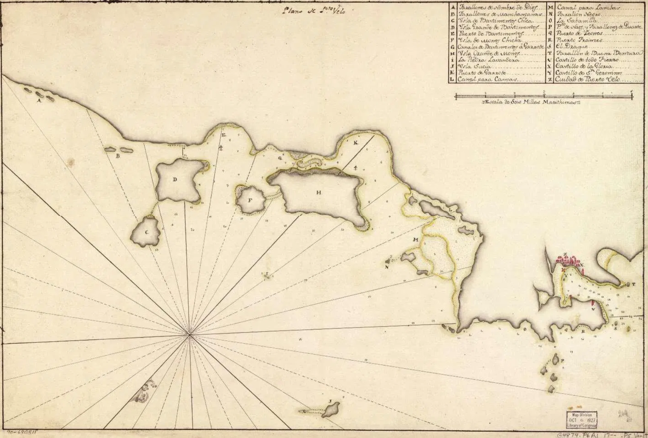
| Description | "Plano de Pto. Velo". Map (upside down/orientation with south at top) of north-east coast of Panama from Porto Bello to Nombre de Dios, based on a Spanish map c.1700, acquired Oct 1927 by the Map Division, Library of Congress, G4874.P6A1 17 P5 Vault. |
| Date | circa 1700 |
| Source | Library of Congress Geography and Map Division Washington, D.C. 20540-4650 USA, Call Number/Physical Location: G4874.P6A1 17-- .P5. Medium: 1 map : ms., col. ; 36 x 53 cm.[1]. Published on internet also at www.firelockgames.com[2]. Catalogue description: "Shows coast of eastern Portobelo region. Depths shown by soundings. Oriented with north toward the lower left. Watermark: D. & C. Blauw. Pen-and-ink and watercolor. Mounted on cloth backing. LC Luso-Hispanic World, 667 Maggs number annotated in pencil in lower right corner: 264. Vault " |
| Author | Unknown Spanish cartographer |
Licensing[edit]
|
This work is in the public domain in its country of origin and other countries and areas where the copyright term is the author's life plus 100 years or fewer. | |
| This file has been identified as being free of known restrictions under copyright law, including all related and neighboring rights. | |
File history
Click on a date/time to view the file as it appeared at that time.
| Date/Time | Thumbnail | Dimensions | User | Comment | |
|---|---|---|---|---|---|
| current | 01:38, 3 November 2020 | | 1,654 × 1,118 (2.46 MB) | Lobsterthermidor (talk | contribs) | {{Information |Description=Map (upside down/orientation to south) of north-east coast of Panama from Porto Bello to Nombre de Dios, based on a Spanish map c.1700, acquired Oct 1927 by the Map Division, Library of Congress, G4874.P6A1 17 P5 Vault. |Source=https://www.firelockgames.com/blood-plunder-organized-play/the-first-south-sea-adventure-san-felipe-de-portobello/ |Date=c.1700 |Author=Unknown Spanish cartographer |Permission= |other_versions= }} Category:Bastimentos, Portobelo |
You cannot overwrite this file.
File usage on Commons
The following 2 pages use this file:
File usage on other wikis
The following other wikis use this file:
- Usage on en.wikipedia.org