File:Map Sampler, A Map of England and Wales, late 18th century (CH 18563961-2).jpg
Jump to navigation
Jump to search

Size of this preview: 492 × 600 pixels. Other resolutions: 197 × 240 pixels | 394 × 480 pixels | 630 × 768 pixels | 840 × 1,024 pixels | 1,680 × 2,048 pixels | 3,361 × 4,096 pixels.
Original file (3,361 × 4,096 pixels, file size: 15.13 MB, MIME type: image/jpeg)
Captions
Captions
Add a one-line explanation of what this file represents
Summary
[edit]| English: Map Sampler, A Map of England and Wales, late 18th century
( |
|||||||||||||||||||||||||||
|---|---|---|---|---|---|---|---|---|---|---|---|---|---|---|---|---|---|---|---|---|---|---|---|---|---|---|---|
| Artist |
Unknown artist |
||||||||||||||||||||||||||
| Title |
English: Map Sampler, A Map of England and Wales, late 18th century |
||||||||||||||||||||||||||
| Description |
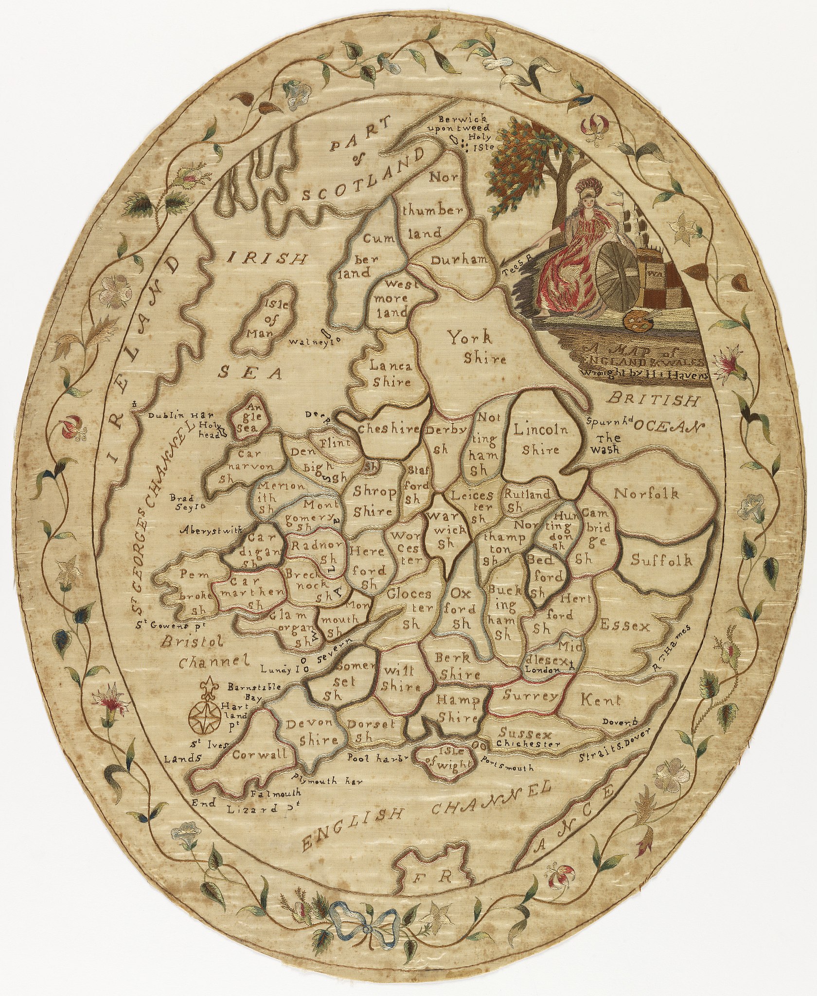
English: Oval map sampler of England and Wales, with the counties outlined and identified. With a portrait of Britannia in the upper right, and a flowering vine border. |
||||||||||||||||||||||||||
| Date | late 18th century | ||||||||||||||||||||||||||
| Medium | silk | ||||||||||||||||||||||||||
| Dimensions | H x W: 55.9 × 46.7 cm (22 × 18 3/8 in.) | ||||||||||||||||||||||||||
| Collection |
|
||||||||||||||||||||||||||
| Current location |
Textiles |
||||||||||||||||||||||||||
| Accession number |
1941-69-121 |
||||||||||||||||||||||||||
| Credit line | Bequest of Mrs. Henry E. Coe | ||||||||||||||||||||||||||
| Notes |
|
||||||||||||||||||||||||||
| Source/Photographer | Catalog Photo | ||||||||||||||||||||||||||
| Other versions |
|
||||||||||||||||||||||||||
.jpg)
.jpg&action=edit§ion=1)
Licensing
[edit].jpg&action=edit§ion=2)
|
This work is in the public domain in its country of origin and other countries and areas where the copyright term is the author's life plus 100 years or fewer. This work is in the public domain in the United States because it was published (or registered with the U.S. Copyright Office) before January 1, 1929. | |
| This file has been identified as being free of known restrictions under copyright law, including all related and neighboring rights. | |
File history
Click on a date/time to view the file as it appeared at that time.
| Date/Time | Thumbnail | Dimensions | User | Comment | |
|---|---|---|---|---|---|
| current | 03:02, 28 November 2017 | | 3,361 × 4,096 (15.13 MB) | Fæ (talk | contribs) | Cooper-Hewitt 450.12 18563961 |
You cannot overwrite this file.
File usage on Commons
The following 2 pages use this file:
.jpg)
.jpg&oldid=745351951)