File:Map of Barbados (1888).jpg

Originaldatei (627 × 1.009 Pixel, Dateigröße: 386 KB, MIME-Typ: image/jpeg)
Bildtexte
Kurzbeschreibungen
| Datum | 1888 | ||||
| Inventarnummer |
British Library HMNTS 10004.dd.2 |
||||
| Herkunft/Fotograf |
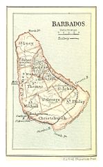
Image extracted from page 158 of volume 2 of A Historical Geography of the British Colonies, by Charles P. Lucas. Original held and digitised by the British Library. Copied from Flickr. Note: The colours, contrast and appearance of these illustrations are unlikely to be true to life. They are derived from scanned images that have been enhanced for machine interpretation and have been altered from their originals.
|
||||
| Genehmigung (Weiternutzung dieser Datei) |
|
||||
| Andere Versionen |
|
||||

.jpg)
.jpg)
.jpg)
.jpg)
.jpg)
Dateiversionen
Klicke auf einen Zeitpunkt, um diese Version zu laden.
| Version vom | Vorschaubild | Maße | Benutzer | Kommentar | |
|---|---|---|---|---|---|
| aktuell | 14:20, 18. Feb. 2014 | | 627 × 1.009 (386 KB) | Metilsteiner (Diskussion | Beiträge) | User created page with UploadWizard |
Du kannst diese Datei nicht überschreiben.
Dateiverwendung
Die folgenden 5 Seiten verwenden diese Datei:
Globale Dateiverwendung
Die nachfolgenden anderen Wikis verwenden diese Datei:
- Verwendung auf de.wikipedia.org
- Verwendung auf en.wikipedia.org
.jpg&oldid=330438487)