File:Map of Beaumont.png
Jump to navigation
Jump to search
No higher resolution available.
Map_of_Beaumont.png (370 × 300 pixels, file size: 283 KB, MIME type: image/png)
Captions
Captions
Add a one-line explanation of what this file represents
Summary
[edit]| Description |
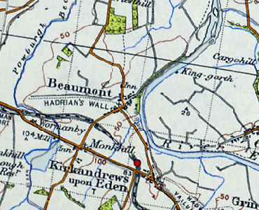
English: Map of Beaumont |
| Date | between 1945 and 1948 |
| Source | Ordnance Survey of Great Britain New Popular Edition (1945–1948), via Visionofbritain.org.uk |
| Author | Ordnance Survey |
Licensing
[edit]This work created by the United Kingdom Government is in the public domain.
This is because it is one of the following:
HMSO has declared that the expiry of Crown Copyrights applies worldwide (ref: HMSO Email Reply)
|
 |
Original upload log
[edit]The original description page was here. All following user names refer to en.wikipedia.
| Date/Time | Dimensions | User | Comment |
|---|---|---|---|
| 2012-05-03 11:45 | 370×300× (290248 bytes) | Kierenbutler | Uploading a non-free work, as object of commentary using [[Wikipedia:File_Upload_Wizard|File Upload Wizard]] |

File history
Click on a date/time to view the file as it appeared at that time.
| Date/Time | Thumbnail | Dimensions | User | Comment | |
|---|---|---|---|---|---|
| current | 21:42, 22 September 2014 | | 370 × 300 (283 KB) | Innotata (talk | contribs) | Transferred from en.wikipedia |
You cannot overwrite this file.
File usage on Commons
There are no pages that use this file.
File usage on other wikis
The following other wikis use this file:
- Usage on en.wikipedia.org