File:Map of Component Landscapes of Monocacy (4586cec5-93e8-d646-485e-fb436387cc77).JPG
Jump to navigation
Jump to search
Size of this preview: 800 × 480 pixels. Other resolutions: 320 × 192 pixels | 1,024 × 615 pixels | 1,313 × 788 pixels.
Original file (1,313 × 788 pixels, file size: 136 KB, MIME type: image/jpeg)
Captions
Captions
Add a one-line explanation of what this file represents

|
The categories of this image need checking. You can do so here.
|
.JPG&action=edit&withJS=MediaWiki:Catcheck.js)
Summary
[edit].JPG&action=edit§ion=1)
| English: Map of Component Landscapes of Monocacy | ||||
|---|---|---|---|---|
| Photographer |
English: NPS |
|||
| Title |
English: Map of Component Landscapes of Monocacy |
|||
| Publisher |
English: U.S. National Park Service |
|||
| Description |
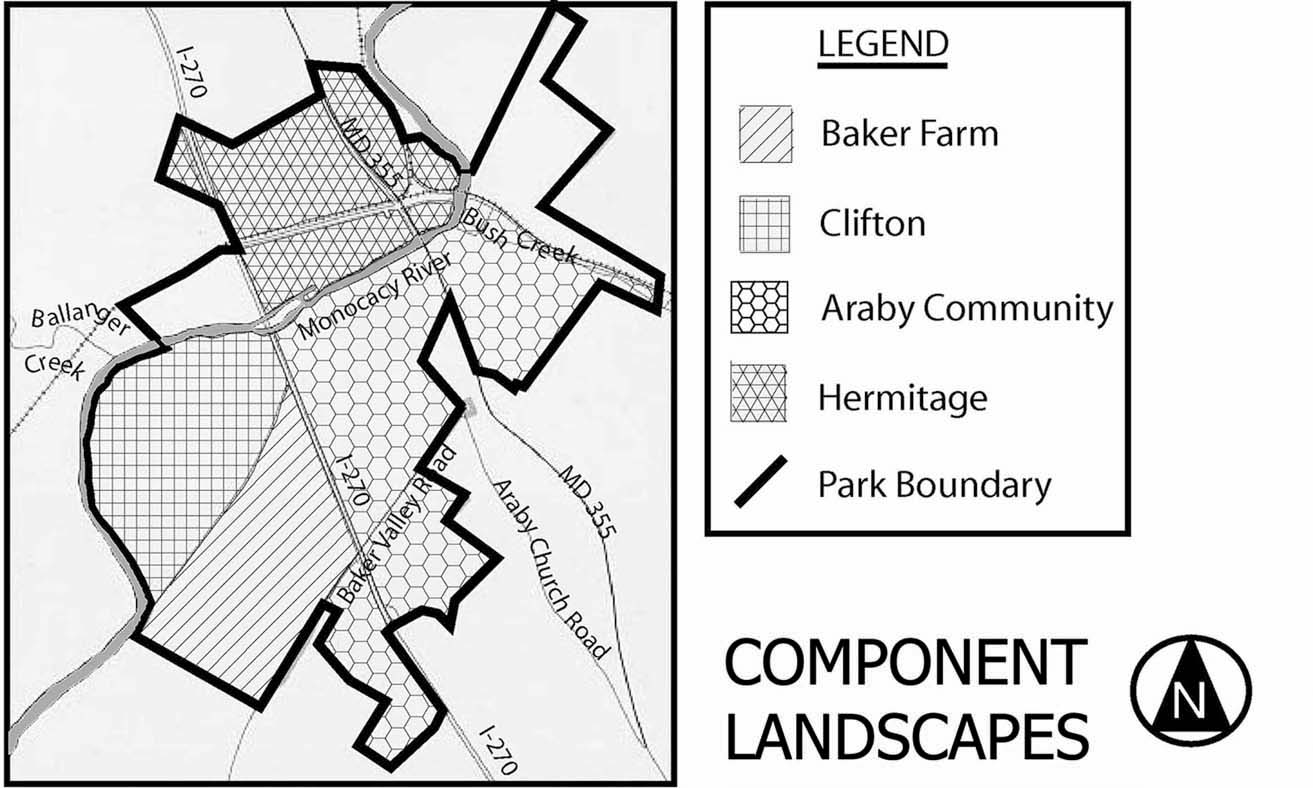
English: A map uses different patterns to indicate component landscapes within the parent landscape border. Monocacy National Battlefield. The parent cultural landscape contains four component landscapes, defined by individual histories, characteristics, and conditions and contributing to the significance or the park as a whole. They are: Baker Farm, Clifton, Araby Community, and Hermitage.
|
|||
| Depicted place |
English: 39.37031, -77.39844; Monocacy National Battlefield, Frederick County, Maryland; Latitude: 39.3577003479004, Longitude: -77.4024963378906 |
|||
| Accession number | ||||
| Source |
English: NPGallery |
|||
| Permission (Reusing this file) |
|
|||
| NPS Unit Code | MONO | |||
| Album(s) | English: Monocacy National Battlefield |
|||
File history
Click on a date/time to view the file as it appeared at that time.
| Date/Time | Thumbnail | Dimensions | User | Comment | |
|---|---|---|---|---|---|
| current | 03:59, 12 May 2024 | | 1,313 × 788 (136 KB) | BMacZeroBot (talk | contribs) | Batch upload (Commons:Batch uploading/NPGallery) |
You cannot overwrite this file.
File usage on Commons
There are no pages that use this file.
.JPG&oldid=875867377)