File:Map of Kiribati CIA WFB.png
跳去導覽
跳去搵嘢
冇更高解像度嘅圖像。
Map_of_Kiribati_CIA_WFB.png (325 × 350 像素,檔案大細:9 KB ,MIME類型:image/png)
Captions
Captions
Add a one-line explanation of what this file represents

|
This map image could be recreated using vector graphics as an SVG file. This has several advantages; see Commons:Media for cleanup for more information. If an SVG form of this image is already available, please upload it. After uploading an SVG, replace this template with {{vector version available|new image name.svg}}.
|
摘要[編輯]
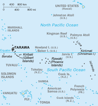
CIA-WF map of Kiribati
協議[編輯]
This image is in the public domain because it contains materials that originally came from the United States Central Intelligence Agency's World Factbook.
|
 |
檔案歷史
撳個日期/時間去睇響嗰個時間出現過嘅檔案。
| 日期/時間 | 縮圖 | 尺寸 | 用戶 | 註解 | |
|---|---|---|---|---|---|
| 現時 | 2010年9月17號 (五) 15:35 | | 325 × 350(9 KB) | Ras67(傾偈 | 貢獻) | cropped |
| 2005年3月27號 (日) 09:15 |  | 330 × 354(10 KB) | Wolfman~commonswiki(傾偈 | 貢獻) | {{CIA-map}} |
你無得衾咗個檔案。
檔案用途
以下嘅4版用到呢個檔:
全域檔案使用情況
下面嘅維基都用緊呢個檔案:
- af.wikipedia.org嘅使用情況
- avk.wikipedia.org嘅使用情況
- azb.wikipedia.org嘅使用情況
- ban.wikipedia.org嘅使用情況
- bjn.wikipedia.org嘅使用情況
- br.wikipedia.org嘅使用情況
- bs.wikipedia.org嘅使用情況
- ceb.wikipedia.org嘅使用情況
- cs.wikipedia.org嘅使用情況
- da.wikipedia.org嘅使用情況
- de.wikivoyage.org嘅使用情況
- en.wikipedia.org嘅使用情況
- Howland Island
- Jarvis Island
- Line Islands
- Tabuaeran
- List of towns and villages in Kiribati
- Lists of hospitals in Oceania
- Talk:List of sovereign states and dependent territories in Oceania
- List of airports in Kiribati
- Wikipedia:Featured picture candidates/February-2007
- Wikipedia:Featured picture candidates/Kingman Reef
- Outline of Kiribati
- Wikipedia:Graphics Lab/Image workshop/Archive/Nov 2008
- Ministry of Line and Phoenix Islands Development
- en.wikisource.org嘅使用情況
- en.wikiversity.org嘅使用情況
- eo.wikipedia.org嘅使用情況
- es.wikipedia.org嘅使用情況
- et.wikipedia.org嘅使用情況
- eu.wikipedia.org嘅使用情況
- fa.wikipedia.org嘅使用情況
- fi.wikipedia.org嘅使用情況
睇呢個檔案嘅更多全域使用情況。