File:Map of NUTS 3 areas in England by GVA per capita (1998).png
Jump to navigation
Jump to search
Size of this preview: 484 × 600 pixels. Other resolutions: 194 × 240 pixels | 387 × 480 pixels | 620 × 768 pixels | 826 × 1,024 pixels | 2,121 × 2,629 pixels.
Original file (2,121 × 2,629 pixels, file size: 587 KB, MIME type: image/png)
Captions
Captions
Add a one-line explanation of what this file represents
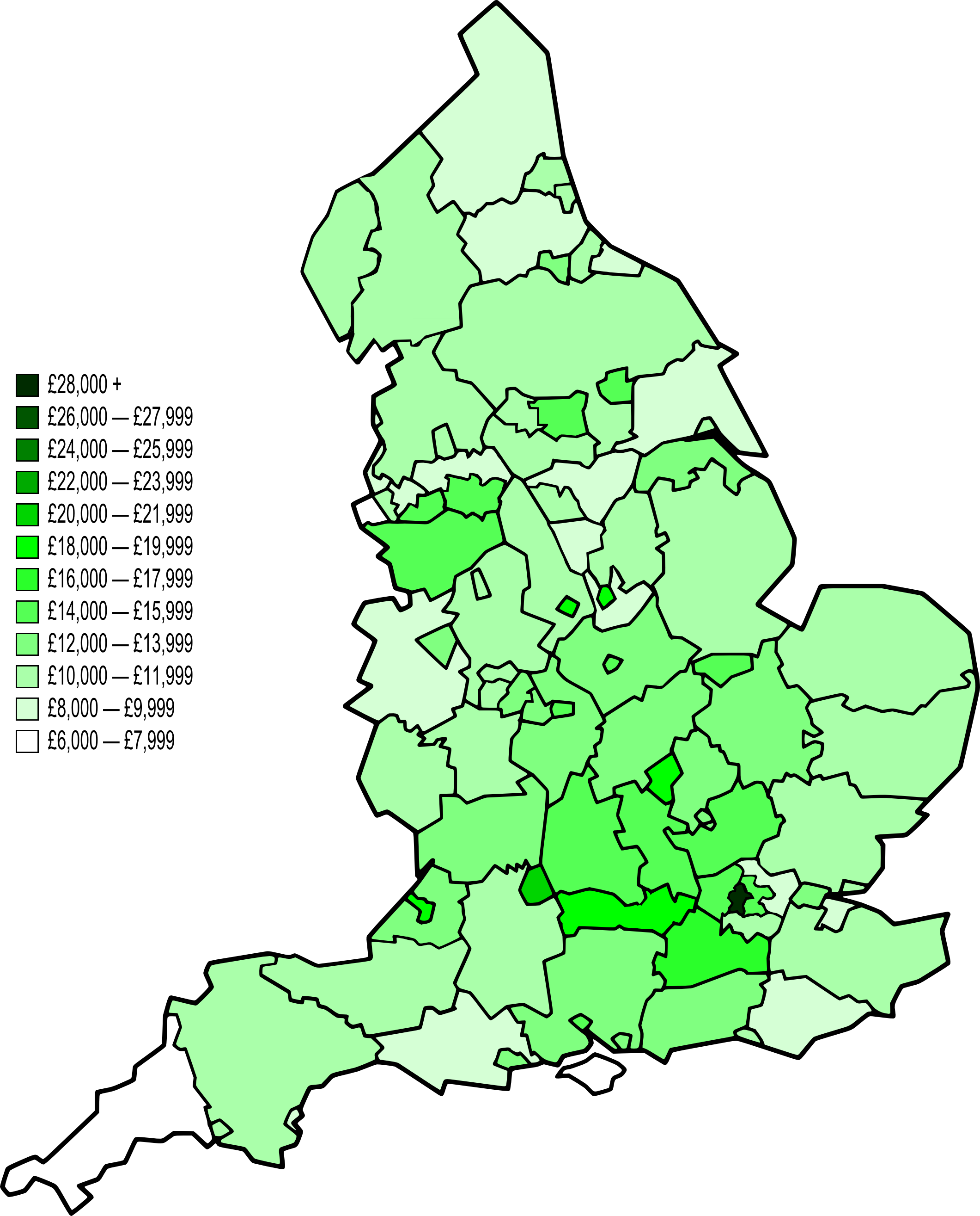
| Description | A map of England divided by NUTS 3 level subdivisons. They are coloured on a ten shade scale of green with light green having the lowest average GVA per capita in 1998 to dark green for the highest. England average is £13,222. |
| Date | |
| Source | Most of the map's structure came from Image:BlankMap-EnglandSubdivisions.svg, although several merging and splitting of subdivisons was done by myself using Inkscape. The data was from a report by the Office for National Statistics (URL). |
| Author | Kanguole and Evian Pepper. |
| Permission (Reusing this file) |
Must attribute Kanguole. |
| Other versions |
.svg)
.png)
.svg)
.png)
.svg)
.png)
.svg)
.png)
.svg)
.png)
.svg)
.png)
.svg)
.png)
.svg)
.svg)
.png)
.svg)
.png)
.svg)
.png)
Licensing
[edit].png&action=edit§ion=1)
| This file is licensed under the Creative Commons Attribution-Share Alike 3.0 Unported license. Subject to disclaimers. | ||
| ||
| This licensing tag was added to this file as part of the GFDL licensing update. |

|
Permission is granted to copy, distribute and/or modify this document under the terms of the GNU Free Documentation License, Version 1.2 or any later version published by the Free Software Foundation; with no Invariant Sections, no Front-Cover Texts, and no Back-Cover Texts. A copy of the license is included in the section entitled GNU Free Documentation License. Subject to disclaimers. |
File history
Click on a date/time to view the file as it appeared at that time.
| Date/Time | Thumbnail | Dimensions | User | Comment | |
|---|---|---|---|---|---|
| current | 21:24, 28 October 2008 | | 2,121 × 2,629 (587 KB) | Evian Pepper (talk | contribs) | {{Information |Description=A map of England divided by NUTS 3 level subdivisons. They are coloured on a ten shade scale of green with light green having the lowest average [[Wikipedia:Gross va |
You cannot overwrite this file.
File usage on Commons
There are no pages that use this file.
.png&oldid=459408476)