File:Map of Napa & Solano Counties, Cal. LOC 2005625301.jpg
Jump to navigation
Jump to search

Size of this preview: 560 × 600 pixels. Other resolutions: 224 × 240 pixels | 448 × 480 pixels | 717 × 768 pixels | 956 × 1,024 pixels | 1,912 × 2,048 pixels | 9,042 × 9,686 pixels.
Original file (9,042 × 9,686 pixels, file size: 16 MB, MIME type: image/jpeg)
Captions
Captions
Add a one-line explanation of what this file represents
Summary
[edit]| Warning | The original file is very high-resolution. It might not load properly or could cause your browser to freeze when opened at full size. |
|---|
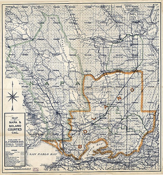
| Description |
English: Blue line; county borders hand colored. Shows roads, railways, towns, drainage, township and range, power lines, irrigation projects, and ranchos. Available also through the Library of Congress Web site as a raster image. |
||
| Title | Map of Napa & Solano Counties, Cal. | ||
| Shelf ID | G4363.N3 1913 .W4 | ||
| Date | |||
| Source | https://www.loc.gov/item/2005625301/ | ||
| Author | C.F. Weber & Co.; Punnett Brothers | ||
| Permission (Reusing this file) |
|
||
| Other versions |
|
||
| Location | United States · Napa County · California · Solano County | ||
| Part of | American Memory · General Maps · Catalog · Geography And Map Division | ||
| Subject | Solano County (Calif.) · Solano County · United States · Maps · California · Napa County (Calif.) · Napa County |


Licensing
[edit]
|
This is a faithful photographic reproduction of a two-dimensional, public domain work of art. The work of art itself is in the public domain for the following reason:
The official position taken by the Wikimedia Foundation is that "faithful reproductions of two-dimensional public domain works of art are public domain".
This photographic reproduction is therefore also considered to be in the public domain in the United States. In other jurisdictions, re-use of this content may be restricted; see Reuse of PD-Art photographs for details. | ||||
File history
Click on a date/time to view the file as it appeared at that time.
| Date/Time | Thumbnail | Dimensions | User | Comment | |
|---|---|---|---|---|---|
| current | 15:56, 4 June 2018 | | 9,042 × 9,686 (16 MB) | Fæ (talk | contribs) | LOC Maps https://www.loc.gov/item/2005625301/ #19883 |
You cannot overwrite this file.
File usage on Commons
The following page uses this file: