File:Map of New York State, Census of 1850, Valentine's Manual 1851.jpg
Jump to navigation
Jump to search

Size of this preview: 764 × 599 pixels. Other resolutions: 306 × 240 pixels | 612 × 480 pixels | 979 × 768 pixels | 1,280 × 1,004 pixels | 2,559 × 2,008 pixels.
Original file (2,559 × 2,008 pixels, file size: 5.49 MB, MIME type: image/jpeg)
Captions
Captions
Add a one-line explanation of what this file represents
Summary[edit]
| Description |
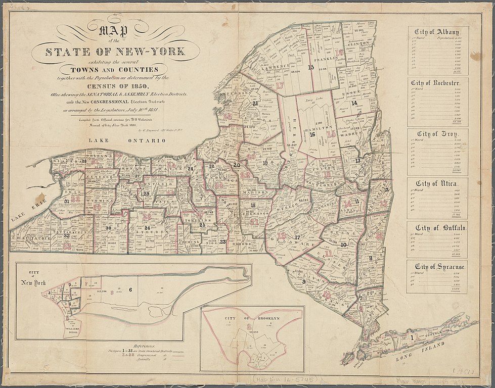
English: Full title: Map of the State of New-York exhibiting the several Towns and Counties together with the Population as determined by the Census of 1850. Also showing the Senatorial & Assembly Election Districts, and the New Congressional Election Districts as arranged by the Legislature, July 10th 1851. Compiled from Official sources for D. T. Valenine's [sic] Manal [sic] City of New-York 1851 by G. Hayward 120 Water St. N. Y.
|
||
| Date | |||
| Source |
|
||
| Author | George Hayward |
Licensing[edit]
|
This work is in the public domain in its country of origin and other countries and areas where the copyright term is the author's life plus 70 years or fewer. This work is in the public domain in the United States because it was published (or registered with the U.S. Copyright Office) before January 1, 1929. | |
| This file has been identified as being free of known restrictions under copyright law, including all related and neighboring rights. | |
File history
Click on a date/time to view the file as it appeared at that time.
| Date/Time | Thumbnail | Dimensions | User | Comment | |
|---|---|---|---|---|---|
| current | 10:01, 13 January 2021 | | 2,559 × 2,008 (5.49 MB) | Vzeebjtf (talk | contribs) | Uploaded a work by George Hayward from {{NYPL-image-DigitalID |id=5422744}} with UploadWizard |
You cannot overwrite this file.
File usage on Commons
There are no pages that use this file.