File:Map of Novgorod Namestnichestvo 1796 (small atlas).jpg
Jump to navigation
Jump to search
Size of this preview: 714 × 600 pixels. Other resolutions: 286 × 240 pixels | 571 × 480 pixels | 914 × 768 pixels | 1,219 × 1,024 pixels | 2,438 × 2,048 pixels | 2,882 × 2,421 pixels.
Original file (2,882 × 2,421 pixels, file size: 933 KB, MIME type: image/jpeg)
Captions
Captions
Add a one-line explanation of what this file represents
Summary[edit]
| Description |
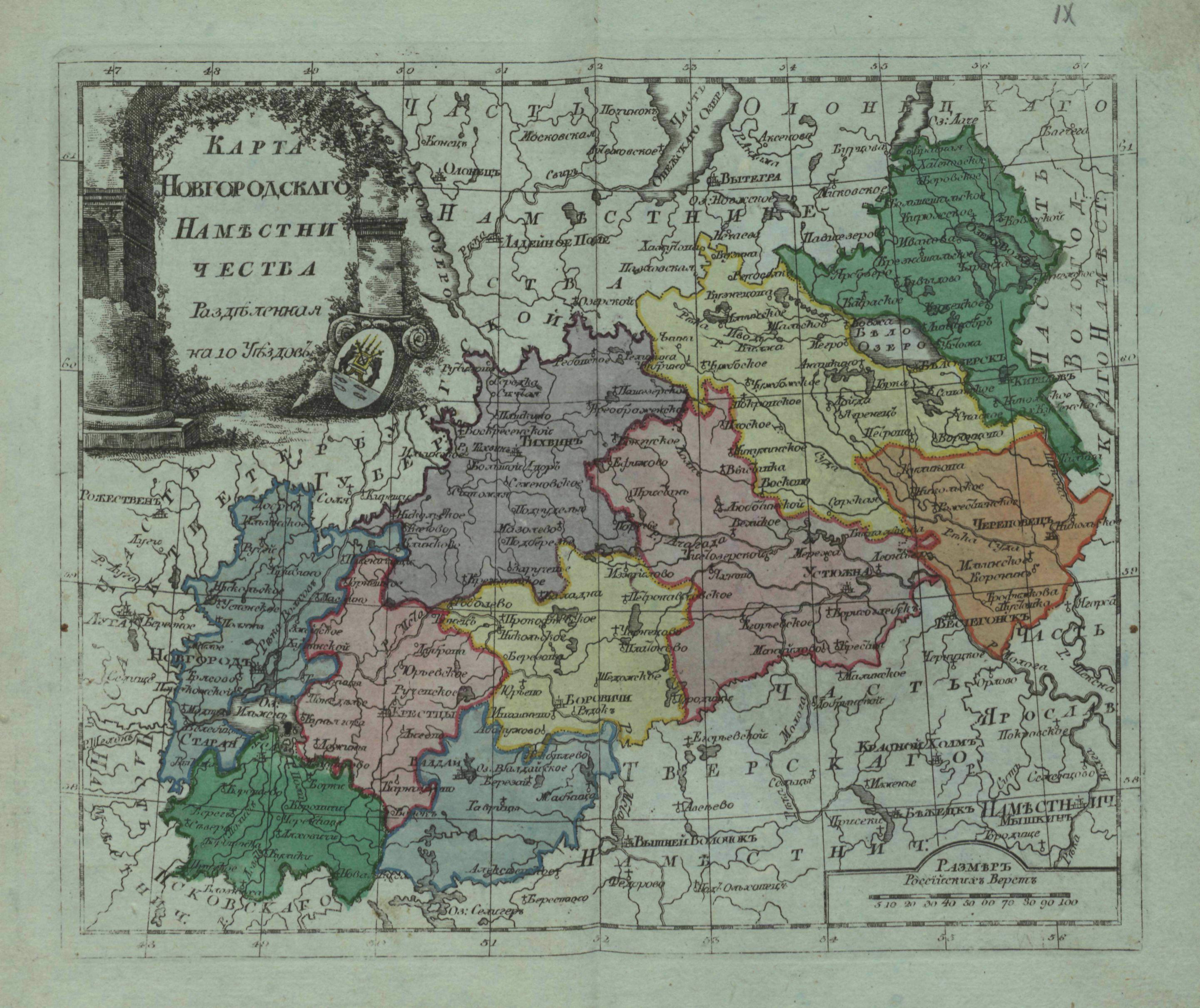
Русский: Малоформатный атлас Российской империи (1796). Карта Новгородского наместничества (карта 9).
English: Small atlas of the Russian Empire (1796). Map of Novgorod Namestnichestvo (map 9). |
| Date | |
| Source |
Русский: Атлас Российской империи, : Состоящий из 52 карт, : Изданный во граде св. Петра в лето 1796 е, а царствования Екатерины II XXXV е. Цифровая копия сделана Российской государственной библиотекой (http://www.rsl.ru)
English: Atlas of the Russian Empire, : Consist of 52 maps, : Published in St. Petersburg (1796). Digital copy made by Russian State Library (http://www.rsl.ru/en) |
| Author |
Русский: издатель: типография Сытина English: publisher:Sytin's print shop |
| Other versions |
|
.jpg)
.jpg)
.jpg)
.jpg&action=edit§ion=1)
Licensing[edit]
.jpg&action=edit§ion=2)
|
This work is in the public domain in its country of origin and other countries and areas where the copyright term is the author's life plus 100 years or fewer. | |
| This file has been identified as being free of known restrictions under copyright law, including all related and neighboring rights. | |
File history
Click on a date/time to view the file as it appeared at that time.
| Date/Time | Thumbnail | Dimensions | User | Comment | |
|---|---|---|---|---|---|
| current | 08:33, 1 May 2011 | | 2,882 × 2,421 (933 KB) | Transcend (rus) (talk | contribs) | {{BookNaviBar2|Map of Tver Namestnichestvo 1796 (small atlas).jpg|Map of Olonets Namestnichestvo 1796 (small atlas).jpg}} == {{int:filedesc}} == {{Information |Description= {{ru|Малоформатный атлас Российской империи (17 |
You cannot overwrite this file.
File usage on Commons
The following page uses this file:
File usage on other wikis
The following other wikis use this file:
- Usage on ru.wikipedia.org
- Usage on uk.wikipedia.org
.jpg&oldid=490472899)