File:Map of Prefecture 37 香川県.svg
Jump to navigation
Jump to search

Size of this PNG preview of this SVG file: 569 × 443 pixels. Other resolutions: 308 × 240 pixels | 617 × 480 pixels | 987 × 768 pixels | 1,280 × 997 pixels | 2,560 × 1,993 pixels.
Original file (SVG file, nominally 569 × 443 pixels, file size: 18 KB)
Captions
Captions
Add a one-line explanation of what this file represents
Summary[edit]
| Description |
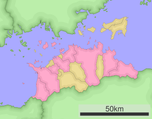
日本語: 香川県行政区分地図 |
||
| Source |
|
||
| Author | Lincun | ||
| Permission (Reusing this file) |
|
Licensing[edit]
Lincun at Japanese Wikipedia, the copyright holder of this work, hereby publishes it under the following licenses:

|
Permission is granted to copy, distribute and/or modify this document under the terms of the GNU Free Documentation License, Version 1.2 or any later version published by the Free Software Foundation; with no Invariant Sections, no Front-Cover Texts, and no Back-Cover Texts. A copy of the license is included in the section entitled GNU Free Documentation License. |
This file is licensed under the Creative Commons Attribution-Share Alike 3.0 Unported license.
Attribution: Lincun at Japanese Wikipedia
- You are free:
- to share – to copy, distribute and transmit the work
- to remix – to adapt the work
- Under the following conditions:
- attribution – You must give appropriate credit, provide a link to the license, and indicate if changes were made. You may do so in any reasonable manner, but not in any way that suggests the licensor endorses you or your use.
- share alike – If you remix, transform, or build upon the material, you must distribute your contributions under the same or compatible license as the original.
You may select the license of your choice.
Original upload log[edit]
The original description page was here. All following user names refer to ja.wikipedia.
| Date/Time | Dimensions | User | Comment |
|---|---|---|---|
| 2023-01-27 07:05 | 569×443× (18725 bytes) | Khatia SVG Erlösug | Removed event-handler attributes 'onmouseover', 'onmousemove' and 'onmouseout' because these cannot be accepted for security reasons. |
| 2007-03-19 13:43 | 569×443× (26830 bytes) | Lincun | {{都道府県内行政区分地図情報|都道府県=香川県}} |
| This file was moved from Japanese Wikipedia.
See below for original file information. | ||||||||||||||||||||||||||||||||||||||||
| ||||||||||||||||||||||||||||||||||||||||
|
| ||||||||||||||||||||||||||||||||||||||||
File history
Click on a date/time to view the file as it appeared at that time.
| Date/Time | Thumbnail | Dimensions | User | Comment | |
|---|---|---|---|---|---|
| current | 00:21, 4 February 2023 | | 569 × 443 (18 KB) | Khatia SVG Erlösug (talk | contribs) | == {{int:filedesc}} == {{Information |Description={{ja|{{Information |Description = ja:香川県行政区分地図 |Source = * Map: * Data used: Ministry of Land, Infrastructure, Transport and Tourism National Land Numerical Information (Administrative Area (N03)) * 使用データ: 国土交通省 国土数値情報(行政区域(N03)) |Date = |Author = Lincun |Permission = |other_versions = }} == {{int:license-header}} == ja:Category:Unidentified subjects in Japan}} |Source={{t... |
You cannot overwrite this file.
File usage on Commons
There are no pages that use this file.