File:Map of the Cattaraugus Indian Reservation, New York. LOC 81692883.jpg
Jump to navigation
Jump to search
Size of this preview: 781 × 599 pixels. Other resolutions: 313 × 240 pixels | 626 × 480 pixels | 1,001 × 768 pixels | 1,280 × 982 pixels | 2,560 × 1,965 pixels | 4,298 × 3,299 pixels.
Original file (4,298 × 3,299 pixels, file size: 1.63 MB, MIME type: image/jpeg)
Captions
Captions
Add a one-line explanation of what this file represents
Summary
[edit]| Description |
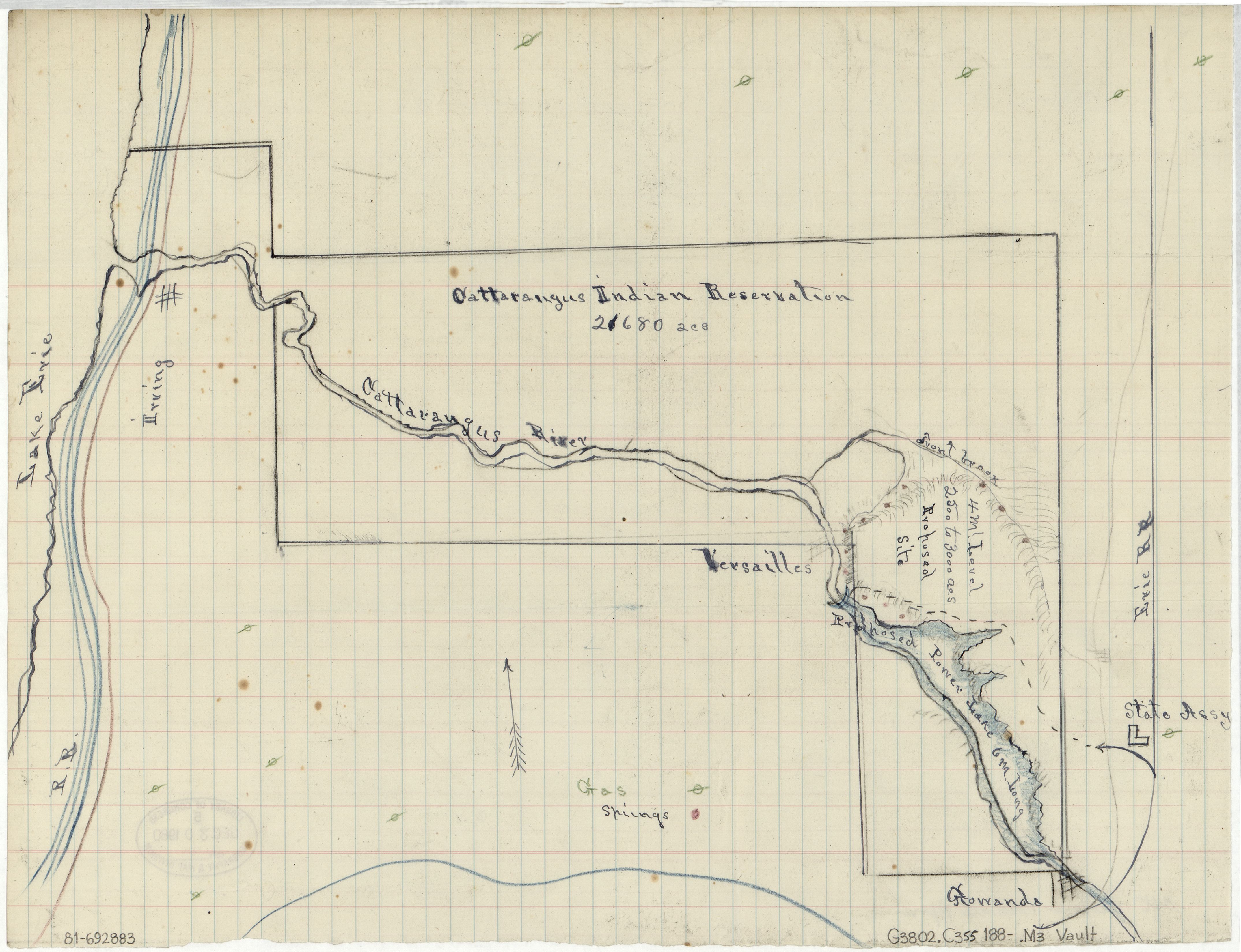
English: Shows natural gas wells, springs, and proposed reservoir. Title devised by cataloger. Pen-and-ink and col. pencil. From the Theodore Roosevelt papers. Available also through the Library of Congress Web site as a raster image. Vault |
||
| Title | [Map of the Cattaraugus Indian Reservation, New York]. | ||
| Shelf ID | G3802.C355 188- .M3 | ||
| Date | |||
| Source | https://www.loc.gov/item/81692883/ | ||
| Author | Roosevelt, Theodore | ||
| Permission (Reusing this file) |
|
||
| Other versions |
|
||
| Location | United States · New York · Cattaraugus Indian Reservation · New York (State) | ||
| Part of | American Memory · General Maps · Catalog · Geography And Map Division | ||
| Subject | Cattaraugus Indian Reservation (N.Y.) · Maps · Cattaraugus Indian Reservation · New York (State) · United States |


Licensing
[edit]
|
This is a faithful photographic reproduction of a two-dimensional, public domain work of art. The work of art itself is in the public domain for the following reason:
The official position taken by the Wikimedia Foundation is that "faithful reproductions of two-dimensional public domain works of art are public domain".
This photographic reproduction is therefore also considered to be in the public domain in the United States. In other jurisdictions, re-use of this content may be restricted; see Reuse of PD-Art photographs for details. | ||||
File history
Click on a date/time to view the file as it appeared at that time.
| Date/Time | Thumbnail | Dimensions | User | Comment | |
|---|---|---|---|---|---|
| current | 01:45, 15 May 2018 | | 4,298 × 3,299 (1.63 MB) | Fæ (talk | contribs) | LOC Maps https://www.loc.gov/item/81692883/ #216 |
You cannot overwrite this file.
File usage on Commons
The following 3 pages use this file:
._LOC_81692883.jpg&redirect=no)