File:Map of the electoral district of Oodgeroo, 2017.pdf
Jump to navigation
Jump to search

Size of this JPG preview of this PDF file: 424 × 600 pixels. Other resolutions: 169 × 240 pixels | 339 × 480 pixels | 543 × 768 pixels | 724 × 1,024 pixels | 1,752 × 2,479 pixels.
Original file (1,752 × 2,479 pixels, file size: 2.02 MB, MIME type: application/pdf)
Captions
Captions
Add a one-line explanation of what this file represents
Summary[edit]
| Description |
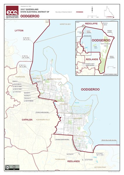
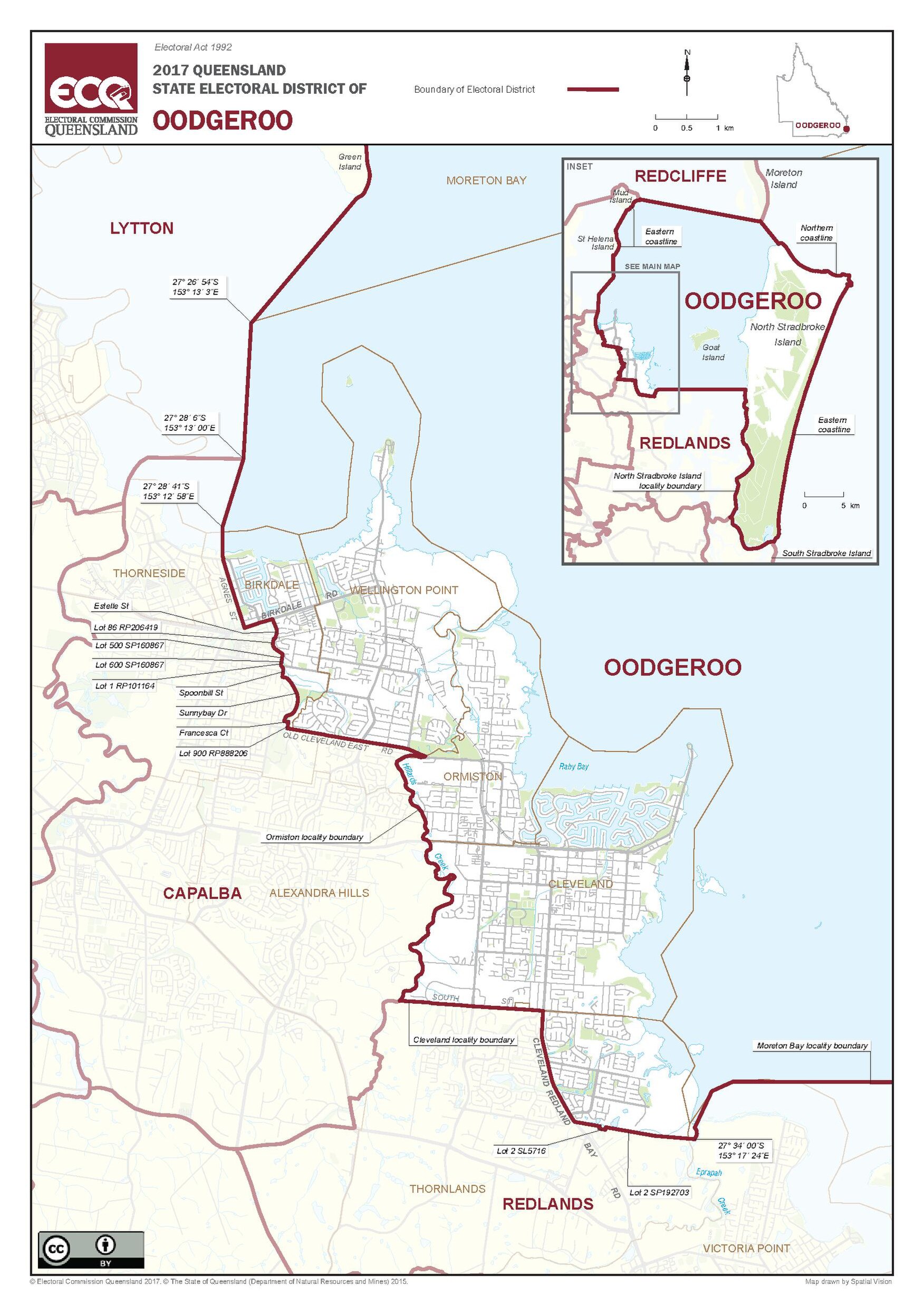
English: Map of the electoral district of Oodgeroo, 2017 |
| Date | |
| Source | 2017 Queensland State Electoral district of Oodgeroo, from https://ecq.qld.gov.au/__data/assets/pdf_file/0003/69366/ECQ-2017-Final-Oodgeroo.pdf |
| Author | Electoral Commission of Queensland |
| Camera location | | View this and other nearby images on: OpenStreetMap |
|---|
Licensing[edit]
This file is licensed under the Creative Commons Attribution 4.0 International license.
- You are free:
- to share – to copy, distribute and transmit the work
- to remix – to adapt the work
- Under the following conditions:
- attribution – You must give appropriate credit, provide a link to the license, and indicate if changes were made. You may do so in any reasonable manner, but not in any way that suggests the licensor endorses you or your use.
File history
Click on a date/time to view the file as it appeared at that time.
| Date/Time | Thumbnail | Dimensions | User | Comment | |
|---|---|---|---|---|---|
| current | 21:28, 4 November 2017 |  | 1,752 × 2,479 (2.02 MB) | Kerry Raymond (talk | contribs) | User created page with UploadWizard |
You cannot overwrite this file.
File usage on Commons
There are no pages that use this file.
File usage on other wikis
The following other wikis use this file:
- Usage on en.wikipedia.org
- Usage on simple.wikipedia.org